

- Usage in publication:
-
- Chinati Mountain volcanic series
- Modifications:
-
- Original reference
- Dominant lithology:
-
- Lava
- AAPG geologic province:
-
- Permian basin
Summary:
Pg. 31 (table 2), 118+, geol. map. Chinati Mountain volcanic series. Rhyolite and trachyte lava flows. Subdivided into 4 informal units, separately mapped (descending): unit T8, soda rhyolite, 500+/- feet; unit T7, porphyritic olivine augite andesine trachyte, 930+/- feet; unit T6, soda rhyolite, 790+/- feet; and unit T5, quartz trachyte, includes volcanic ash at base, 100+/- feet. Younger than Mitchell Mesa welded tuff of Buck Hill volcanic series. Age is Tertiary (Miocene? or Pliocene?).
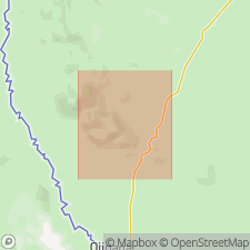
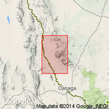
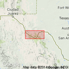
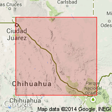
Type locality: at base of east scarp of Chinati Mountains, 1.5 mi west of Cibolo Ranch headquarters. Named for thick section of lava flows which form Chinati Mountains, Chinati Peak quadrangle, Presidio Co., TX
Source: Publication.
- Usage in publication:
-
- Chinati Mountain group
- Modifications:
-
- Redescribed
- Revised
- Dominant lithology:
-
- Trachyte
- Rhyolite
- Tuff
- AAPG geologic province:
-
- Permian basin
Summary:
Chinati Mountain group. Composed of more than 3,500 feet of plagioclase trachyte, rhyolite, and tuff, crops out south of Shely fault to form Chinati Mountains. Group is here expanded to include 1,500 feet of plagioclase trachyte, tuff, and basal conglomerate which are probably older than lowest unit at type locality as designated by Rix, 1953 [Univ. Texas-Austin unpub. PhD dissert.]. Where base is exposed, group overlies Comanche strata; in fault contact with older Shely group (new). Older than Allen intrusive complex.
Source: US geologic names lexicon (USGS Bull. 1200, p. 774).
- Usage in publication:
-
- Chinati Mountains Group
- Modifications:
-
- Mapped 1:250k
- Dominant lithology:
-
- Trachyte
- Rhyolite
- Tuff
- Conglomerate
- AAPG geologic province:
-
- Permian basin
Summary:
Chinati Mountains Group (map unit Tcm). Trachyte, rhyolite, tuff, and conglomerate subdivided into 6 map units (descending) Tcm6 through Tcm1. Thickness of formation [group] about 3,500 feet. K-Ar ages, 31.9 +/-0.7 m.y. (3 determinations); age of West Chinati stock 31.2 +/-0.6 m.y.
Tcm6, upper rhyolite, coarse-grained with granitic appearance, green; thickness more than 500 feet.
Tcm5, upper trachyte, olivine-augite trachyandesite, many thick flows, aphanitic to very fine-grained, porphyritic, reddish-brown to grayish-black; thickness 930 feet.
Tcm4, lower rhyolite, many thick flows, fine-grained, porphyritic, light brownish-black; thickness 500 feet.
Tcm3, middle trachyte, many flows, very fine-grained, porphyritic, hard and tough, medium- to dark-gray, light to dark olive-gray, and dark greenish-gray; weathers reddish; thickness 1,000 feet.
Tcm2, lower trachyte and tuff, very fine-grained, amygdaloidal, porphyritic, dark-reddish, interbedded, with conglomeratic tuff, fine- to coarse-grained, greenish; thickness 500 feet.
Tcm1, conglomerate, boulders, cobbles, and pebbles in a matrix of sand, silt, and clay all derived from Comanchean rocks; thickness 100 feet.
Source: Publication.
- Usage in publication:
-
- Chinati Mountains Group
- Modifications:
-
- Geochronologic dating
- AAPG geologic province:
-
- Permian basin
Summary:
Pg. 15. Chinati Mountains Group. (1) sample from rhyolite lava (=lower rhyolite of Cepeda and Henry, 1983), in Chinati Peak quadrangle, Presidio County, southwestern Texas, yielded a K-Ar age of 32.8 +/-0.7 Ma (alkali feldspar); (2) sample from rhyolite, in Cerro Orona quadrangle, Presidio County, yielded a K-Ar age of 32.6 +/-0.7 Ma (alkali feldspar); and (3) sample from peralkaline rhyolite (=upper rhyolite (ash-flow tuff) of Cepeda and Henry, 1983), in Cerro Orona quadrangle, yielded a K-Ar age of 32.5 +/-3.1 Ma (amphibole). Data from D.L. Amsbury, 1958 (Univ. Texas-Austin Bur. Econ. Geol., Geol. Quad. Map No. 22), and J.C. Cepeda and C.D. Henry, 1983 (Univ. Texas-Austin Bur. Econ. Geol. Rpt. Inv., no. 135, 32 p.); ages recalculated using decay constants of Steiger and Jager, 1977 (Earth Planet. Sci. Letters, v. 36, p. 359-362).
[Age considered Oligocene; Eocene-Oligocene boundary 36.6 (38-34) Ma (from Geologic Names Committee, USGS, 1983 ed. geol. time scale, with additions from N.J. Snelling, 1985, The Geol. Soc. Mem., no. 10).]
Source: Publication.
For more information, please contact Nancy Stamm, Geologic Names Committee Secretary.
Asterisk (*) indicates published by U.S. Geological Survey authors.
"No current usage" (†) implies that a name has been abandoned or has fallen into disuse. Former usage and, if known, replacement name given in parentheses ( ).
Slash (/) indicates name conflicts with nomenclatural guidelines (CSN, 1933; ACSN, 1961, 1970; NACSN, 1983, 2005, 2021). May be explained within brackets ([ ]).