The National Geologic Map Database is migrating to a new infrastructure. We apologize for any service disruptions during this process.
|
|---|


- Usage in publication:
-
- Chilson member*
- Modifications:
-
- Named
- Dominant lithology:
-
- Sandstone
- Mudstone
- AAPG geologic province:
-
- Chadron arch
Summary:
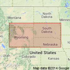
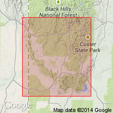
Named as a member of Lakota Formation for exposures in Chilson Canyon, Fall River Co, SD where member is 250 ft thick and consists of two conspicuous fluvial sandstone bodies and an intervening greenish-gray mudstone unit. Subdivided (ascending) into fluvial units 1 and 2. Sandstone in fluvial units 1 and 2 finger laterally into flood-plain, lacustrine, or paludial facies. Overlies Morrison Formation or Unkpapa Sandstone; underlies Minnewaste Limestone Member or Fuson Member of Lakota Formation. Upper and lower contacts locally disconformable. Age is Early Cretaceous. Type section in Chilson Canyon, sec 32, T8S, R4E, Fall River Co, SD, Flint Hill quad, on the Chadron arch.
Source: GNU records (USGS DDS-6; Denver GNULEX).
- Usage in publication:
-
- Chilson Member*
- Modifications:
-
- Overview
- AAPG geologic province:
-
- Chadron arch
- Powder River basin
Summary:
Discusses lithologic variation, minerology, and fossil content and shows distribution of the member and its two subdivisions--fluvial units 1 and 2--in the southern Black Hills, Fall River and Custer Cos, SD on Chadron arch, and Weston Co, WY in Powder River basin. 1) Fluvial unit 1 consists of sandstone, shale, siltstone, and mudstone; locally black fissile shale has been mapped as basal part of unit. Is a complex of channel deposits apparently deposited under predominantly fluvial conditions. Fossiliferous. Produces uranium. Rests unconformably on Morrison Formation; in some places, rests on shales of the Lakota Formation. 2) Fluvial unit 2 consists of sandstones and mudstones (stream and flood-plain deposits), including locally rocks of possible lacustrine origin. Comparison--unit 2 is: more oxidized than unit 1; fissile shale absent; some sandstones contain pink calcite cement--unit 1 calcite cement less abundant, and is gray; contains more red, brown, and yellow colors than unit 1, which has less vivid colors. Contact relations between the two units are variable. Of Early Cretaceous age.
Source: GNU records (USGS DDS-6; Denver GNULEX).
For more information, please contact Nancy Stamm, Geologic Names Committee Secretary.
Asterisk (*) indicates published by U.S. Geological Survey authors.
"No current usage" (†) implies that a name has been abandoned or has fallen into disuse. Former usage and, if known, replacement name given in parentheses ( ).
Slash (/) indicates name conflicts with nomenclatural guidelines (CSN, 1933; ACSN, 1961, 1970; NACSN, 1983, 2005, 2021). May be explained within brackets ([ ]).