The National Geologic Map Database is migrating to a new infrastructure. We apologize for any service disruptions during this process.
|
|---|


- Usage in publication:
-
- Chico group
- Modifications:
-
- Original reference
- AAPG geologic province:
-
- Klamath Mountains province
- Sacramento basin
- San Joaquin basin
Summary:
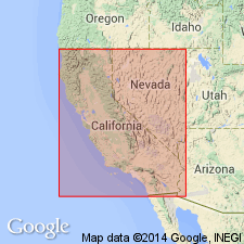
Pg. XIV, as reported by J.D. Whitney from unpublished paper by Gabb, and footnote by Gabb on p. 129. Chico group. One of most extensive and important members of Pacific coast Cretaceous. Is extensively represented in Shasta and Butte Counties, California; also in foothills of Sierra Nevada as far south as Folsom; on east face of Coast Ranges bordering Sacramento Valley; at Martinez; and in Oristamba Canyon, in Stanislaus County, California. It includes all known Cretaceous of Oregon and extreme northern part of California, and is the coal-bearing formation of Vancouver's Island. It underlies Martinez group and overlies Shasta group, but Martinez group may eventually prove to be worthy of ranking only as a subdivision of Chico group. Age is Late Cretaceous.
Typical localities are Chico Creek [Butte Co., CA], Pence's ranch, and Tuscan Springs.
Source: US geologic names lexicon (USGS Bull. 896, p. 428).

- Usage in publication:
-
- Chico formation*
- Chico group*
- Modifications:
-
- Overview
- Dominant lithology:
-
- Sandstone
- Shale
- Conglomerate
- AAPG geologic province:
-
- Klamath Mountains province
- Sacramento basin
- San Joaquin basin
Summary:
Chico formation; Chico group. The Chico rocks consist of sandstones, shales, and conglomerates of marine origin, varying in thickness up to 21,000 feet and characterized by an Upper Cretaceous fauna. In Diablo Range the Chico is of very great thickness and becomes a group, divided into Moreno formation above and Panoche formation below.
Source: US geologic names lexicon (USGS Bull. 896, p. 428).
- Usage in publication:
-
- Chico series
- Modifications:
-
- Revised
- AAPG geologic province:
-
- Klamath Mountains province
- San Joaquin basin
Summary:
Pg. 1612. Chico series is nowhere found in single section but on the whole aggregates 25,000 feet or more. Begins with unconformity and overlaps in late Albian time, [late Early Cretaceous]; embraces all succeeding stages known in Europe, probably up to highest. Subdivided into Gaines group (new), western Shasta County, 5,300 feet; Panoche group, Diablo Range, 14,700 feet; Moreno group, Diablo Range, 5,000 feet.
Present in northern CA.
Source: US geologic names lexicon (USGS Bull. 1200, p. 763).
- Usage in publication:
-
- Chico series
- Modifications:
-
- Revised
- AAPG geologic province:
-
- Klamath Mountains province
- San Joaquin basin
Anderson, F.M., 1938, Synopsis of the Upper Cretaceous deposits [Chico series] in California and Oregon [abs.]: Geological Society of America Bulletin, v. 49, no. 12, pt. 2, p. 1863.
Summary:
Pg. 1863; 6th Pacific Sci. Cong. Proc., v. 1, p. 394-398. Chico series. Marine Upper Cretaceous detrital deposits in California and Oregon constitute Chico series. It is well represented in Great Valley of California where it has aggregate thickness of 26,700 feet. Representative exposures lie along west border of valley, generally in monclinal attitude, for about 400 miles. Divided into three major groups: Pioneer (new), Panoche, and Orestimba (new).
Source: US geologic names lexicon (USGS Bull. 1200, p. 763).
- Usage in publication:
-
- Chico formation
- Modifications:
-
- Principal reference
- Revised
- AAPG geologic province:
-
- Sacramento basin
Summary:
Chico formation. Results of study show that Chico Creek must be considered type locality of Chico formation (group). Cretaceous rocks exposed in Chico Creek comprise series of clastics 2,000 feet in thickness, resting unconformably on older Sierra Nevada metamorphics and covered by Tertiary volcanics. Fauna is abundant, but only meager evidence exists to correlate it with other Cretaeoous localities in central valley of California.
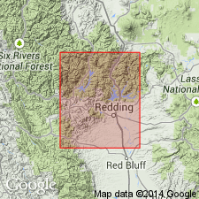
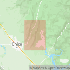
Type locality: in canyon of Chico Creek, 8 to 16 mi northeast of Chico, Butte Co., northern CA.
Source: US geologic names lexicon (USGS Bull. 1200, p. 763).
- Usage in publication:
-
- Chico formation
- Modifications:
-
- Revised
- AAPG geologic province:
-
- Sacramento basin
Summary:
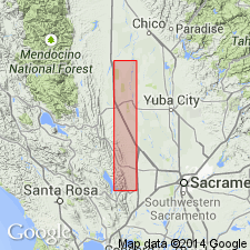
Chico series. Includes following formations (ascending): Golden Gate, Mills, Sites, Funks, Guinda, and Forbes (all new). Discussion of area on west side of Sacramento Valley south of Willows, Glenn County, northern California. [Age is Late Cretaceous.]
Source: US geologic names lexicon (USGS Bull. 1200, p. 763).
For more information, please contact Nancy Stamm, Geologic Names Committee Secretary.
Asterisk (*) indicates published by U.S. Geological Survey authors.
"No current usage" (†) implies that a name has been abandoned or has fallen into disuse. Former usage and, if known, replacement name given in parentheses ( ).
Slash (/) indicates name conflicts with nomenclatural guidelines (CSN, 1933; ACSN, 1961, 1970; NACSN, 1983, 2005, 2021). May be explained within brackets ([ ]).