- Usage in publication:
-
- Chickwolnepy complex*
- Modifications:
-
- Named
- Dominant lithology:
-
- Gabbro
- Diabase
- Tonalite
- Trondhjemite
- AAPG geologic province:
-
- New England province
Summary:
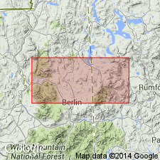
Named informally as "Chickwolnepy complex." Named as a result of mapping in Milan 15-min quad and adjacent areas of NH and ME. Described as an igneous complex composed of metamorphosed gabbro, sheeted diabase dikes, tonalite, and minor trondhjemite. Minimum dimensions of 5 X 10 km. Occurs on northern end of Jefferson dome (northernmost and largest of the [so-called] Oliverian domes. Intrudes Albee Formation and Middle Ordovician Ammonoosuc Volcanics. Discordantly intruded by foliated pink to gray granite of Oliverian Plutonic Suite, dated elsewhere at 445 m.y. Age of Chickwolnepy is tentatively Middle Ordovician.
Source: GNU records (USGS DDS-6; Reston GNULEX).

- Usage in publication:
-
- Chickwolnepy intrusions*
- Modifications:
-
- Revised
- Age modified
- Geochronologic dating
- AAPG geologic province:
-
- New England province
Summary:
Name revised to Chickwolnepy intrusions. Previously called Chickwolnepy complex by Moench and others (1982). Name is applied to a north-trending body, about 10 km long and 2-4 km wide, of metamorphosed gabbro and sheeted diabase and tonalite exposed on Chickwolnepy Mountain and extending across Chickwolnepy Stream, central part of Milan quad, NH. Usage supersedes that of Lyons and others (in press) on NH State Map. Also tentatively includes a lenticular body of quartz-porphyritic tonalite northwest of main body and, tentatively, several nearby isolated metadiabase and metagabbro dikes. Intrusions are informally named in order to highlight their unusual nature and tectonic importance as an inferred center of crustal spreading and subvolcanic plutonism related to Ammonoosuc Volcanics. Age is Ordovician based on U-Pb zircon age of 467 +/-3 Ma for tonalite (Aleinikoff and Moench, 1992) and use of time scale of Ross and others (1982, revised by Ross, 1992, written commun.).
Source: GNU records (USGS DDS-6; Reston GNULEX).

- Usage in publication:
-
- Chickwolnepy complex*
- Modifications:
-
- Geochronologic dating
- AAPG geologic province:
-
- New England province
Summary:
Used informally as Chickwolnepy Complex of Moench and others (1982). Not mapped on 1:250,000-scale geologic map, but is shown separately on 1:500,000-scale derivative map of plutons and sample localities for isotopic dating. Age of 467 +/-4 Ma [Middle Ordovician by time scale of Palmer, 1983] by U/Th methods is from Aleinikoff and Moench (1992; GSA Abstracts with Programs, v. 24, no. 3, p. 2).
Source: GNU records (USGS DDS-6; Reston GNULEX).
For more information, please contact Nancy Stamm, Geologic Names Committee Secretary.
Asterisk (*) indicates published by U.S. Geological Survey authors.
"No current usage" (†) implies that a name has been abandoned or has fallen into disuse. Former usage and, if known, replacement name given in parentheses ( ).
Slash (/) indicates name conflicts with nomenclatural guidelines (CSN, 1933; ACSN, 1961, 1970; NACSN, 1983, 2005, 2021). May be explained within brackets ([ ]).

