The National Geologic Map Database is migrating to a new infrastructure. We apologize for any service disruptions during this process.
|
|---|


- Usage in publication:
-
- Chicken Creek Tuff
- Modifications:
-
- Original reference
- Geochronologic dating
- Dominant lithology:
-
- Tuff
- AAPG geologic province:
-
- Great Basin province
Summary:
Pg. 965, 967. Chicken Creek Tuff. Consists of pink tuff interbedded at top of "Green River" beds. Is overlain by other volcanic rocks which include Sage Valley limestone. H.D. MacGinitie (personal commun.) states small inadequate flora of the limestone [Sage Valley Limestone flora] is indeterminate as to age and could be anything from middle Eocene to late Oligocene (Bridgerian to Whitneyan North American land mammal age). Sample of Chicken Creek Tuff yielded a K-Ar age of 33.2 Ma (biotite), Chadronian North American land mammal age [early Oligocene] (citing H. Mackin and H.D. MacGinitie, personal commun.).
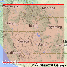
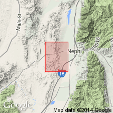
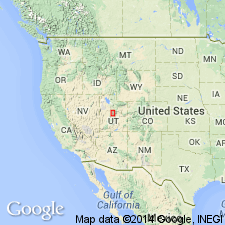
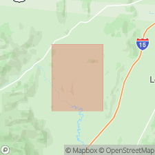
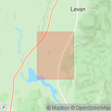
[Type locality not stated.] Notable exposures on east side of U.S. Highway 91, 8 to 10 mi southwest of Levan, just south of Chicken Creek Reservoir, Juab Co., central UT.
Source: Publication; US geologic names lexicon (USGS 1350, p. 148-149); GNU records (USGS DDS-6; Menlo GNULEX).
- Usage in publication:
-
- Chicken Creek Tuff Member
- Modifications:
-
- Revised
- AAPG geologic province:
-
- Great Basin province
Summary:
Assigned to Goldens Ranch Formation, as basal member, in the Nephi NW 7.5-min quadrangle, Juab County, Utah (Great Basin province). Composed of interbedded volcanic tuffs and bentonitic clays. Equivalent to Chicken Creek Tuff of Evernden and James (1964). Underlies Hall Canyon Conglomerate Member (new) of Goldens Ranch. Unconformably overlies Orme Spring Conglomerate (new). Age is Oligocene, based on K-Ar date of 33.2 Ma obtained by Evernden and James (1964). Report includes correlation chart.
Source: Modified from GNU records (USGS DDS-6; Denver GNULEX).
- Usage in publication:
-
- Chicken Creek Tuff Member
- Modifications:
-
- Not used
Summary:
Not used as a member of Goldens Ranch Formation in the Juab-Sevier Valley areas, Utah (Great Basin province). Rocks assigned to Chicken Creek by Meibos (1983) are called lenticular ash-flow tuffs; these comprise the base of Goldens Ranch Formation (adopted by the USGS), which consists chiefly of water-laid sediments.
Source: Modified from GNU records (USGS DDS-6; Denver GNULEX).
- Usage in publication:
-
- Chicken Creek Tuff Member
- Modifications:
-
- Age modified
- Geochronologic dating
- Mapped 1:24k
- AAPG geologic province:
-
- Great Basin province
- Usage in publication:
-
- Chicken Creek Tuff Member*
- Modifications:
-
- Mapped 1:24k
- Dominant lithology:
-
- Tuff
- AAPG geologic province:
-
- Great Basin province
Summary:
Chicken Creek Tuff Member of Goldens Ranch Formation. Grayish-pink to light-gray, poorly welded, vitric, dacitic ash-flow tuff with pumice lapilli, volcanic and quartzite rock fragments, and minor biotite. Generally not well exposed. Around Chicken Creek Reservoir and "Milky Wash" thickness less than 100 feet (30 m), but in one well (Placid Barton) total dip-corrected thickness is 170 feet (50 m). Lies below, and in places within, Hall Canyon Conglomerate Member of Goldens Ranch Formation, and above Green River Formation. Source of tuff unknown. Age is middle Eocene, based on Ar-Ar age of 38.61 +/-0.13 Ma from the Sage Valley quadrangle (D.L. Clark, 2003, Utah Geol. Survey Misc. Pub., no. 03-2, scale 1:24,000, 57 p.).
Named from small exposure southwest of Chicken Creek Reservoir, in sec. 19, T. 15 S., R. 1 W., Skinner Peaks 7.5-min quadrangle, Juab Co., central UT.
Source: Publication.
For more information, please contact Nancy Stamm, Geologic Names Committee Secretary.
Asterisk (*) indicates published by U.S. Geological Survey authors.
"No current usage" (†) implies that a name has been abandoned or has fallen into disuse. Former usage and, if known, replacement name given in parentheses ( ).
Slash (/) indicates name conflicts with nomenclatural guidelines (CSN, 1933; ACSN, 1961, 1970; NACSN, 1983, 2005, 2021). May be explained within brackets ([ ]).