The National Geologic Map Database is migrating to a new infrastructure. We apologize for any service disruptions during this process.
|
|---|


- Usage in publication:
-
- Chetek Member
- Modifications:
-
- Principal reference
- Dominant lithology:
-
- Sand
- AAPG geologic province:
-
- Wisconsin arch
Summary:
Pg. vi (chart), 47-48. Chetek Member of Copper Falls Formation. (Follows informal usage of M.D. Johnson, 1986, Wisconsin Geol. Nat. Hist. Survey Inf. Circ., no. 55, 42 p., and M.D. Johnson, 1984, Univ. Wisconsin PhD dissert.) Stream sediment. Sand, slightly gravelly sand, and gravelly sand. Thickness 5+ m at type; commonly 10 m thick. Lower contact not exposed. Interpreted as having been deposited by Superior and Chippewa Lobes during late St. Croix and late Chippewa advances about 15,000 yr B.P. (Pleistocene; late Wisconsinan), citing Clayton and Moran, 1982 (Quat. Sci. Rev., v. 1, p. 55-82). Mapped where stream sediment cannot be confidently included in overlying Sylvan Lake Member (Superior Lobe) or Mikana Member (Chippewa Lobe) of Copper Falls Formation.
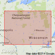
Type section: gravel pit on east side of County Trunk Highway SS near Cameron, WI, in SW/4 SE/4 sec. 28, T. 34 N., R. 11 W., Rice Lake South 7.5-min quadrangle, Barron Co., northwestern WI.
Named from village of Chetek, Chetek 7.5-min quadrangle, Barron Co., northwestern WI, [about 8 mi southeast of type section]; name credited to Mark D. Johnson.
Reference section (stream sediment): gravel pit, in SE/4 sec. 23, T. 35 N., R. 11 W., Rice Lake North and Rice Lake South 7.5-quadrangles, Barron Co., northwestern WI.
[Additional locality information from Wisconsin Highways, wisconsinhighways.org, accessed on June 9, 2018.]
Source: Publication.
- Usage in publication:
-
- Chetek Member†
- Modifications:
-
- Abandoned
- AAPG geologic province:
-
- Wisconsin arch
Summary:
Pg. 173. †Chetek Member of Copper Falls Formation. Abandoned. This unit was defined in western Wisconsin as sand and gravel derived from the Chippewa and Superior Lobes that could not be associated with any other member in the Copper Falls Formation (Attig and others, 1988). Term abandoned here due to lack of usage. Sediment formerly mapped as Chetek Member is now classified as undifferentiated stream sediment of the Copper Falls Formation.
[See Copper Falls, p. 4 (fig. 2), 7 (fig. 3), 8, 58-87 of Syverson and others, 2011.]
Source: Publication.
For more information, please contact Nancy Stamm, Geologic Names Committee Secretary.
Asterisk (*) indicates published by U.S. Geological Survey authors.
"No current usage" (†) implies that a name has been abandoned or has fallen into disuse. Former usage and, if known, replacement name given in parentheses ( ).
Slash (/) indicates name conflicts with nomenclatural guidelines (CSN, 1933; ACSN, 1961, 1970; NACSN, 1983, 2005, 2021). May be explained within brackets ([ ]).