

- Usage in publication:
-
- Cherokee shale
- Modifications:
-
- Original reference
- Dominant lithology:
-
- Shale
- AAPG geologic province:
-
- Cherokee basin
Summary:
Pg. 105-106. Cherokee shale. Ashy white to black shales, 500 feet thick, containing many beds of coal, sandstone, and limestone. Suggest that term be applied to all shales above Galena limestone and below Oswego limestone, unless Swallow limestone should prove to be more extensive in Cherokee County, Kansas, than now seems probable. Should such be the case the term should apply only to shales below Swallow limestone. [The underlying limestone was years ago proved not to be Galena limestone, but to be of Mississippian age.]
Named from prominent exposures in Cherokee Co., KS. (Neosho River forms the southwest border of Cherokee Co., KS.)
Source: US geologic names lexicon (USGS Bull. 896, p. 415); supplemental information from GNU records (USGS DDS-6; Denver GNULEX).
- Usage in publication:
-
- Cherokee shale
- Modifications:
-
- Revised
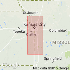
- Areal extent
- AAPG geologic province:
-
- Cherokee basin
- Forest City basin
- Ozark uplift
Summary:
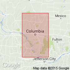
Cherokee shale underlies Fort Scott limestone member of Henrietta formation and unconformably overlies Mississippian in northwest Missouri. Is basal formation of Des Moines group and of Pennsylvanian. Includes, near top, Lexington coal (=Mystic coal), and lower down, at different (descending) horizons, Summit coal, Mulky (Macon City) coal, Bevier coal, and Tebo (Lower Ardmore) coal.
Source: US geologic names lexicon (USGS Bull. 896, p. 415).
- Usage in publication:
-
- Cherokee formation
- Cherokee shale
- Modifications:
-
- Revised
- AAPG geologic province:
-
- Cherokee basin
- Forest City basin
- Ozark uplift
Summary:
Lexington or Butler coal occurs in lower part of Labette shale; the upper Fort Scott or Summit coal occurs in Fort Scott limestone, 0 to 15 feet above its base; the lower Fort Scott or Mulky coal lies in upper 10 feet of Cherokee formation in west-central Missouri; the Bevier or Williams coal lies in upper part of Cherokee shale, 60 to 100 feet below Mulky coal.
Source: US geologic names lexicon (USGS Bull. 896, p. 415).

- Usage in publication:
-
- Cherokee shale
- Modifications:
-
- Revised
- AAPG geologic province:
-
- Cherokee basin
Summary:
Pg. 42, 61. Lexington coal (=Mystic coal of Iowa) occurs in lower part of Fort Scott limestone; Mulky and Bevier coals lie in upper part of Cherokee shale.
Source: US geologic names lexicon (USGS Bull. 896, p. 415).

- Usage in publication:
-
- Cherokee formation
- Cherokee shale
- Modifications:
-
- Overview
- AAPG geologic province:
-
- Chautauqua platform
Summary:
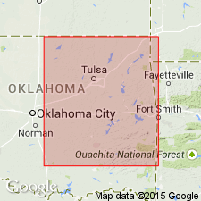
In northeastern Oklahoma Cherokee shale unconformably overlies Morrow formation (of Pennsylvanian age), and contains so much sandstone and limestone that it is called Cherokee formation.
Source: US geologic names lexicon (USGS Bull. 896, p. 415).
- Usage in publication:
-
- Cherokee group
- Modifications:
-
- Revised
- AAPG geologic province:
-
- Cherokee basin
Summary:
Pg. 18-23; 1938, Kansas Acad. Sci. Trans., v. 41, p. 193-195. Cherokee group in southeastern Kansas subidivided into 15 formations or cyclothems (cyclic formational units) as follows (ascending): Riverton, Neutral, Columbus, Bluejacket, Knifeton, Weir-Pittsburg, Pilot, Scammon, Mineral, Fleming, Coalvale, Croweburg, Ardmore, Bevier, and Mulky. Age is Middle Pennsylvanian (Des Moines).
Source: US geologic names lexicon (USGS Bull. 1200, p. 746-747).
- Usage in publication:
-
- Cherokee shale
- Modifications:
-
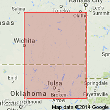
- Areal extent
- AAPG geologic province:
-
- Cherokee basin
Summary:
Pg. 33-35, fig. 2; 1937, Kansas Geol. Soc. Gdbk., 11th Ann. Field Conf., p. 17. Cherokee shale, southeastern Kansas, includes Little Cabin sandstone member near base. Bluejacket sandstone member near middle, and Breezy Hill limestone (new) at top. Thickness about 425 feet. Overlies Mississippian limestone; underlies Fort Scott limestone. Age is Middle Pennsylvanian (Des Moines).
Source: US geologic names lexicon (USGS Bull. 1200, p. 746-747).
- Usage in publication:
-
- Cherokee group
- Modifications:
-
- Revised
- AAPG geologic province:
-
- Cherokee basin
- Forest City basin
- Ozark uplift
Summary:
Pg. 29-92, pls. 5,6, measured sections. Cherokee group, as defined in this report, is composed of several new formations. Names of well-known coal beds have been used in order to reduce to minimum the introduction of new names. Sequence (ascending) unnamed shale and sandstone of local occurrence, Graydon formation, Cheltenham, Loutre (new), Tebo (new), Ardmore, Bevier, and Lagonda. Group is restricted by removal of Squirrel sandstone which is placed in overlying Henrietta group. Age is Middle Pennsylvanian (Des Moines).
Source: US geologic names lexicon (USGS Bull. 1200, p. 746-747).

- Usage in publication:
-
- Cherokee group
- Modifications:
-
- Revised
- AAPG geologic province:
-
- Forest City basin
- Iowa shelf
Summary:
Pg. 670-671, 691, Chart no. 6 (column 31, Iowa, collated by R.C. Moore). Cherokee group. Group status in Iowa. Pennsylvanian correlation chart shows that upper part includes Seahorne and Munterville limestones. Age of upper part of group is [Middle Pennsylvanian]; Desmoinesian; Westphalian C to D. Age of lower part of group (undivided) is Lampasas [Atokan].
Source: Publication; US geologic names lexicon (USGS Bull. 1200, p. 746-747).

- Usage in publication:
-
- Cherokee shale*
- Modifications:
-
- Areal extent
- AAPG geologic province:
-
- Anadarko basin
Summary:
Extended into the subsurface of Baca County, Colorado, in the Anadarko basin. Overlies undesignated Atokan rocks and underlies Marmaton group (undivided). Age is Middle Pennsylvanian (Desmoinesian). Report includes correlation chart.
Source: Modified from GNU records (USGS DDS-6; Denver GNULEX).

- Usage in publication:
-
- Cherokee group
- Modifications:
-
- Revised
- AAPG geologic province:
-
- Cherokee basin
- Forest City basin
- Chautauqua platform
- Ozark uplift
Summary:
Pg. 37-47. Cherokee group. Defined to include all strata from base of Pennsylvanian north of Kansas-Oklahoma line to base of Fort Scott limestone. In Kansas, comprises 16 cyclothems. Classification is modified from that of Abernathy (1937) in that Croweburg and Ardmore are combined into Ardmore cyclothem; Stice cyclothem (new) occurs above the Bevier; term Mulky is discarded and terms Breezy Hill and Blackjack Creek are used. Age is Middle Pennsylvanian (Des Moines).
Source: US geologic names lexicon (USGS Bull. 1200, p. 746-747).
- Usage in publication:
-
- Cherokee group
- Modifications:
-
- Revised
- AAPG geologic province:
-
- Cherokee basin
Summary:
Pg. 51-55, pl. 11. Cherokee group, in Weaubleau Creek area, [St. Clair County], Missouri, comprises Dederick subgroup [informal] (undifferentiated) and Graydon formation. Overlies Burlington formation; underlies Tertiary(?) unconsolidated upland gravels. Age is Middle Pennsylvanian (Des Moines).
["Subgroup" not recognized as a formal stratigraphic rank term (CSN, 1933; ACSN, 1961, 1970; NACSN, 1983, 2005, 2021). Considered informal and should not be capitalized.]
Source: US geologic names lexicon (USGS Bull. 1200, p. 746-747).
- Usage in publication:
-
- Cherokee formation
- Modifications:
-
- Revised
- AAPG geologic province:
-
- Chautauqua platform
Summary:
Pg. 2087. Cherokee formation. In northern Oklahoma includes (ascending) older Pennsylvanian units, Little Cabin sandstone, Bluejacket sandstone, Broken Arrow coal, Verdigris limestone, sandstone (Squirrel sand), Iron Post coal, Kinnison shale (new), and Breezy Hill limestone members. Age is Middle Pennsylvanian (Des Moines).
Source: US geologic names lexicon (USGS Bull. 1200, p. 746-747).
- Usage in publication:
-
- Cherokee group
- Modifications:
-
- Revised
- AAPG geologic province:
-
- Ozark uplift
Summary:
Pg. 68-90. Cherokee group. McQueen defined top of the Cherokee as the base of Squirrel sandstone, but this boundary is not now recognized by Missouri Geological Survey. Cherokee is defined as extending from base of Pennsylvanian to base of Fort Scott. Age is Middle Pennsylvanian (Desmoinesian).
Source: US geologic names lexicon (USGS Bull. 1200, p. 746-747).
- Usage in publication:
-
- Cherokee group
- Modifications:
-
- Not used
- AAPG geologic province:
-
- Chautauqua platform
Summary:
Pg. 1523-1526. Cherokee group. Rocks of Krebs and Cabaniss groups (both new) are nearly but not quite the same, stratigraphically, as Cherokee rocks of southeastern Kansas. Hartshorne sandstone and possibly some lower McAlester rocks are older than any Cherokee rocks of Kansas; Thruman sandstone, Stuart shale, and lower part of Senora formation are probably not represented in Cherokee rocks of Kansas because of progressive northward overlap in post-Boggy rocks. Otherwise the Krebs and Cabaniss rocks are equivalent to Cherokee rocks of Kansas. Age is Middle Pennsylvanian (Desmoinesian).
Source: US geologic names lexicon (USGS Bull. 1200, p. 746-747).
- Usage in publication:
-
- Cherokee group
- Modifications:
-
- Not used
Summary:
Pg. 2747-2749. Cherokee group. In reclassification of Desmoinesian (Pennsylvanian) of northern Midcontinent, term Cherokee is replaced with Krebs and Cabaniss groups.
Source: US geologic names lexicon (USGS Bull. 1200, p. 746-747).

- Usage in publication:
-
- Cherokee group
- Modifications:
-
- Overview
- AAPG geologic province:
-
- Cherokee basin
- Forest City basin
Summary:
Term Cherokee readopted for Kansas and Missouri. Krebs and Cabaniss relegated to [informal] subgroup status. Cherokee subdivided into (ascending) Riverton, Warner, Rowe, Dry Wood, Bluejacket, Seville, Weir, Tebo, Scammon, Mineral, Robinson Branch, Fleming, Croweburg, Verdigris, Bevier, Lagonda, Mulky, and Excello formations. Underlies Marmaton group. Age is Middle Pennsylvanian (Des Moines).
["Subgroup" not recognized as a formal stratigraphic rank term (CSN, 1933; ACSN, 1961, 1970; NACSN, 1983, 2005, 2021). Considered informal and should not be capitalized.]
Source: US geologic names lexicon (USGS Bull. 1200, p. 746-747).

- Usage in publication:
-
- Cherokee group
- Modifications:
-
- Overview
Summary:
Chart shows that Cherokee group in Kansas includes Krebs and Cabaniss formations. Age is Middle Pennsylvanian (Desmoinesian).
Source: US geologic names lexicon (USGS Bull. 1200, p. 746-747).

- Usage in publication:
-
- Cherokee group
- Modifications:
-
- Areal extent
Summary:
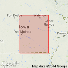
Pg. 34, fig. 5. Cherokee group. Section between base of Marmaton group to top of Mississippian system is designated Cherokee group. Although this may include a part of either Atoka or Morrow series, Iowa Geological Survey has not differentiated them. Other states have further subdivided the Cherokee in Krebs-Cabaniss subgroups [informal]. Mulky coal, Bedford coal, Bevier coal, Ardmore limestone, and Whitebreast coal have been recognized. Age is Middle Pennsylvanian (Des Moines).
["Subgroup" not recognized as a formal stratigraphic rank term (CSN, 1933; ACSN, 1961, 1970; NACSN, 1983, 2005, 2021). Considered informal and should not be capitalized.]
Source: US geologic names lexicon (USGS Bull. 1200, p. 746-747).
- Usage in publication:
-
- Cherokee Group
- Modifications:
-
- Revised
- AAPG geologic province:
-
- Iowa shelf
Summary:
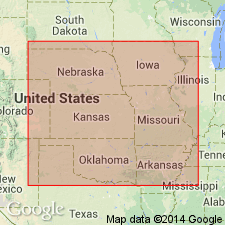
Is the basal group of the Des Moines Supergroup. Occurs on the surface and in the subsurface of IA, MO, NE, KS, and OK. Has an average thickness of 755 ft. Overlies Morrow Supergroup locally, or Mississippian limestone. Underlies Mouse Creek Formation (new) of Marmaton Group. Divided into the Kilburn Formation (new), Kalo Formation and its Blackoak Coal and Cliffland Coal Members (all new), Floris Formation and its Laddsdale Member and Carruthers Coal Member (all new), and Swede Hollow Formation (new). Swede Hollow includes the Whitebreast Coal Member (new), Oakley Shale Member (new), Ardmore Limestone Member (extended into IA from MO), Wheeler Coal Member (new), Bevier and Mulky Coal Members (extended into IA from MO). Cherokee deposits show influence of cyclic deposition in south-central IA on the Iowa shelf. Of Pennsylvanian age "Atokan-Desmoinesian Series boundary" is placed "within the Des Moines Supergroup of IA." Nomenclature chart. Cross sections. Graphic columns.
Source: GNU records (USGS DDS-6; Denver GNULEX).
For more information, please contact Nancy Stamm, Geologic Names Committee Secretary.
Asterisk (*) indicates published by U.S. Geological Survey authors.
"No current usage" (†) implies that a name has been abandoned or has fallen into disuse. Former usage and, if known, replacement name given in parentheses ( ).
Slash (/) indicates name conflicts with nomenclatural guidelines (CSN, 1933; ACSN, 1961, 1970; NACSN, 1983, 2005, 2021). May be explained within brackets ([ ]).