The National Geologic Map Database is migrating to a new infrastructure. We apologize for any service disruptions during this process.
|
|---|


- Usage in publication:
-
- "Checkerboard limestone"
- Modifications:
-
- Original reference
- Dominant lithology:
-
- [Limestone]
- AAPG geologic province:
-
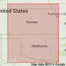
- Chautauqua platform
Summary:
Pg. 151-164. Lenapah limestone is same formation that is known as "Checkerboard limestone" in region of Glenn pool. Age is Pennsylvanian.
Source: US geologic names lexicon (USGS Bull. 896, p. 409).
- Usage in publication:
-
- Checkerboard limestone
- Modifications:
-
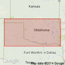
- Areal extent
- AAPG geologic province:
-
- Chautauqua platform
Summary:
[Pg. 107.] Checkerboard limestone is probably 100 feet above Lenapah limestone. [Age is Pennsylvanian.]
Source: US geologic names lexicon (USGS Bull. 896, p. 409).
- Usage in publication:
-
- Checkerboard lime
- Modifications:
-
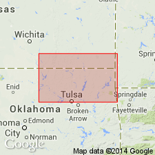
- Overview
- AAPG geologic province:
-
- Chautauqua platform
Summary:
Pg. 369-372. The limestone, 2 feet thick, locally known as Checkerboard lime, outcrops in creek bed at old "Checkerboard Crossing" near E-W/4 line of sec. 22, T. 15 N., R. 11 E. Age is Pennsylvanian.
Source: US geologic names lexicon (USGS Bull. 896, p. 409).
- Usage in publication:
-
- Checkerboard limestone
- Modifications:
-
- Overview
- AAPG geologic province:
-
- Chautauqua platform
Summary:
Pg. 122. Checkerboard limestone lies about 70 feet above Lenapah limestone. Age is Pennsylvanian.
Source: US geologic names lexicon (USGS Bull. 896, p. 409).
- Usage in publication:
-
- Checkboard lime
- Modifications:
-
- Overview
- Dominant lithology:
-
- Limestone
- AAPG geologic province:
-
- Chautauqua platform
Summary:
Pg. 282-292. Checkerboard lime is a hard blue limestone, 4 feet in average thickness, which contains peculiar semicircular markings caused by presence of fossil brachiopods. Weathered surface usually of light cream or very light yellow color. Breaks into blocks, nearly cubical and 4+/- feet on each side. Remarkable for persistent character, such as thickness, color, resistance to weathering, peculiar fossil markings, jointing, etc. Present in Okmulgee district, Oklahoma. Has been mapped for a distance of 20 miles. Can be traced from Deep Fork in sec. 19, T. 14 N., R. 11 E., through Mounds and Jenks, over Turkey Mountain and into Tulsa, but can not be followed continuously southwest from Deep Fork. Lies 100 to 120 feet above Seminole conglomerate. Age is Pennsylvanian.
Source: US geologic names lexicon (USGS Bull. 896, p. 409).
- Usage in publication:
-
- Checkerboard limestone
- Modifications:
-
- Overview
- AAPG geologic province:
-
- Chautauqua platform
Summary:
Pg. 541-550. According to general stratigraphic relation of Checkerboard limestone to Lenapah limestone of Oklahoma, as described by Ohern, the Checkerboard limestone has been tentatively regarded as = base of Kansas City formation or the Hertha limestone. Age is Pennsylvanian.
Source: US geologic names lexicon (USGS Bull. 896, p. 409).
- Usage in publication:
-
- Checkerboard limestone member
- Modifications:
-
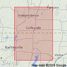
- Principal reference
- Revised
- Dominant lithology:
-
- Limestone
- AAPG geologic province:
-
- Chautauqua platform
Summary:
Pg. 72. Checkerboard limestone member of Coffeyville formation. Lies near base of that formation. It is 2.5 to 3 feet thick, fine-grained, fossiliferous, bluish white on fresh surfaces but weathers yellowish white. In bare areas, it presents a "checkerboard" appearance, due to solution channels along joints, which occur in two sets, the one crossing the other. From this feature the limestone was for years known as "Checkerboard lime," but the geographic location which is here designated as its type locality is the exposures on Checkerboard Creek in T. 15 N., R. 11 E. A good exposure may be seen at "Checkerboard Crossing" of the creek, near E-W/4 line of sec. 22, T. 15 N., 11 E. Age is Pennsylvanian.
Source: US geologic names lexicon (USGS Bull. 896, p. 409).
- Usage in publication:
-
- Checkerboard limestone
- Modifications:
-
- Revised
- AAPG geologic province:
-
- Chautauqua platform
Summary:
Pg. 40 (table), 42. Checkerboard limestone of Skiatook group. Rank raised to formation in Skiatook group. Overlies Seminole sandstone; underlies Coffeyville shale (restricted).
Source: US geologic names lexicon (USGS Bull. 1200, p. 739-740).
- Usage in publication:
-
- Checkerboard limestone
- Modifications:
-
- Areal extent
- AAPG geologic province:
-
- Chautauqua platform
Summary:
Pg. 634 (fig. 11), 638-639. Checkerboard limestone. Geographically extended into southern Kansas where it overlies Hepler sandstone.
Source: US geologic names lexicon (USGS Bull. 1200, p. 739-740).

- Usage in publication:
-
- Checkerboard limestone
- Modifications:
-
- Overview
- AAPG geologic province:
-
- Chautauqua platform
Summary:
Pg. 91. Checkerboard limestone of Pleasanton group. In Kansas, included in Pleasanton group; underlies shales below Knobtown sandstone. Thickness ranges from featheredge to about 6 feet.
Source: US geologic names lexicon (USGS Bull. 1200, p. 739-740).
- Usage in publication:
-
- Checkerboard limestone
- Modifications:
-
- Overview
- AAPG geologic province:
-
- Chautauqua platform
Summary:
Pg. 16-17. Name Checkerboard seems to have crept into general usage without formal definition. Hutchinson (1911) made reference to it by name. Smith (1914, USGS Bull. 541) used name without describing it. Fath and Emery (1917, Oklahoma Geol. Survey Bull., no. 35) described the Checkerboard and designated type exposure. Checkerboard limestone in Creek County [this report] is single bed about 2.5 feet thick. Conformably overlies Seminole formation; conformably underlies Coffeyville formation. [Is formation of] Skiatook group. Age is Pennsylvanian (Missourian).
Source: US geologic names lexicon (USGS Bull. 1200, p. 739-740).
For more information, please contact Nancy Stamm, Geologic Names Committee Secretary.
Asterisk (*) indicates published by U.S. Geological Survey authors.
"No current usage" (†) implies that a name has been abandoned or has fallen into disuse. Former usage and, if known, replacement name given in parentheses ( ).
Slash (/) indicates name conflicts with nomenclatural guidelines (CSN, 1933; ACSN, 1961, 1970; NACSN, 1983, 2005, 2021). May be explained within brackets ([ ]).