

- Usage in publication:
-
- Charlottesville formation
- Modifications:
-
- Named
- Dominant lithology:
-
- Gneiss
- Schist
- AAPG geologic province:
-
- Piedmont-Blue Ridge province
Summary:
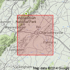
Named for city of Charlottesville, Albemarle Co., central VA. The name Charlottesville formation has been used in structural geology lectures at University of Virginia since 1945. Occurs as a belt extending northeast from Charlottesville to county line, and in a belt extending southwest from Charlottesville to Nelson Co. line in vicinity of Schuyler. Good outcrops on Rose Hill Dr where it crosses Shenks Branch in Charlottesville, and along VA Hwy 600 east of Watts Station on Southern RR. Composed of fine-grained, massive layers of quartz biotite gneiss, calcareous in places, with a few beds of sericitic and graphitic schist. Contains numerous soapstone dikes, best developed near Nelson Co. line. Thickness at type locality is approx 4500 ft. Overlies Johnson Mill formation. Equivalent to upper part of Lynchburg formation at Lynchburg. Age is Precambrian.
Source: GNU records (USGS DDS-6; Reston GNULEX).
- Usage in publication:
-
- Charlottesville formation
- Modifications:
-
- Overview
- AAPG geologic province:
-
- Piedmont-Blue Ridge province
Summary:
Charlottesville formation included within rocks mapped as Lynchburg formation.
Source: GNU records (USGS DDS-6; Reston GNULEX).

- Usage in publication:
-
- Charlottesville Formation
- Modifications:
-
- Overview
- AAPG geologic province:
-
- Piedmont-Blue Ridge province
Summary:
Charlottesville Formation assigned to Lynchburg Group. Typically consists of schistose siltstone and mudstone with isolated outcrops of medium- to coarse-grained, commonly amalgamated sandstone beds. In Culpeper area, a few beds of pebbly sandstone and one of cobble conglomerate are present. In Rockfish River area, lower 1000 m consists of very thin-bedded, fine-grained sandstone and siltstone with prominent biotite porphyroblasts. Similar rocks are found locally near base of formation in Culpeper area. Partially equivalent to rocks discussed by Furcron (1969) as Fauquier Formation and to the "upper sequence" of Conley (1978). In both Culpeper and Rockfish River areas, fine-grained Charlottesville is in fault(?) contact with either Ball Mountain Formation or its Johnson Mill Member. Age is Late Proterozoic.
Source: GNU records (USGS DDS-6; Reston GNULEX).
- Usage in publication:
-
- Charlottesville Formation
- Modifications:
-
- Overview
- AAPG geologic province:
-
- Piedmont-Blue Ridge province
Summary:
Lynchburg Group, on the southeastern limb of the Blue Ridge anticlinorium, is subdivided in this report into (ascending) Fauquier Formation, unnamed metagraywacke turbidite deposits (which combines Rockfish conglomerate formation and Lynchburg gneiss formation of Nelson, 1962), Johnson Mill Formation, and the Charlottesville Formation. Lynchburg rocks also occur in several outliers, the largest and most westerly of which is the belt containing the Mechums River Formation, which has been previously correlated with the Lynchburg. [Field trip is based on reconnaissance geologic mapping in the Charlottesville 1 deg X 2 deg quad. as part of a new edition of the Geologic Map of VA to be completed by 1993.]
Source: GNU records (USGS DDS-6; Reston GNULEX).

- Usage in publication:
-
- Charlottesville Formation
- Modifications:
-
- Overview
- AAPG geologic province:
-
- Piedmont-Blue Ridge province
Summary:
Lynchburg Group as used on the State map, includes Monumental Mills, Charlottesville, Alligator Back, Ashe Formations, and Moneta Gneiss along with several unnamed lithologic units. Charlottesville, in the Culpeper area, includes in part the Ball Mountain Formation of Wehr (1985) and Kasselas (1993). Southwest of Nelson Co., rocks equivalent to the Charlottesville Formation are mapped as Alligator Back. The cross-bedded quartzite, feldspathic metasandstone, and muscovite schist in the upper portion were mapped as Swift Run Formation by Nelson (1962). Age is Late Proterozoic.
Source: GNU records (USGS DDS-6; Reston GNULEX).
- Usage in publication:
-
- Charlottesville Formation*
- Modifications:
-
- Revised
- AAPG geologic province:
-
- Piedmont-Blue Ridge province
Summary:
Ball Mountain and Charlottesville Formations are the only two formations assigned to the Lynchburg Group. Report includes geologic maps, correlation chart, and isotopic data.
Source: GNU records (USGS DDS-6; Reston GNULEX).
For more information, please contact Nancy Stamm, Geologic Names Committee Secretary.
Asterisk (*) indicates published by U.S. Geological Survey authors.
"No current usage" (†) implies that a name has been abandoned or has fallen into disuse. Former usage and, if known, replacement name given in parentheses ( ).
Slash (/) indicates name conflicts with nomenclatural guidelines (CSN, 1933; ACSN, 1961, 1970; NACSN, 1983, 2005, 2021). May be explained within brackets ([ ]).