

- Usage in publication:
-
- Charles formation
- Modifications:
-
- Original reference
- Dominant lithology:
-
- Shale
- Limestone
- Dolomite
- Anhydrite
- AAPG geologic province:
-
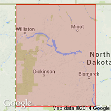
- Williston basin
Summary:
Pg. 861-864. Charles formation of Big Snowy group (subsurface). Term introduced to describe series of interbedded limestones, dolomite, anhydrite, and shales that lie between basal member (Kibbey) of Scott's Big Snowy group and the Madison. Lies at depths of 6,350 to 6,815 feet in Carter Oil Company's Northern Pacific test well No. 1, in [SW/4 SE/4] sec. 19, T. 4 N., R. 62 E., Fallon County, Montana. Possible that Charles sediment fills gap between Madison and Big Snowy time and should be included in Madison; however, widespread development of porosity in upper part of Madison indicates that the time break is here; hence, Charles is considered basal member of Big Snowy group. Age is Mississippian.
Named from occurrence in Arro Oil and Refining Company and California Company's Charles No. 4 well [referred to by later authors as type well], in sec. 21, T. 15 N., R. 30 E., Garfield Co., MT.
Source: US geologic names lexicon (USGS Bull. 1200, p. 725).
- Usage in publication:
-
- Charles formation
- Modifications:
-
- Areal extent
- AAPG geologic province:
-
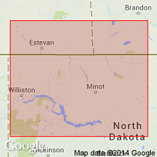
- Williston basin
- Central Montana uplift
Summary:
Charles formation of Big Snowy Group. Light-colored earthy limestones and dolomites interbedded with evaporites (chiefly anhydrite) in beds approaching 100 feet thickness, and minor amounts of red shale. [Thickness 760 feet.] Unconformably underlies Kibbey Formation. Conformably overlies Mission Canyon limestone; contact placed below lowest major massive anhydrite and above zone of porosity which is recognizable throughout Williston basin. Age is Mississippian.
[Type well]: depth-interval [3,050 to 3,810 ft], Arro Oil and Refining Company and California Company's Charles No. 4 well, Mosby dome, Garfield Co., central MT [depths estimated from correlation diagram (fig. 3)].
Source: Modified from GNU records (USGS DDS-6; Denver GNULEX).
- Usage in publication:
-
- Charles formation
- Modifications:
-
- Revised
- AAPG geologic province:
-
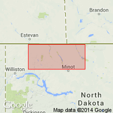
- Williston basin
- Central Montana uplift
- Sweetgrass arch
Summary:
Revised to include rocks in the interval between depths 3,195 and 3,800 [total thickness 605 ft] in the Arro Oil and Refining Co. and the California Co.'s Charles no. 4 well [type well, in Garfield Co, MT in Williston basin]. Notes that a massive salt bed is present at the top over an extensive area in the deep part of Williston basin. Underlain by Mission Canyon limestone; overlain unconformably by Kibbey formation or younger rocks. Isopach map shows distribution and thickness in northern MT and adjacent parts of Saskatchewan in Williston basin and on the Central Montana uplift and Sweetgrass arch. Shows correlation diagrams. A formation in Madison group. Mississippian (Meramec) in age.
Source: GNU records (USGS DDS-6; Denver GNULEX).
- Usage in publication:
-
- Charles formation
- Modifications:
-
- [Principal reference]
- AAPG geologic province:
-
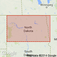
- Williston basin
Summary:
Pg. 2176. Charles formation of Madison group. Recognized north of Black Hills. As mapped, includes rocks from top of upper depositional sequence down to second (upper) evaporite zone of middle sequence of Madison. Thickness 300+ feet at South Dakota-North Dakota border. Age is Mississippian. Type section suggested.
Type section (subsurface): depth-interval 3,200 to 3,800 feet, Arro Oil and Refining Company and California Company Charles No. 4 well, in sec. 21, T. 15 N., R. 30 E., Garfield Co., MT. Named from Charles lease.
Source: Excerpted from North Dakota lexicon (North Dakota Geol. Survey Rept. Inv. 71, p. 21-22).
- Usage in publication:
-
- Charles formation
- Modifications:
-
- Overview
- AAPG geologic province:
-
- Williston basin
Summary:
Contains seven separate salt beds in ND, Williston basin, termed (descending) Mississippian "A" through "F" and Mississippian "X". An eight bed, Mississippian "XY", was found in two wells. Salt attains a maximum thickness of 150 ft in Mississippian "A" salt. Maps show distribution and thickness of each of the beds except bed "XY". Shows stratigraphic relations of the principal beds in an electric log of the Gulf Oil Corp., Bennie Pierre Federal no. 1 well, sec 28, T148N, R104W, McKenzie Co, ND. Mississippian in age.
Source: GNU records (USGS DDS-6; Denver GNULEX).
- Usage in publication:
-
- Charles formation
- Modifications:
-
- Overview
- AAPG geologic province:
-
- Williston basin
Summary:
Introduces into northwestern ND a system of nomenclature for subdividing the formation, utilizing a notation established earlier in Saskatchewan. Subdivided into 8 units, numbered (ascending) C-1 through C-8. [The boundaries of the units are electric-log markers thought to be time-stratigraphic horizons that can be carries across facies boundaries over large areas in northwestern ND and neighboring parts of Saskatchewan. Describes lithologies of the subdivisions, and shows their correlations in a series of eight electric-log correlation diagrams. Producing horizons of oil fields in the area are indicated on the diagrams. Mississippian in age.
Source: GNU records (USGS DDS-6; Denver GNULEX).
- Usage in publication:
-
- Charles formation
- Modifications:
-
- Areal extent
- AAPG geologic province:
-
- Williston basin
Summary:
Name used in the Williston basin to distinguish Charles magnafacies consisting of interbedded limestone and anhydrite or salt. Contact with underlying Mission Canyon formation (or magnafacies) descends stratigraphically to the east. Superimposes a time-stratigraphic terminology that permits correlations across the facies boundary. Terminology is assembled from time-stratigraphic nomenclatural schemes used by petroleum geologists in Saskatchewan. Certain marker beds selected on electric and radioactivity logs are used as boundaries for the time-stratigraphic intervals. The Charles magnafacies includes one or more of the following units in the superimposed terminology (descending): Poplar, Ratcliffe, Midale, Hastings, Frobisher, and MC-3 beds. The Ratcliffe beds and stratigraphically lower intervals are shown passing from Mission Canyon to Charles formation (or magnafacies) from west to east. Shows electric-log correlation diagrams. Compares terminology with that of previous authors, including Harrison and Flood (1956) in ND. Overlain unconformably by Spearfish formation or younger rocks. Is a formation in Madison group. Mississippian in age.
Source: GNU records (USGS DDS-6; Denver GNULEX).
- Usage in publication:
-
- Charles facies
- Modifications:
-
- Overview
- Redescribed
- Dominant lithology:
-
- Evaporite
- AAPG geologic province:
-
- Williston basin
Summary:
Uses "facies" as the designation for the formational unit in north-central ND and southeastern Saskatchewan in Williston basin to emphasize that its lower boundary transgresses time. Consists predominantly of evaporites. Its top is generally conformable with overlying beds and is represented by top of first salt or anhydrite below Kibbey limestone or its erosional counterpart, and its base is base of lowest evaporite which is associated with overlying evaporitic sequence. In general, is a manifestation of cyclic oscillation of a lagoonal, or restricted, environment. Interbedded salts, anhydrites, and fine argillaceous limestones and dolomites are characteristic, with occasional appearances of thin-bedded clastic carbonates. Lower part interfingers with the partly equivalent and partly older Mission Canyon facies. Contains from place to place one or more of the following [time-stratigraphic] mechanical-log units (ascending): Frobisher-Alida member, Ratcliffe member, and Poplar member. Is a formation in Madison group. Is Mississippian in age.
Source: GNU records (USGS DDS-6; Denver GNULEX).
- Usage in publication:
-
- Charles formation*
- Modifications:
-
- Overview
- AAPG geologic province:
-
- Williston basin
Summary:
Corals from three wells in Wibaux, Dawson, and Roosevelt Cos, respectively, northeastern MT in Williston basin, are divided into three groups for facies analysis: nondissepimented solitary corals, dissepimented solitary corals, and colonial corals. Lateral changes in abundance, diversification, and vertical limits of coral fauna seem to be directly related to changes in lithic facies. Distribution of corals in Charles appears to be related to northward increase of evaporites, which indicate extreme restriction of late Early Mississippian sea in this region. Corals hold little promise as horizon markers because of strong facies control and long stratigraphic range of common genera. They offer greater potential for regional correlation because of the wide distribution of distinctive associations of genera and species in rocks of Early Mississippian age. Describes 24 species distributed among 18 genera, collected from the (ascending) Lodgepole and Mission Canyon limestones and Charles formation. Shows frequency distributions and stratigraphic ranges of coral types or coral genera in the Madison group. Early Mississippian in age.
Source: GNU records (USGS DDS-6; Denver GNULEX).
- Usage in publication:
-
- Charles formation*
- Modifications:
-
- Biostratigraphic dating
- AAPG geologic province:
-
- Williston basin
Summary:
Shows distribution of coral zones in Madison group in MT, including coral zones in Charles formation at one locality, the Shell Oil Co., Pine unit no. 1 well, Wibaux Co, MT in Williston basin. At this locality contains Zones C2 and overlying Zone D, suggesting correlation with [upper part of] Mission Canyon limestone at the surface. The coral faunas do not provide a satisfactory basis for detailed correlation with type Mississippian of Midcontinent region, because their sensitivity to depositional conditions appears to have given rise to different assemblages and distribution patterns in rocks believed to be nearly contemporaneous. Preliminary studies by Dutro, Jr., of brachiopods associated with coral assemblages suggests the following tentative correlations with type Mississippian: Osage equivalents are found in Zones C2, and D, but part of Zone D is probably of Meramec age. These correlations are confirmed, in general, by distribution patterns of coral genera common to Madison and type Mississippian sequences.
Source: GNU records (USGS DDS-6; Denver GNULEX).
- Usage in publication:
-
- Charles Formation*
- Modifications:
-
- Age modified
- Areal extent
- Overview
- AAPG geologic province:
-
- Williston basin
Summary:
Reviews previous work on faunal zonation of Madison Group in Williston basin, MT, ND, and nearby areas. Concludes that: (1) coral zones are useful in correlation of subsurface sections of Madison Group in Williston basin with outcrop sections; (2) corals are less sensitive to environmental factors and are thus more useful for correlation within Williston basin subsurface than previously was thought by Sando (1960); (3) the base of Charles Formation as originally defined transgresses the Osagean/Meramecian boundary, climbing basinward with respect to that boundary in the well cores studied; (4) use of the term Charles Formation should be restricted to the Williston basin subsurface; (5) Charles Formation as originally defined ranges in age from late Osagean into early Meramecian; (6) Charles is separated from overlying Kibbey Formation by a disconformity that represents an erosion interval ranging from middle Meramecian into early Chesterian.
Source: GNU records (USGS DDS-6; Denver GNULEX).
For more information, please contact Nancy Stamm, Geologic Names Committee Secretary.
Asterisk (*) indicates published by U.S. Geological Survey authors.
"No current usage" (†) implies that a name has been abandoned or has fallen into disuse. Former usage and, if known, replacement name given in parentheses ( ).
Slash (/) indicates name conflicts with nomenclatural guidelines (CSN, 1933; ACSN, 1961, 1970; NACSN, 1983, 2005, 2021). May be explained within brackets ([ ]).