The National Geologic Map Database is migrating to a new infrastructure. We apologize for any service disruptions during this process.
|
|---|


- Usage in publication:
-
- Chamisal Formation
- Modifications:
-
- Named
- Dominant lithology:
-
- Sandstone
- Conglomerate
- AAPG geologic province:
-
- California Coast Ranges province
Summary:
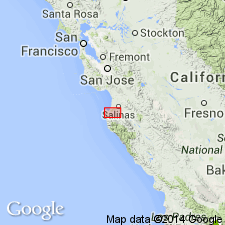
Named for exposures on northeast flank of Chamisal Ridge. Type locality and type section straddle boundary common to Point Sur and Monterey 15' quads along Robinson Canyon. Type section begins at crest of Chamisal Ridge; trends northeast to confluence of Robinson Canyon Co, CA and east tributary; turns northwest to floor of Carmel Valley. Northern half crosses sec.25-26 T16S R1E, Monterey 15' quad. Southern half is in Rancho Potrero de San Carlos land grant, Point Sur 15' quad, Monterey Co, CA. Unit in Point Sur quad formerly mapped as Temblor Formation by Trask (1926). Type section divisible into two members (ascending); Robinson Canyon and Los Tularcitos Members (both new). Robinson Canyon (450 ft thick) consists of nonmarine sandstone and conglomerate. Los Tularcitos (400 ft thick) consists of marine brown sandstone and conglomerate containing abundant fossils. In vicinity of Carmelite Monastery at mouth of San Jose Creek may unconformably overlie Carmelo Formation. In some areas unconformably overlies granitic rocks. Underlies and in some places interfingers with Monterey Formation. In some areas separated from Monterey by olivine basalt flow. Age considered middle Miocene on basis of fossils and stratigraphic relations.
Source: GNU records (USGS DDS-6; Menlo GNULEX).
For more information, please contact Nancy Stamm, Geologic Names Committee Secretary.
Asterisk (*) indicates published by U.S. Geological Survey authors.
"No current usage" (†) implies that a name has been abandoned or has fallen into disuse. Former usage and, if known, replacement name given in parentheses ( ).
Slash (/) indicates name conflicts with nomenclatural guidelines (CSN, 1933; ACSN, 1961, 1970; NACSN, 1983, 2005, 2021). May be explained within brackets ([ ]).