

- Usage in publication:
-
- Chalk Creek member
- Modifications:
-
- Named
- Dominant lithology:
-
- Sandstone
- Claystone
- AAPG geologic province:
-
- Central Western Overthrust
Summary:
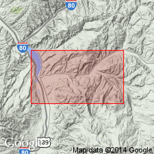
Named as a member (one of ten) of the Frontier Formation for exposures north of the Chalk Creek valley between the Spring Hollow fault and the Great fault, Summit Co, UT on the Uinta uplift. No type locality designated. Consists of gray to tan, medium-grained to conglomeratic sandstone alternating with claystone that ranges from pink, maroon, gray, to green. Reddish "shales" predominate. The sandstone is usually poorly sorted, angular, and has a calcareous matrix. Entire member is on the east or upthrown side of the "Great" fault. Is 3,150 ft thick. Considered a redbed facies of the Frontier deposited during an orogenic pulse in the source area to west during Belle Fourche? and Greenhorn times under paludal and marine conditions. Cross section. Correlation chart. Recognized on cross section as equivalent to most of the Spring Valley coal, nonmarine member, and marine sandstone and shale member, from Coalville area, Summit Co, UT on the Wasatch uplift north to Cumberland Gap, Lincoln Co, WY in the Greater Green River basin. Areal limits of the two nomenclatures not stated. Of Cenomanian and Turonian, Late Cretaceous age.
Source: GNU records (USGS DDS-6; Denver GNULEX).
- Usage in publication:
-
- Chalk Creek Member
- Modifications:
-
- Age modified
- AAPG geologic province:
-
- Green River basin
Summary:
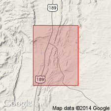
Is basal nonmarine part of Frontier Formation that interfingers with upper part of Aspen Shale in the Cumberland Gap area, Ts18 and 19N, R116W, Lincoln and Uinta Cos, southwest WY in the Greater Green River basin. In this area, carbonaceous shale and associated sandstone and shale pinch out and lie stratigraphically below top of Aspen Shale. Locally, beds in upper part of Aspen pinch out within basal Frontier Formation. Since Aspen Shale in this area has been paleontologically dated as late Albian (Cobban and Reeside, 1952; Reeside and Cobban, 1960), Chalk Creek Member is considered late Albian. Early Cretaceous-Late Cretaceous boundary is probably within Chalk Creek Member. Geologic map. Underlies Hilliard Shale.
Source: GNU records (USGS DDS-6; Denver GNULEX).
For more information, please contact Nancy Stamm, Geologic Names Committee Secretary.
Asterisk (*) indicates published by U.S. Geological Survey authors.
"No current usage" (†) implies that a name has been abandoned or has fallen into disuse. Former usage and, if known, replacement name given in parentheses ( ).
Slash (/) indicates name conflicts with nomenclatural guidelines (CSN, 1933; ACSN, 1961, 1970; NACSN, 1983, 2005, 2021). May be explained within brackets ([ ]).