

- Usage in publication:
-
- Chadakoin beds
- Modifications:
-
- Named
- Dominant lithology:
-
- Shale
- AAPG geologic province:
-
- Appalachian basin
Summary:
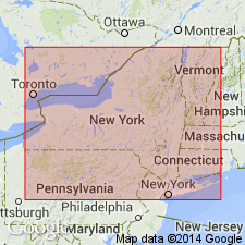
Named for Chadakoin River for exposures in nearby shale-brick quarries at Dexterville (Jamestown). Consists of shale, distinctly reddish or chocolate color on Chautauqua Lake, chocolate color in Elmira area. Overlies Volusia shale in Chautauqua gulf section west of Mayville. Passes southward into "Chemung" of Warren folio and Olean region, which is characterized by chocolate-colored shale. Upper limit is presumably at base of Panama conglomerate or of equivalent of Le Boeuf sandstone of PA. Age is [Late] Devonian.
Source: GNU records (USGS DDS-6; Reston GNULEX).
- Usage in publication:
-
- Chadakoin Formation
- Modifications:
-
- Overview
- AAPG geologic province:
-
- Appalachian basin
Summary:
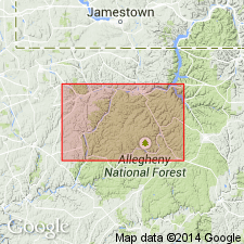
Chadakoin Formation averages about 450 ft in study area. Consists of interbedded greenish-gray to light-gray or reddish-purple-gray siltstone and medium-gray to medium-dark-gray or reddish-purple-gray shale, with some very fine to fine-grained sandstone. Brachiopods and ichnofossils common. Top of the Warren First sand (drillers' term) marks the base of the Chadakoin. Underlies the Venango Formation. In eastern Warren Co., the Tanners Hill red beds, a tongue of the Catskill Formation represent the upper member of the Chadakoin. The Tanners Hill is about 15 to 40 ft thick and is composed of dominantly grayish-red siltstones and shales. Chadakoin crops out along the lower parts of the Allegheny River valley as far west as Youngsville and northward along the length of the Conewago River. Depositional environment interpreted as shallow-marine shelf. Age is Late Devonian.
Source: GNU records (USGS DDS-6; Reston GNULEX).
For more information, please contact Nancy Stamm, Geologic Names Committee Secretary.
Asterisk (*) indicates published by U.S. Geological Survey authors.
"No current usage" (†) implies that a name has been abandoned or has fallen into disuse. Former usage and, if known, replacement name given in parentheses ( ).
Slash (/) indicates name conflicts with nomenclatural guidelines (CSN, 1933; ACSN, 1961, 1970; NACSN, 1983, 2005, 2021). May be explained within brackets ([ ]).