The National Geologic Map Database is migrating to a new infrastructure. We apologize for any service disruptions during this process.
|
|---|


- Usage in publication:
-
- Cerro Toledo Rhyolite*
- Modifications:
-
- Original reference
- Dominant lithology:
-
- Rhyolite
- AAPG geologic province:
-
- San Juan basin
Summary:
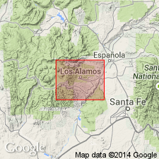
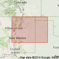
Pg. 18 (fig. 8), 56-57, pl. 1. Cerro Toledo Rhyolite of Tewa Group. A fine-grained light-gray banded rock. Domes of Cerro Toledo Rhyolite cut across and lap onto rocks of Tschicoma Formation near Rito de los Indos at northwest end of Sierra de Toledo and at Rabbit Mountain, north-central New Mexico. In turn, the Cerro Toledo Rhyolite is cut and overlapped by Cerro Rubio Quartz Latite (new) dome at Cerro Rubio, and by Valles Rhyolite (new) domes on south side of Sierra de Toledo. Overlain with erosional unconformity by Tshirege Member (new) of Bandelier Tuff on northeast side of Sierra de Toledo and by Quaternary fan deposits on edge of Valles Caldera. Age is Pleistocene.
Type locality: on northeast side of Valles Caldera in steep forested northwestward-trending ridge, the Sierra de Toledo, btw. Rito de los Indos and Valle de los Posos, Los Alamos area, north-central NM. Highest parts of ridge are more than 10,000 ft in altitude. Rabbit Mountain on southeast side of the caldera is a composite dome of Cerro Toledo Rhyolite. Named from Cerro Toledo, a peak in the Sierra de los Valles, northwest of the Valles Caldera.
Source: US geologic names lexicon (USGS Bull. 1350, p. 139).
- Usage in publication:
-
- Cerro Toledo Rhyolite*
- Cerro Toledo B ash bed (informal)*
- Cerro Toledo X ash bed (informal)*
- Modifications:
-
- Geochronologic dating
- Age modified
- AAPG geologic province:
-
- San Juan basin
Summary:
Samples from tephra units of the Cerro Toledo Rhyolite in its source area, eastern Jemez Mountains, north-central New Mexico, yielded K-Ar ages between 1.47 +/-0.04 Ma and 1.23 +/-0.02 Ma (early Pleistocene). Ages recalculated using decay constants of Steiger and Jager (1977); Plio-Pliocene boundary placed at 1.8 Ma.
Izett (Jour. Geophys. Res., v. 86, no. B11, 1981) lists informal designations for volcanic ash beds considered downwind equivalents of source area tephra, notably:
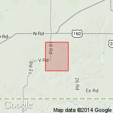
Cerro Toledo B ash bed. Lies within Hibbard's (1958) Crooked Creek Formation (Pliocene and Pleistocene), in SW/4 SE/4 sec. 16, T. 33 S., R. 28 W., Irish Flats 7.5-min quadrangle, Meade Co., southwestern KS, about 10 m above Huckleberry Ridge ash bed.
Cerro Toledo X ash bed. Lies within Tule Formation (Pleistocene) along Rock Creek, Cope Creek 7.5-min quadrangle, Briscoe Co., panhandle of TX, about 35 m below Lava Creek B ash bed.
Source: Publication.
- Usage in publication:
-
- Cerro Toledo B ash bed (informal)*
- Cerro Toledo Rhyolite*
- Modifications:
-
- Mapped 1:24k
- AAPG geologic province:
-
- Anadarko basin
Summary:
Cerro Toledo B ash bed (informal). Lenticular, impure grayish-white volcanic ash. Thickness 0 to 0.5 m. Lies within upper unnamed member of Crooked Creek Formation, about 2 m above Aries fauna (early Irvingtonian NALMA) and about 10 m above Huckleberry Ridge ash bed (Pliocene). Source in Jemez Mountains area, New Mexico. Age is Pleistocene, based on isotopic dating (between 1.47 Ma and 1.23 Ma, citing Izett and others, 1981). [Pliocene-Pleistocene boundary placed at 1.8 Ma.]
Source: Publication.
For more information, please contact Nancy Stamm, Geologic Names Committee Secretary.
Asterisk (*) indicates published by U.S. Geological Survey authors.
"No current usage" (†) implies that a name has been abandoned or has fallen into disuse. Former usage and, if known, replacement name given in parentheses ( ).
Slash (/) indicates name conflicts with nomenclatural guidelines (CSN, 1933; ACSN, 1961, 1970; NACSN, 1983, 2005, 2021). May be explained within brackets ([ ]).