The National Geologic Map Database is migrating to a new infrastructure. We apologize for any service disruptions during this process.
|
|---|


- Usage in publication:
-
- Centerfield limestone member
- Modifications:
-
- Revised
- Biostratigraphic dating
- AAPG geologic province:
-
- Appalachian basin
Summary:
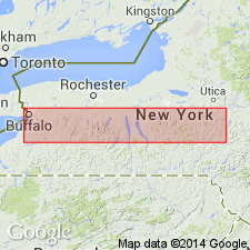
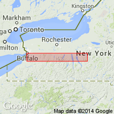
Pg. 223. Centerfield limestone member of Ludlowville formation. Centerfield limestone is basal member of Ludlowville formation. Identified from Murder Creek, western New York, to east of Skaneateles Lake. Is especially characterized by variety and perfection of preservation of its fossils, most notably its corals. Characterized by SPIRIFER DIVARICATUS [brachiopod]. In Livonia salt shaft it is 19 feet thick; at Blossom, 4.5 feet; is probably 1.5 feet thick in cliff at Bayview, Lake Erie.
Type section: on Schaffer Creek, 1 mi north of Centerfield, [Canandaigua quadrangle, Ontario Co., central western NY].
Source: US geologic names lexicon (USGS Bull. 896, p. 387).
- Usage in publication:
-
- Centerfield Member
- Modifications:
-
- Revised
- AAPG geologic province:
-
- Appalachian basin
Summary:
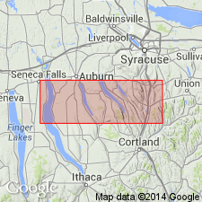
Peppermill Gulf bed is a newly recognized, fossil-rich horizon at the base of the Centerfield Member (and the correlative "Chenango facies") of the Ludlowville Formation. Overlies the Levanna Member of the Skaneateles Formation. Fossil bed consists of a bioturbated, silty mudstone with a diverse assemblage of brachiopods, bivalves, and some rugose corals. Outcrops extend from Big Hollow Creek on the west side of Cayuga Lake to Case Hill Ravine south of Syracuse. Age is Middle Devonian.
Source: GNU records (USGS DDS-6; Reston GNULEX).
- Usage in publication:
-
- Centerfield Member
- Modifications:
-
- Revised
- AAPG geologic province:
-
- Appalachian basin
Summary:
At the type sections of the Centerfield and Ledyard Members in the Finger Lakes region, their contact is drawn between underlying relatively fossiliferous limestone and overlying black shale. Westward, near Lake Erie, the Centerfield/Ledyard contact has been defined biostratigraphically and marked a meter or more above the limestone. Author here proposes that a lithostratigraphic boundary be drawn at the uppermost limestone bed of the Centerfield throughout its geographic extent.
Source: GNU records (USGS DDS-6; Reston GNULEX).

- Usage in publication:
-
- Centerfield Limestone Member*
- Modifications:
-
- Areal extent
- AAPG geologic province:
-
- Appalachian basin
Summary:
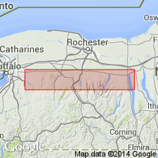
Centerfield Limestone Member of Ludlowville Shale extended from western NY into western PA and northeastern OH and into the subsurface in northern WV and westernmost MD (Garrett Co.).
Source: GNU records (USGS DDS-6; Reston GNULEX).
- Usage in publication:
-
- Centerfield Limestone Member*
- Modifications:
-
- Overview
- AAPG geologic province:
-
- Appalachian basin
Summary:
Tenmile Creek Dolomite in OH is approximate equivalent of Centerfield Limestone Member of Ludlowville Formation in NY. Contains rugose coral HELIOPHYLLUM STEWARTI. Age is middle Givetian.
Source: GNU records (USGS DDS-6; Reston GNULEX).
For more information, please contact Nancy Stamm, Geologic Names Committee Secretary.
Asterisk (*) indicates published by U.S. Geological Survey authors.
"No current usage" (†) implies that a name has been abandoned or has fallen into disuse. Former usage and, if known, replacement name given in parentheses ( ).
Slash (/) indicates name conflicts with nomenclatural guidelines (CSN, 1933; ACSN, 1961, 1970; NACSN, 1983, 2005, 2021). May be explained within brackets ([ ]).