The National Geologic Map Database is migrating to a new infrastructure. We apologize for any service disruptions during this process.
|
|---|


- Usage in publication:
-
- Center Peak Latite
- Modifications:
-
- First used
- Dominant lithology:
-
- Latite
- AAPG geologic province:
-
- Pedregosa basin
Summary:
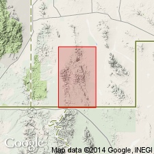
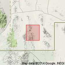
First use of name. On geologic map only. No type locality designated. Probably named for Center Peak, sec 5, T31S, R18W, southwest part of Walnut Wells quad, Hidalgo Co, NM in Pedregosa basin. Confined within a radius of several mi of Center Peak. Is a flow of light-gray latite with conspicuous acicular hornblende phenocrysts. Is younger than Gillespie Tuff and older than Park Tuff (both new). Is of Tertiary age.
Source: GNU records (USGS DDS-6; Denver GNULEX).
- Usage in publication:
-
- Center Peak Latite
- Modifications:
-
- Named
- Dominant lithology:
-
- Latite
- Sandstone
- Breccia
- AAPG geologic province:
-
- Pedregosa basin
Summary:
Named for Center Peak, sec 5, T31S, R18W, southwest part of Walnut Wells quad, Hidalgo Co, NM in Pedregosa basin. No type locality designated. Confined within a radius of several mi of Center Peak. Geologic map. Consists of hornblende latite; abundance of black, gray, and red, glossy needles of hornblende are conspicuous against the light-colored matrix. Rock is well indurated, generally massive, and devoid of streaks, lenses, cavities, and xenoliths; has some fine gray flow streaks. Thin sandstone and breccia bed ranging in thickness from 0-30+ ft lies at base. Also a vesicular and amygdaloidal basal zone in sec 8, T32S, R18W. Weathers to a grayish cream color; forms dome-shaped masses and rounded, gently inclined slopes. Lacks columnar jointing and is not brecciated above the basal zone. Source area is in vicinity of Center Peak; from a maximum of 1,000 ft thins rapidly away from source. Clastic beds at base fill stream channels and other low areas on deeply eroded surface of unconformably underlying Gillespie Tuff (new). Overlain unconformably by Park Tuff (new), the sandstone member of Park Tuff, and OK Bar Conglomerate (new). Is Tertiary in age.
Source: GNU records (USGS DDS-6; Denver GNULEX).
For more information, please contact Nancy Stamm, Geologic Names Committee Secretary.
Asterisk (*) indicates published by U.S. Geological Survey authors.
"No current usage" (†) implies that a name has been abandoned or has fallen into disuse. Former usage and, if known, replacement name given in parentheses ( ).
Slash (/) indicates name conflicts with nomenclatural guidelines (CSN, 1933; ACSN, 1961, 1970; NACSN, 1983, 2005, 2021). May be explained within brackets ([ ]).