The National Geologic Map Database is migrating to a new infrastructure. We apologize for any service disruptions during this process.
|
|---|


- Usage in publication:
-
- Cedartop gypsum
- Modifications:
-
- Original reference
- Dominant lithology:
-
- Gypsum
- AAPG geologic province:
-
- Anadarko basin
Summary:
Pg. 42, 56. Cedartop gypsum. Massive white gypsum, 18 to 20 feet thick, in midst of red clay shale which separates Haystack gypsum below from Collingsworth gypsum above. Included in Greer division as 1 of 6 named units. Is conspicuous on North Fork, Haystack, and Elm Fork. Forms a number of buttes and bluffs throughout the region. Age is Permian.
Type locality not designated. Named from prominent butte, called Cedartop, on North Fork of the Red River, in southeastern corner of Roger Mills Co., OK, in Anadarko basin.
Source: US geologic names lexicon (USGS Bull. 896, p. 384); supplemental information from GNU records (USGS DDS-6; Denver GNULEX).
- Usage in publication:
-
- Cedartop gypsum member
- Modifications:
-
- Not used
Summary:
Pg. 324-341. Cedartop gypsum member of Blaine gypsum. Is provisionally considered = Medicine Lodge gypsum member.
[This gypsum is believed to be same as Medicine Lodge gypsum member of the Blaine, according to H.D. Miser.]
Source: US geologic names lexicon (USGS Bull. 896, p. 384).
- Usage in publication:
-
- Cedartop member
- Modifications:
-
- Overview
- AAPG geologic province:
-
- Anadarko basin
Summary:
Pg. 686 (table 1). Table of upper Leonardian series in Kansas, Oklahoma, and Texas shows Cedartop member above Medicine Lodge member and below Acme member.
Source: US geologic names lexicon (USGS Bull. 1200, p. 691-692).
- Usage in publication:
-
- [Cedartop member]
- Modifications:
-
- Overview
- AAPG geologic province:
-
- Permian basin
Summary:
Pg. 30. [Cedartop member of Blaine formation]. Shown on correlation chart of West Texas.
Source: US geologic names lexicon (USGS Bull. 1200, p. 691-692); supplemental information from GNC index card files (USGS-Reston).
- Usage in publication:
-
- Cedartop gypsum member
- Modifications:
-
- Principal reference
- AAPG geologic province:
-
- Anadarko basin
Summary:
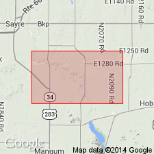
Pg. 22-23, pl. 1. New type locality designated. Present study shows that Haystack gypsum caps Cedartop Butte and since all rocks younger than what is here have been eroded away, this butte cannot be type locality for what is here called Cedartop gypsum. At newly selected type locality, member is 10.5 feet thick, separated from underlying Haystack gypsum member by 12.5 feet of red and gray-green shale and from overlying Collingsworth gypsum member by 13.5 feet of shale.
Type locality (redesignated): in bluffs about 250 yds north of Cedartop butte, in SE/4 SE/4 sec. 35, T. 8 N., R. 21 W., Beckham Co., OK.
Source: US geologic names lexicon (USGS Bull. 1200, p. 691-692).
- Usage in publication:
-
- Cedartop Gypsum Bed
- Modifications:
-
- Revised
- AAPG geologic province:
-
- Anadarko basin
- Palo Duro basin
- South Oklahoma folded belt
Summary:
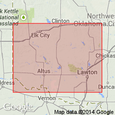
Reduced in stratigraphic rank from member of Blaine Formation to bed of Elm Fork Member (first used) of Blaine Gypsum of El Reno Group. Overlies Jester Dolomite Bed of Elm Fork. Underlies unnamed red-brown and gray-green shale of Elm Fork. Consists of 10.5 feet of white gypsum at its type section, in SE/4 SE/4 sec. 35, T. 8 N., R. 21 W., Beckham County (Anadarko basin). Ranges between 7.5 to 21.6 feet thick. Sections measured in Harmon and Jackson Counties (Palo Duro basin) and in Greer County (S. Oklahoma folded belt province). Thickens from east to northwest. Age is Permian. Report includes cross sections, measured sections.
Source: Modified from GNU records (USGS DDS-6; Denver GNULEX).
For more information, please contact Nancy Stamm, Geologic Names Committee Secretary.
Asterisk (*) indicates published by U.S. Geological Survey authors.
"No current usage" (†) implies that a name has been abandoned or has fallen into disuse. Former usage and, if known, replacement name given in parentheses ( ).
Slash (/) indicates name conflicts with nomenclatural guidelines (CSN, 1933; ACSN, 1961, 1970; NACSN, 1983, 2005, 2021). May be explained within brackets ([ ]).