

- Usage in publication:
-
- Cayuse limestone*
- Modifications:
-
- Named
- Dominant lithology:
-
- Dolomite
- Argillite
- Limestone
- AAPG geologic province:
-
- Northern Rocky Mountain region
Summary:
Pg. 211, 213 (table 1), 215-216. Cayuse limestone. Dull-gray crystalline buff-tan-weathering dolomite interbedded with pale-maroon and green-gray fissile argillite which grades upward into alternating zones of shaly bedded calcareous argillite and finally passes into sideritic and dolomitic hard marble; upper part blue- and dull-gray, thick-bedded, finely oolitic, coarsely crystalline algal limestone which shows typical bioherm structure. Thickness 1,000 to 2,100 feet; entire thickness exposed throughout distance of only 4 miles on upper part of hills west of South Fork and south of West Fork of Sun River. Unconformably overlies Miller Peak argillite north and south of Deer Creek; north of West Fork of Sun River, Cayuse is thrust upon Mississippian Hannan limestone and shale of Lower Cretaceous Kootenai along Lewis overthrust. Underlies Hoadley formation (new) with contact probably gradational. Miller Peak argillite, Cayuse limestone, Hoadley formation, and Ahorn quartzite (new) are equivalent in age to lower and middle part of Missoula group of Clapp and Deiss (1931) in Sapphire and Garnett Ranges. Report covers southwestern Saypo quadrangle. Age is Precambrian (Belt).
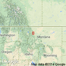
Named from Cayuse Creek, tributary of South Fork of Flathead River in northern part of Ovando quadrangle, [in T. 20 N., R. 12 W., Pilot Peak 7.5-min quadrangle, Powell Co., Flathead National Forest, central western MT], where formation is thickest.
Source: US geologic names lexicon (USGS Bull. 1200, p. 683-684).

- Usage in publication:
-
- Cayuse Limestone†
- Modifications:
-
- Abandoned
- AAPG geologic province:
-
- Northern Rocky Mountain region
Summary:
Pg. A6, A8, A9 (fig. 3). †Cayuse Limestone of Deiss abandoned. Replaced with Helena Dolomite. [Adopted by the USGS (see Changes in stratigraphic nomenclature, 1972, USGS Bull. 1394-A, p. A8-A9).]
[See Helena.]
Source: Publication; Changes in stratigraphic nomenclature, 1972 (USGS Bull. 1394-A, p. A8-A9).
For more information, please contact Nancy Stamm, Geologic Names Committee Secretary.
Asterisk (*) indicates published by U.S. Geological Survey authors.
"No current usage" (†) implies that a name has been abandoned or has fallen into disuse. Former usage and, if known, replacement name given in parentheses ( ).
Slash (/) indicates name conflicts with nomenclatural guidelines (CSN, 1933; ACSN, 1961, 1970; NACSN, 1983, 2005, 2021). May be explained within brackets ([ ]).