

- Usage in publication:
-
- Catlin member*
- Modifications:
-
- Original reference
- Biostratigraphic dating
- Dominant lithology:
-
- Limestone
- AAPG geologic province:
-
- Great Basin province
Summary:
Pg. 20-21, 22, pls. 1, 2. Catlin member of Windfall formation (new). Composed of interbedded massive limestone, in part cherty, and thin-bedded shaly and sandy limestone. The massive limestone beds are for the most part fine-grained although some are coarser grained; some of the coarser beds are crowded with trilobite fragments. The thinner bedded limestones are light- to medium-gray and have sandy interbeds that weather to brown or pinkish brown. Thickness 250 feet throughout the area around Eureka. Member is in sharp though normal contact with Dunderberg shale below and is conformable with Bullwhacker member (new) of Windfall formation above. Is lower member of Windfall formation. Fossils [listed] identified by A.R. Palmer; characteristic trilobites PSEUDAGNOSTUS PROLONGUS (Hall and Whitfield), ELVINIA ROEMERI (Shumard), IRVINGELLA MAJOR (Ulrich and Resser) from lower part, and BIENVILLIA CORAX (Billings) and LOTAGNOSTUS OBSCURUS Palmer from upper part. Age is considered middle and late Late Cambrian, based on fossils.
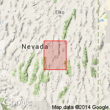
Named from exposures near Catlin shaft of the Croesus Mine in New York Canyon, [in W/2 sec. 35, T. 19 N., R. 53 E., approx. Lat. 39 deg. 28 min. 28 sec. N., Long. 115 deg. 58 min. 45 sec. W., northwestern corner Pinto Summit 15-min quadrangle, Eureka Co.], central NV.
[Additional locality information from USGS historical topographic map collection TopoView, accessed Memorial Day 2018.]
Source: Publication; US geologic names lexicon (USGS Bull. 1200, p. 674-675); GNU records (USGS DDS-6; Menlo GNULEX).
For more information, please contact Nancy Stamm, Geologic Names Committee Secretary.
Asterisk (*) indicates published by U.S. Geological Survey authors.
"No current usage" (†) implies that a name has been abandoned or has fallen into disuse. Former usage and, if known, replacement name given in parentheses ( ).
Slash (/) indicates name conflicts with nomenclatural guidelines (CSN, 1933; ACSN, 1961, 1970; NACSN, 1983, 2005, 2021). May be explained within brackets ([ ]).