

- Usage in publication:
-
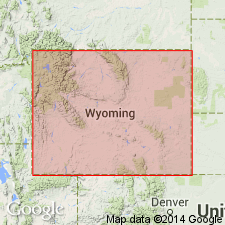
- Casper formation*
- Modifications:
-
- Original reference
- Dominant lithology:
-
- Limestone
- Sandstone
- AAPG geologic province:
-
- Green River basin
- Wind River basin
Summary:
Pg. 407, 413, 414, 416, 418-430. Casper formation. From Casper Range southward Tensleep sandstone, Amsden formation, and Madison limestone give place to Casper formation, 500 to 1,000 feet thick, consisting of limestones generally lying on and overlain by gray sandstone. In Laramie region and southward these rocks merge into red grits. [Page 407.] The name Casper formation is proposed for the limestones and sandstones constituting greater part of sedimentary rocks in Casper and Laramie Mountains. These rocks represent southeastern extension of Amsden and Tensleep formations, but are so changed in character and indefinite in stratigraphic limits that correlation is not desirable and new name is required. The Casper lies unconformably on pre-Cambrian rocks in greater part of area, but possibly to north the basal sandstone represents an attenuated eastern extension of Deadwood formation [Upper Cambrian] and in eastern Carbon and Natrona Counties there may also be a small amount of Madison limestone at base, but at present there is no evidence on which to separate these. The plain on which the formation lies rises to south, so that lowest beds included in northern part of area are not present at Laramie and southward. The formation caps Casper Mountain and the series of high ridges extending from east of Freeland nearly to Douglas. It extends along both slopes of Laramie Mountains, but in places is hidden by Tertiary deposits, especially in northwestern part of Laramie County. It extends around southern end of Laramie Basin and along western side of that basin as far north Jelm Mountain, beyond which it is dropped far beneath surface by the great fault which follows eastern side of Medicine Bow Mountains. In Colorado, along eastern side of Front Range, the formation consists mostly or red beds and becomes Fountain formation. As there is overlap of higher beds to south, it is probable that at lattitude of Laramie, and even for some distance farther north, the Casper formation is entirely of Pennsylvanian age.
Source: US geologic names lexicon (USGS Bull. 896, p. 362-363).
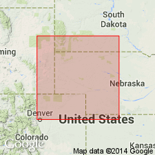
- Usage in publication:
-
- Casper formation
- Modifications:
-
- Revised
- AAPG geologic province:
-
- Green River basin
- Wind River basin
Knight, S.H., 1929, The Fountain and the Casper formations of the Laramie basin [Wyoming]; A study on the genesis of sediments: University of Wyoming, Department of Geology and Geophysics, Contributions to Geology, v. 1, no. 1.
Summary:
Casper formation. Restricted. W.T. Lee (USGS Prof. Paper 149, p. 67, 1927) pointed out that Casper formation as used by Darton is composite formation and in his opinion name should be abandoned. In vew of fact that Casper has for 20 years been used to designate the sediments flanking Laramie Range, and is appropriate, it does not seem advisable to abandon it and substitute the later name Ingleside, as suggested by Lee. The Ingleside rests on Fountain formation, and writer considers it as representing the southern attenuate extension of the Casper [restricted]. In this paper Casper formation is restricted to the rocks to which the name was originally applied, except that Fountain formation and Madison limestone are not included. Writer believes that Fountain and Casper formations are, in part at least, contemporaneous, and that Casper as here restricted in part overlies Fountain formation. Evidence does not substantiate marked unconformity, as suggested by Lee. Thickness of Casper formation as here restricted ranges from 208 feet in Centennial section to maximum of 695 feet in Plumbago Canyon section.
Source: US geologic names lexicon (USGS Bull. 896, p. 362-363).
- Usage in publication:
-
- Casper formation
- Modifications:
-
- Areal extent
- AAPG geologic province:
-
- Green River basin
- Wind River basin
Miller, A.K., and Thomas, H.D., 1936, The Casper formation (Pennsylvanian) of Wyoming and its cephalopod fauna: Journal of Paleontology, v. 10, no. 8, p. 715-738.
Summary:
Pg. 715+. Casper formation. In type region, around Casper Mountain, the lower part of the sequence is Mississippian and is now generally eliminated from the Casper. It seems to us that it is impossible, without a great deal of additional stratigraphic knowledge, to devise a satisfactory nomenclature for the beds in Laramie basin which were called Casper by Darton. For present, therefore, it will perhaps be best in areas where the Fountain is present, as in southern part of Laramie basin, to use Casper in Knight's restricted sense. But in northern part of basin, where the Fountain beds seem to be replaced by others of different lithology, there is no name to use except Casper in Darton's sense, excluding, of course, the Mississippian strata which in some places occur between the Casper and the pre-Cambrian granite.
Source: US geologic names lexicon (USGS Bull. 896, p. 362-363).

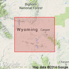
- Usage in publication:
-
- Casper formation*
- Modifications:
-
- Overview
- AAPG geologic province:
-
- Green River basin
- Wind River basin
Summary:
[ca. 1938] The USGS still uses the local name Casper formation as defined by Darton. As thus defined [in Laramie basin, Wyoming] the formation rests unconformably on pre-Cambrian granite. [Age is Pennsylvanian, and in some areas Mississippian.]
Source: US geologic names lexicon (USGS Bull. 896, p. 362-363).
- Usage in publication:
-
- Casper formation
- Modifications:
-
- Areal extent
- AAPG geologic province:
-
- Green River basin
- Wind River basin
Summary:
Pg. 10-11; Nebraska Geol. Survey Bull. 13-A, p. 11, 1950. Casper formation. Section measured in Laramie Range, Wyoming, south of Union Pacific RR, 18 miles west of Cheyenne. According to Colorado terminology, upper formations of section would be classed under Ingleside formation, but in Wyoming this part of section plus equivalent of the Fountain is called Casper as revised by Knight, 1929 (Wyoming Univ. Pub. Sci. Geol., v. 1, no. 1). Hence, name Casper is used for Pennsylvanian in Laramie Range to include Ingleside and Fountain formations.
Source: US geologic names lexicon (USGS Bull. 1200, p. 659-660).
- Usage in publication:
-
- Casper formation
- Modifications:
-
- Biostratigraphic dating
- AAPG geologic province:
-
- Wind River basin
Summary:
Pg. 88-89. Casper formation. In Casper Mountain-Alcova area, the Casper is 400 to 500 feet thick; this is comparable to combined thickness of Amsden and Tensleep to the west. Many geologists have divided section in this area into Amsden and Tensleep. Basal bed, commonly sandstone, rests on eroded surface of Madison. Lower part of Casper comprises thin interbedded limestones and sandstones resembling Amsden; upper part is thick tan cross-bedded sandstone which seems lithologically identical to Tensleep of areas to west. Entire Casper of this area seems to be completely younger than any part of Tensleep. Fusulinids (TRITICITES) have been collected from Casper. [Age is Pennsylvanian.]
Source: US geologic names lexicon (USGS Bull. 1200, p. 659-660).
- Usage in publication:
-
- Casper formation
- Modifications:
-
- Biostratigraphic dating
- AAPG geologic province:
-
- Green River basin
- Powder River basin
- Wind River basin
Thompson, M.L., Thomas, H.D., and Harrison, J.W., 1953, Fusulinids of the Casper formation of Wyoming: Wyoming Geological Survey Bulletin, no. 46, 56 p., 1 pl.
Summary:
Part 1, Stratigraphy of the Casper formation (H.D. Thomas, M.L. Thompson, and J.W. Harrison); Part II, Systematic paleontology of fusulinids from the Casper formation (M.L. Thompson and H.D. Thomas).
Casper formation. Comprises alternating succession of beds made up principally of cross-bedded sandstones and fossiliferous limestones. Thickness 500 to over 1,000 feet. Rests unconformably on Mississippian limestone (Madison) along northern part of Laramie Range. Mississippian rocks thin southward, and south of Little Medicine section the Casper everywhere rests on Precambrian rocks. In northern part of range, overlain unconformably by Opeche shale, but evidence of such break becomes less clear in southern part of range. Fusulinid faunas indicate formation ranges from Middle Pennsylvanian (Desmoinesian) to Lower Permian (Wolfcampian).
Source: US geologic names lexicon (USGS Bull. 1200, p. 659-660).
- Usage in publication:
-
- Casper Formation*
- Modifications:
-
- Revised
- AAPG geologic province:
-
- Powder River basin
- Wind River basin
Summary:
Basal part of Casper Formation from Fremont Canyon in Natrona Co, Wind River basin to northern Laramie Range, Converse Co in the Powder River basin assigned to the Darwin Sandstone Member of Pennsylvanian (possibly Morrowan to Desmoinesian) age. Only lower or Pennsylvanian part of Casper studied.
Source: GNU records (USGS DDS-6; Denver GNULEX).
- Usage in publication:
-
- Casper Formation*
- Modifications:
-
- Age modified
- AAPG geologic province:
-
- Powder River basin
Summary:
Fusulinids from a basal limestone ledge in Casper Formation at 5,470 ft elevation in tributary of La Bonte Creek in sec 35, T35N, R71W, Converse Co, WY in the Powder River basin, have been identified as probable Atokan or Middle Pennsylvanian age. Casper assigned a Pennsylvanian and Early Permian age in this map area where it can be as much as 850 ft thick.
Source: GNU records (USGS DDS-6; Denver GNULEX).
For more information, please contact Nancy Stamm, Geologic Names Committee Secretary.
Asterisk (*) indicates published by U.S. Geological Survey authors.
"No current usage" (†) implies that a name has been abandoned or has fallen into disuse. Former usage and, if known, replacement name given in parentheses ( ).
Slash (/) indicates name conflicts with nomenclatural guidelines (CSN, 1933; ACSN, 1961, 1970; NACSN, 1983, 2005, 2021). May be explained within brackets ([ ]).