

- Usage in publication:
-
- Cascade Station Member
- Modifications:
-
- Named
- Dominant lithology:
-
- Shale
- Sandstone
- Conglomerate
- Claystone
- Siltstone
- AAPG geologic province:
-
- Piedmont-Blue Ridge province
Summary:
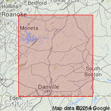
The Cascade Station Member of the Leakesville Formation is here named for discontinuous beds, lenses, and tongues of maroon, red, and brown shale and sandstone and minor conglomerate, claystone, and siltstone in the Danville basin, VA. Intertongues with the Cow Branch Member of the Leakesville and with the arkosic facies of the Dry Fork Formation. Cross-bedding, ripple marks, and worm-trails are common. Thickness at type section is 84 ft (25 m). Age is Late Triassic.
Source: GNU records (USGS DDS-6; Reston GNULEX).
For more information, please contact Nancy Stamm, Geologic Names Committee Secretary.
Asterisk (*) indicates published by U.S. Geological Survey authors.
"No current usage" (†) implies that a name has been abandoned or has fallen into disuse. Former usage and, if known, replacement name given in parentheses ( ).
Slash (/) indicates name conflicts with nomenclatural guidelines (CSN, 1933; ACSN, 1961, 1970; NACSN, 1983, 2005, 2021). May be explained within brackets ([ ]).