The National Geologic Map Database is migrating to a new infrastructure. We apologize for any service disruptions during this process.
|
|---|


- Usage in publication:
-
- Carmelo series
- Modifications:
-
- Named
- Dominant lithology:
-
- Conglomerate
- Sandstone
- AAPG geologic province:
-
- California Coast Ranges province
Summary:
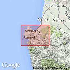
[Named for Carmelo Bay, about 5 mi south of Monterey Bay, Monterey Co, CA.] Shown on geologic sketch map of Carmelo Bay. Occurs in three distinct areas: (1) largest is on Carmelo Point, (2) area at north end of Carmelo Bay, and (3) at junction of main coast road with short road to Mission church. Rocks are prevailingly thick-bedded conglomerates of dark color and thinly-bedded tawny sandstone with minor amounts of shale and shaly sandstone. Is 800 feet thick at Carmelo Point. Unconformably overlies Santa Lucia granite; unconformably underlies Monterey series. Although no fossils were found, series appears to correlate with Tejon (Eocene) age, coal-bearing sandstones of Malpaso Canyon. Age is considered Eocene(?).
Source: GNU records (USGS DDS-6; Menlo GNULEX).
- Usage in publication:
-
- Carmelo Formation
- Modifications:
-
- Revised
- Biostratigraphic dating
- AAPG geologic province:
-
- California Coast Ranges province
Summary:
Carmelo Series of Lawson (1893) is renamed Carmelo Formation. "It was given formation status by R.A. Bramkamp in a private report for Point Lobos State Park in 1934." p.50. Type locality designated as Point Lobos (previously called Carmelo Point). Measured section along sea cliffs across Pebble Beach and Stillwater Cove between Pescadero and Arrowhead Points is 725 ft thick. Crops out in five patches adjacent to Monterey Bay and underlies 3 to 3.5 sq mi. Shown on geologic sketch map of Monterey quad. Unconformably overlies Sur Series; may underlie Chamisal Formation (new); also unconformably underlies Quaternary sedimentary rocks. Is Paleocene age on basis of fossils. Faunal list included in report.
Source: GNU records (USGS DDS-6; Menlo GNULEX).
- Usage in publication:
-
- Carmelo Formation*
- Modifications:
-
- Areal extent
- AAPG geologic province:
-
- California Coast Ranges province
Summary:
Mapped in Monterey and Seaside 7.5' quads, Monterey Co, CA. Described as marine, interbedded sandstone, siltstone, mudstone, and cobble-pebble conglomerate. Age given as Paleocene.
Source: GNU records (USGS DDS-6; Menlo GNULEX).
For more information, please contact Nancy Stamm, Geologic Names Committee Secretary.
Asterisk (*) indicates published by U.S. Geological Survey authors.
"No current usage" (†) implies that a name has been abandoned or has fallen into disuse. Former usage and, if known, replacement name given in parentheses ( ).
Slash (/) indicates name conflicts with nomenclatural guidelines (CSN, 1933; ACSN, 1961, 1970; NACSN, 1983, 2005, 2021). May be explained within brackets ([ ]).