The National Geologic Map Database is migrating to a new infrastructure. We apologize for any service disruptions during this process.
|
|---|


- Usage in publication:
-
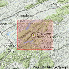
- Cardens Bluff shale member*
- Modifications:
-
- Named
- Dominant lithology:
-
- Shale
- AAPG geologic province:
-
- Piedmont-Blue Ridge province
- Appalachian basin
Summary:
Named for Cardens Bluff on Watauga River below Watauga Dam, Carter Co., northeastern TN. Named as a member of Hampton formation and is its basal shale. Occurs along crest of Iron Mountains and forms well-defined strike valley that continues northeastward as far as US Hwy 21 between Shady Valley and Mountain City. Occurs in Johnson and parts of Sullivan and Carter Cos., TN, and in small areas of Ashe, Watauga, and Avery Cos., NC. Pinches out northeastward or passes into interbedded sandstone and shale. Consists of clay shale that is darker than rest of Hampton; weathers into bright-orange, rusty chips. In gorges of Doe and Watauga Rivers through Iron Mountains, bedding is crossed by well-marked slaty cleavage. Thickness is 100 to 200 ft. Age is Early Cambrian.
Source: GNU records (USGS DDS-6; Reston GNULEX).
For more information, please contact Nancy Stamm, Geologic Names Committee Secretary.
Asterisk (*) indicates published by U.S. Geological Survey authors.
"No current usage" (†) implies that a name has been abandoned or has fallen into disuse. Former usage and, if known, replacement name given in parentheses ( ).
Slash (/) indicates name conflicts with nomenclatural guidelines (CSN, 1933; ACSN, 1961, 1970; NACSN, 1983, 2005, 2021). May be explained within brackets ([ ]).