The National Geologic Map Database is migrating to a new infrastructure. We apologize for any service disruptions during this process.
|
|---|


- Usage in publication:
-
- Cardenas Lavas
- Modifications:
-
- Areal extent
- AAPG geologic province:
-
- Plateau sedimentary province
- Southern Rocky Mountain region
Summary:
Pg. 1244, 1258, geol. map (fig. 1). Cardenas Lavas. Basaltic lava flows. Thickness about 980 feet (294 m). Underlie Nankoweap Group and overlie Unkar Group. First noted by Walcott, 1894 (USGS Ann. Rpt. 14, p. 497-519). Named Cardenas Lavas by Keyes, 1938 (Pan-American Geologist, v. 70, p. 110) but subsequently Maxson (1961, 1967) called them Rama Formation [see entry under Rama]. It has been recommended that the name Rama be dropped and the name Cardenas restored to use (Ford and others, 1972, GSA Bull., v. 83, no. 1, p. 223-226). Minimum age of Cardenas Lavas is 845 +/-15 Ma (Ford and others, 1972). [Age is Precambrian Y (1,600-800 Ma; see Cohee and Wright, 1974, USGS Bull. 1394-A, p. A1).]
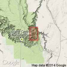
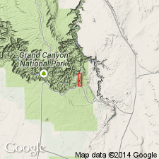
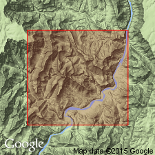
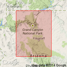
[Notable exposures in Basalt Cliffs and around Ochoa Point, Desert View and Cape Royal 7.5-min quadrangles, eastern Grand Canyon, Grand Canyon National Park, Coconino Co., northern AZ.]
Source: Publication.
- Usage in publication:
-
- Cardenas Lavas*
- Modifications:
-
- Revised
- Overview
- AAPG geologic province:
-
- Southern Rocky Mountain region
Summary:
Unkar Group assigned as the lower group of the Precambrian Grand Canyon Supergroup (new rank; formerly Grand Canyon Series) in the Grand Canyon area of northern AZ in the Southern Rocky Mountain region. Unkar divided into the (ascending): Hotauta Conglomerate, Bass Limestone, Hakatai Shale, Shinumo Quartzite, Dox Sandstone, and Cardenas Lavas. Geologic maps. Consists of a lower rubbly-weathering slope-forming unit about 90 m thick and an overlying cliff-forming unit about 200 m thick. Includes seven or more basalt and basaltic andesite flows separated by layers of silicified sandstone less than 1 to more than 6 m thick. The lowest flow is highly vesiculated and discontinuous, and intertongues with the Dox. Vesiculated and rubbly tops common. Most flows have characteristics attributable to subaerial extrusion. Unconformably underlies Nankoweap Formation of Grand Canyon Supergroup.
Source: GNU records (USGS DDS-6; Denver GNULEX).
- Usage in publication:
-
- Cardenas Lavas*
- Modifications:
-
- Geochronologic dating
- AAPG geologic province:
-
- Southern Rocky Mountain region
Summary:
Six whole-rock specimens of basalt from the Cardenas Lavas and from diabase sills of the Unkar Group in Coconino Co, AZ in the Southern Rocky Mountain region, yield an Rb-Sr isochron of 1.09 +/-0.07 b.y. which is considered to be the time of extrusion. K-Ar ages are younger and may reflect either a period of heating about 800 m.y. ago or diffusive loss of 40Ar.
Source: GNU records (USGS DDS-6; Denver GNULEX).
- Usage in publication:
-
- Cardenas Lavas
- Modifications:
-
- Revised
- AAPG geologic province:
-
- Southern Rocky Mountain region
Summary:
Overlies the newly named Ochoa Point Member of Dox Formation (redefined) of Unkar Group [of Grand Canyon Supergroup]. Dox is a heterogeneous unit that consists of siltstone, shale, minor amount of dolomite and conglomerate, as well as sandstone. Hence the change from Dox Sandstone. Shown on geologic map of eastern Grand Canyon, Coconino Co, AZ, Southern Rocky Mountain region. Of late Precambrian age.
Source: GNU records (USGS DDS-6; Denver GNULEX).
- Usage in publication:
-
- Cardenas Lava*
- Modifications:
-
- Redescribed
- Geochronologic dating
- Overview
- Dominant lithology:
-
- Basalt
- Andesite
- Sandstone
- AAPG geologic province:
-
- Southern Rocky Mountain region
Summary:
Report area is in Coconino Co, AZ, Southern Rocky Mountain region. Redescribed as Cardenas Lava [singular]. Composed of 7 to 15 flows. The number of flows varies from place to place. Divisible into: 1) lower bottle-green member 90-100 m thick that includes lava and some sandstone and that forms a highly weathered slope; 2) sandstone 6 m thick; 3) fan-jointed member separated from 4) basaltic flows by a sandstone; 5) sandstone; 6) lapillite member; 7) sandstone; 8) basalt flows. The flows in the upper 200 m are basalt and basaltic andesite. Sandstone occurs throughout suggesting emplacement in a shallow saline sea whose floor sank at same time as lava pile built up. Contact with underlying Dox Sandstone is conformably to locally interfingering. Contact with overlying Nankoweap is an erosion surface or disconformity. Cardenas is in Unkar Group and near middle of 4000 feet thick Grand Canyon Supergroup. Of Middle Proterozoic age. Rb-Sr isochron yielded age of 1.1 Ga, a cooling age. K-Ar ages of 800 Ma thought to be reset ages reflecting maximum burial under Chuar Group; 950 Ma suggested as an eruption date and 715 suggested as a diagenesis date.
Source: GNU records (USGS DDS-6; Denver GNULEX).
- Usage in publication:
-
- Cardenas Basalt*
- Modifications:
-
- Redescribed
- Geochronologic dating
- Paleomagnetics
- Dominant lithology:
-
- Basalt
- Andesite
- AAPG geologic province:
-
- Southern Rocky Mountain region
Summary:
Redescribed--name changed from Cardenas Lava or Lavas to Cardenas Basalt because lava is hot fluid whereas basalt is solidified. Belongs to Unkar Group of Grand Canyon Supergroup. Overlies Dox Sandstone of Unkar. Underlies Nankoweap Formation unconformably. Eruption of Cardenas Basalt was the final event in Unkar time. Was a potassium-rich mafic lava. A single flow, a precursor to the main eruption is found locally in the Dox. The single flow is coherent, lacks any vestige of pillowing, and is vesiculated at top, indicating extrusion in subaerial environment. Basaltic andesite in multiple flows above in Cardenas forms steep slopes and is characterized by bottle-green color. Water must have been important in development of bottle-green unit, though field relations do not prove it. Several of the flows are separated by thin discontinuous sandstone beds. Flows above green unit are mafic and extrusive. Is 224-450 m thick. Paleomagnetic information suggests source located a short distance to west. Used in the Southern Rocky Mountain region of northern AZ. Middle Proterozoic. Isotopic dating has yielded 1,070 Ma Rb-Sr whole rock isochron of Cardenas flows. K-Ar ages from 5 flows have yielded an apparent age for cooling of 855 to 790 Ma. Columnar section. Pole for Cardenas marks trace of late Keweenawan poles from Jacobsville Sandstone of northern MI.
Source: GNU records (USGS DDS-6; Denver GNULEX).
- Usage in publication:
-
- Cardenas Basalt*
- Modifications:
-
- Overview
- AAPG geologic province:
-
- Southern Rocky Mountain region
Summary:
Is the upper unit of the Middle Proterozoic Unkar Group of the Grand Canyon Supergroup in northern AZ, Southern Rocky Mountain region. Thought to have been erupted into shallow, possibly hypersaline sea water probably in a tidal flat or deltaic environment. Relation of unnamed sills and dikes and the flows of the Cardenas is uncertain. Chemistry of both suggest a common parent. Paleomagnetic and isotopic studies suggest the sill may be older. Isotopic (Rb-Sr) determinations yield an age of 1,070 +/-70 my for the flows. The sill of Shinumo Creek has a five-point isochron of 1,070 +/-30 my. The flows and sills have different 87 Sr/86 Sr ratios and different paleomagnetic pole positions. All of the Cardenas is extrusive. The flows, at least 14 of basalt, are interbedded with at least 7 brown, maroon, purple sandstones that are texturally immature, planar bedded, poorly sorted quartz and feldspar in a matrix of mica and clay and whose coarser grains are medium sand to silt-size that were deposited in quiet water. Sandstones in the upper part of the Cardenas contain more erosion-derived lava-flow fragments. Induration by baking from overlying flows is prominent in the upper sandstones. Measured section.
Source: GNU records (USGS DDS-6; Denver GNULEX).
For more information, please contact Nancy Stamm, Geologic Names Committee Secretary.
Asterisk (*) indicates published by U.S. Geological Survey authors.
"No current usage" (†) implies that a name has been abandoned or has fallen into disuse. Former usage and, if known, replacement name given in parentheses ( ).
Slash (/) indicates name conflicts with nomenclatural guidelines (CSN, 1933; ACSN, 1961, 1970; NACSN, 1983, 2005, 2021). May be explained within brackets ([ ]).