The National Geologic Map Database is migrating to a new infrastructure. We apologize for any service disruptions during this process.
|
|---|


- Usage in publication:
-
- Cannonball marine member*
- Modifications:
-
- Original reference
- Dominant lithology:
-
- Shale
- Sandstone
- AAPG geologic province:
-
- Sioux uplift
Summary:
Pg. 248, 249, pl. Cannonball marine member of Lance formation. The Cannonball marine member comprises upper 250 to 300 feet of Lance formation. Section measured in [type area], in NW/4 sec. 11, T. 132 N., R. 88 W., [Leith 7.5-min quadrangle, Grant County, southern North Dakota], consists of 144.5 feet of strata, as follows (descending): (1) calcareous sandstone, 6 inches; (2) gray, partly consolidated sandstone containing numerous layers cemented with iron, 10.5 feet; (3) yellow consolidated sandstone, 5 feet; (4) hard red sandstone, 6 inches; (5) dark-gray shale with "cannonball" concretions, 25 feet; (6) very dark-gray shale, very sandy, with a layer of marine shells 20 feet from base and with "cannonball" concretions, 103 feet; base concealed. Top of above section lies 50+/- feet below top of member. Similar sections are exposed at other places along Cannonball River and in bluffs of Cedar Creek and Heart River. Several collections of marine invertebrates have been identified by T.W. Stanton as belonging to a modified Fox Hills fauna. Underlies Fort Union formation and rests on 400 to 450 feet of somber-colored shale, yellow sandstone, and thin lignite beds composing lower part of Lance formation.
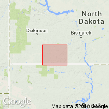
[Type area:] in bluffs of Cannonball River, south of town of Elgin, in T. 132 and 133 N., R. 88 W., [Elgin 30- by 60-min quadrangle, Grant Co.], southern ND.
[Misprint (US geologic names lexicon, USGS Bull. 896, p. 335-336): type area in R. 88 W., not in R. 8 W.; lies in Grant Co.]
Source: Publication; US geologic names lexicon (USGS Bull. 896, p. 335-336).
- Usage in publication:
-
- Cannonball marine member*
- Modifications:
-
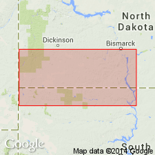
- Areal extent
- AAPG geologic province:
-
- Williston basin
Summary:
Pg. 523-547. In a large region west of Missouri River in North Dakota and South Dakota the Lance formation, consists of 2 distinct parts, a lower nonmarine part containing a flora very similar to, if not identical with, that of the Fort Union, and an upper marine member containing a fauna closely resembling, but not identical with, that of Fox Hills sandstone. This upper part, on account of its peculiar fauna, has been separately mapped and named Cannonball marine member of Lance formation. Farther west nonmarine beds bearing lignite and occupying a similar stratigraphic position have been named Ludlow lignitic member of the Lance. The Cannonball marine member has been mapped from Mandan to a point 4 miles west of Haley, North Dakota, a total distance of about 130 miles. The presence of brackish-water fossils, OSTREA GLABRA, near Yule on Little Missouri River in Billings County, North Dakota, shows that the sea probably extended some distance farther to west than its sediments have been mapped. The extent of this member east of Missouri River is unknown. Cannonball member becomes gradually thinner to west, and sea in which it was deposited perhaps did not extend as far west as Montana line. The oyster beds near Yule, Billings County, may represent western limit of Cannonball sea. This sea presumably advanced into western North and South Dakota from east or northeast, and by inference the Cannonball member continued with undimished or with increased thickness to north and northeast, but region is too deeply drift covered to prove this. It is contemporaneous with Ludlow lignitic member and overlies 400 to525 feet of somber-colored shale, yellow sandstone, and thin lignite beds composing the lower (nonmarine) member of the Lance. It consists chiefly of dark sandy shale or shaly sandstone with subordinate amount of dark-yellow and gray sandstone and some thin limestones. All the strata are lenticular and individual beds can be followed for only short distances. [Gives detailed section in some of which beds belonging to Cannonball marine member are shown as overlying Ludlow lignitic member and in others as grading laterally into the Ludlow.] A peculiar feature of both Fox Hills sandstone and Cannonball member of Lance is abundance of round concretions commonly known as "cannonballs." They are formed by cementation of the sandy shale by deposition of calcium carbonate. No definite line could be drawn between Cannonball marine member and lower part of the Lance, it being impossible to tell where nonmarine beds stop and marine beds begin. [Lower part of Lance later named Hell Creek member.]
[See USGS Bull. 627, 1916, by D.E. Winchester and others, and USGS Prof. Paper 128-A, 1920, by T.W. Stanton.]
[GNC remark (ca. 1936, US geologic names lexicon, USGS Bull. 896, p. 335-336): The USGS now classified the Cannonball member and the demonstrably equivalent part of Ludlow lignitic member as Upper Cretaceous.]
[See also Torrington member of Lance formation.]
Source: US geologic names lexicon (USGS Bull. 896, p. 335-336).
For more information, please contact Nancy Stamm, Geologic Names Committee Secretary.
Asterisk (*) indicates published by U.S. Geological Survey authors.
"No current usage" (†) implies that a name has been abandoned or has fallen into disuse. Former usage and, if known, replacement name given in parentheses ( ).
Slash (/) indicates name conflicts with nomenclatural guidelines (CSN, 1933; ACSN, 1961, 1970; NACSN, 1983, 2005, 2021). May be explained within brackets ([ ]).