

- Usage in publication:
-
- Canning Formation*
- Modifications:
-
- Named
- Biostratigraphic dating
- Dominant lithology:
-
- Shale
- AAPG geologic province:
-
- Alaska Northern region
Summary:
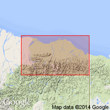
Named after Canning River which flows along much of western boundary of ANWR coastal plain, northern AK. Type section designated as section between 5830 and 11,980 ft in West Staines State-2 well, sec.25 T9N R22E [Flaxman Island quad]. Includes Mikkelsen Tongue (new) named after Mikkelsen Bay. Consists dominantly of shale that conformably overlies Hue Shale (new). Disconformably underlies Sagavanirktok at type section (but conformably underlies Sagavanirktok in most places west of ANWR). Is 5270 ft thick at type; in other wells is 4000 to 6000 ft thick. Age at type is Paleocene and Eocene based on palynomorph data. To east upper part probably ranges into Oligocene(?). Canning is facies equivalent of marine shales of upper Cretaceous Colville Group and even to Lower Cretaceous Torok Formation. It is suggested that term Canning be used to the point where Nanushuk Group pinches out at line extending from lower Colville River and south-southeast along Itkillik River. In this area, Canning is entirely Cretaceous (Albian to Campanian).
Source: GNU records (USGS DDS-6; Menlo GNULEX).
For more information, please contact Nancy Stamm, Geologic Names Committee Secretary.
Asterisk (*) indicates published by U.S. Geological Survey authors.
"No current usage" (†) implies that a name has been abandoned or has fallen into disuse. Former usage and, if known, replacement name given in parentheses ( ).
Slash (/) indicates name conflicts with nomenclatural guidelines (CSN, 1933; ACSN, 1961, 1970; NACSN, 1983, 2005, 2021). May be explained within brackets ([ ]).