- Usage in publication:
-
- Caney shale*
- Modifications:
-
- Original reference
- Dominant lithology:
-
- Shale
- Clay
- AAPG geologic province:
-
- Arkoma basin
- Ouachita folded belt
Summary:
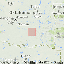
Caney shale. Occurs in 2 small areas in this quadrangle [Coalgate quadrangle, Coal County, Oklahoma, Arkoma basin], one in southwest corner, and the other in southeast corner. At both places about 800 feet of rock is exposed, approximately upper half of formation. This part is blue clay shale, with thin beds of clay, ironstone, lenticular concretions, and a few blue limestone septaria. In lower part of formation, in adjoining Atoka quadrangle [Ouachita tectonic belt province], the blue shale grades into black, friable, bituminous shale with dark-blue limestone segregations. The Caney shale throughout is laminated, fissile, and friable, and consequently rarely exposed. Underlies Wapanucka limestone. Age is Devonian (probably) and Carboniferous. Report includes geologic map, cross sections, columnar section.
Source: US geologic names lexicon (USGS Bull. 896, p. 332-333).
- Usage in publication:
-
- Caney shale
- Modifications:
-
- Revised
Summary:
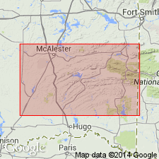
[See entry under Jackfork sandstone.]
Source: US geologic names lexicon (USGS Bull. 896, p. 332-333).
- Usage in publication:
-
- Caney shale
- Modifications:
-
- Revised
- Age modified
- Areal extent
Summary:
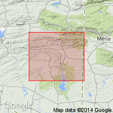
[See entry under Jackfork sandstone.]
Source: US geologic names lexicon (USGS Bull. 896, p. 332-333).
- Usage in publication:
-
- Caney shale
- Modifications:
-
- Age modified
Summary:
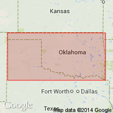
Pg. 24. Caney shale. There has been considerable controversy regarding age of Caney shale, but present consensus of opinion seems to be that upper part of formation is Pennsylvanian and lower part is Mississippian.
Source: US geologic names lexicon (USGS Bull. 896, p. 332-333).
- Usage in publication:
-
- Caney shale
- Modifications:
-
- Overview
- AAPG geologic province:
-
- Ouachita folded belt
Summary:
Pg. 22-23, footnote dated Oct. 5, 1927. Since writing of this paper E.O. Ulrich presented at Tulsa, Oklahoma, in March 1927, a paper that was based on extensive field investigations by him in 1908 and previous years and also on recent office studies of fossils. In his paper he expresses opinion that fauna in the black shale (his Johns Valley shale) on top of Jackfork sandstone is not in place but has been transported from exposures of Mississippian Caney shale, and that the fauna is now really embedded in a black shale of Pennsylvanian age. After presentation of Mr. Ulrich's paper I spent 3 months making a special field study of age relations of Carboniferous rocks in Ouachita Mountains, Oklahoma. Among the things I did was to examine carefully the Caney shale at its type locality, which is now known as Johns Valley. This locality is also type locality of Johns Valley shale of Mr. Ulrich. The shale in Johns Valley lies on top of Jackfork sandstone in a broad, long synclinal basin. In lower 50 to 100 feet of the shale there are numerous ice-borne boulders and blocks of many kinds of rock, including limestone, flint, and sandstone. The limestone masses, which are more numerous than the other kinds, range is size from small particles an inch or less in diameter to blocks measuring 30 feet across, though I observed one block measuring 200 feet in length, another measuring 110 by 195 feet, and a third about 50 by 369 feet. Fossils obtained from many of the masses have been studied by Mr. Ulrich, and his conclusions concerning them are that the represented faunas range in age from that of Arbuckle limestone ([Early] Ordovician) to that of Sycamore limestone (Kinderhook). The boulder bed just mentioned is apparently overlain by black, platy, hard shale perhaps several hundred feet thick. In several fresh clean exposures of the shale there are hundreds of small phosphate nodules --most of them nearly spherical, like toy marbles-- and many concretionary masses of limestone. The limestone concretions all lie parallel with bedding of the shale, and the phosphate nodules are rather uniformly disseminated through portions of the shale. The nodules and the limestone concretions contain fossils, all of which belong to fauna of Mississippian Caney shale. Every feature of the shale, as revealed in the exposures, can be matched with exposures of Caney shale in the areas where it rests upon Woodford chert. The lithology of the shales in the two different stratigraphic positions --one on the Jackfork and the other on the Woodford-- is the same. The character and arrangement of the limestone concretions are the same, and also the character and distribution of the phosphate nodules are the same. To me, as well as to several other geologists who accompanied me to Johns Valley in June 1927, the conclusion which we reached while looking at the field relations was obvious that the fauna represented in the phosphate nodules and limestone concretions lived, died, and was buried where it is now found. If the fauna had been transported by floating ice, as is believed by Mr. Ulrich, there would surely have been some admixing of Caney fossils with those of pre-Caney age. The excellent exposures of the Caney that were examined by me and by my geologist companions do not reveal a single pre-Caney fossil nor a single specimen of rock of pre-Caney age.
Source: US geologic names lexicon (USGS Bull. 896, p. 332-333).
- Usage in publication:
-
- Caney shale
- Modifications:
-
- Revised
- Areal extent
- AAPG geologic province:
-
- Ouachita folded belt
Summary:
Pg. 6, 21-23. I would restrict Caney shale to Mississippian part of beds heretofore included under that name, or to the non-boulder-bearing black shale which contains a Mississippian (Meramec) fauna and is confined to north and west of Ouachita area. The black shale of Pennsylvanian age in Ouachita geosyncline, carrying fossiliferous erratic boulders in lower part, which had formerly been included in Caney shale, I have named Johns Valley shale. It is younger than Wapanucka limestone. [On p. 24 of book cited Ulrich stated: The Wapanucka should include the shaly lower beds with essentially same early Pennsylvanian fauna that Morgan (1924) describes in his report on Stonewall quadrangle as "Upper Caney." On p. 25 he stated: There is a break between the shale with the Middle Mississippian Caney fauna and the "Upper Caney" with the early Pennsylvanian fauna, and this hiatus is very great and = fully 5,000 feet of strata in southwestern Virginia. Also that the Caney as here restricted rests on the Sycamore. On p. 30 he restricted Caney shale to Arbuckle uplift, defined it as of middle Meramec age, and as unconformably overlain by Wapanucka limestone and unconformably underlain by Sycamore limestone.]
Source: US geologic names lexicon (USGS Bull. 896, p. 333).
- Usage in publication:
-
- Caney shale
- Modifications:
-
- Revised
- AAPG geologic province:
-
- South Oklahoma folded belt
Summary:
Caney shale. Underlies Rod Club sandy member (new) of Springer formation. Age is Mississippian.
Source: Modified from GNU records (USGS DDS-6; Denver GNULEX).
- Usage in publication:
-
- Caney shale
- Modifications:
-
- Revised
- AAPG geologic province:
-
- Ouachita folded belt
Summary:
Caney shale of some earlier USGS reports (Tishomingo and Atoka folios) included (at top) Springer shale (Pennsylvanian), which is overlain by Wapanucka limestone and is = Jackfork sandstone, Stanley shale, and Hot Springs sandstone of western Arkansas and adjacent areas in Oklahoma. The name Caney shale is here restricted to the Mississippian shale (of Chester and Meramec age) overlying the Woodford chert (Devonian?) and underlying Springer shale. This Mississippian shale is not exposed in region that has been cited as type locality of Caney shale, where all Carboniferous rocks beneath Atoka formation are Pennsylvanian age. [Also further discusses the Johns Valley shale (Pennsylvanian) and the erratic masses of Mississippian Caney shale contained in it.]
Source: US geologic names lexicon (USGS Bull. 896, p. 333).
- Usage in publication:
-
- Caney shale
- Modifications:
-
- Revised
- AAPG geologic province:
-
- South Oklahoma folded belt
Summary:
Term Caney retained for the lower or Mississippian shale. In the northern Arbuckle Mountains, the Mississippian Caney shale divided into three new members (ascending order): Ahlosa (Meramec age), Delaware Creek (Meramec age), and Sand Branch (Chester age) members. Caney in northern Arbuckles is dark-gray or black, bituminous shale with large limestone and small phosphatic concretions. In the southern Arbuckles Caney is not divided and is shown (correlation chart) as equivalent to the Ahlosa and Delaware Creek. Caney in southern Arbuckles is a dark-gray or gray siliceous shale with large limestone and small phosphatic concretions and of Meramec age. Locally developed large to very large (3 to 12 ft diameter) concretions lie within the Caney. Many of these have septarian structure. Invertebrate fossils (conodonts, pelecypods, gastropods, ostracods, goniatites, cephalopods) listed; measured sections; geologic map. Of Mississippian (Meramec and Chester) age.
Source: GNU records (USGS DDS-6; Denver GNULEX).
- Usage in publication:
-
- Caney shale
- Modifications:
-
- Overview
- Dominant lithology:
-
- Shale
- Limestone
- AAPG geologic province:
-
- South Oklahoma folded belt
Summary:
Type section designated in sec 14, T2S, R7E, Johnston Co, OK in S. Oklahoma folded belt province; the Caney shale type section is called section "A" in this report (where Caney is 180.85 ft thick). Augmented by sections "B" through "D", which contain type sections of its three members: Sand Branch (at top), Delaware Creek, and Ahloso (at base; previously called Ahlosa, but correct spelling is Ahloso). Caney shale type section consists of (ascending): 1) Ahloso member, 38 ft thick--black, silty, massive to laminated shale, brachiopods common. 2) Delaware Creek member, 197.4 ft thick--black, dark-gray laminated shale; zones of large and small limestone concretions; most of the strata is covered; cephalopods (GONIATITES) common. 3) Sand Branch member, 145.45 ft thick--black, laminated to flaky to massive shale; zones of limestone concretions, gray, elliptical to pancake-like; cephalopods (GONIATITES) common, as well as conodonts in upper zones. The Sycamore sandstone underlies Caney at type section (since Sycamore here is quite unlike the Sycamore of its type area, it may be a facies of Ahloso member). Caney is overlain by alluvium. Caney is of Mississippian age--its Ahloso member is of Meramecian age, its Delaware Creek member is of later Meramecian and early Chesterian age, and its Sand Branch member is of late Chesterian age. Correlations given for members. Fossil lists. Generalized geologic map of type section.
Source: GNU records (USGS DDS-6; Denver GNULEX).
- Usage in publication:
-
- Caney Shale*
- Modifications:
-
- Revised
- Adopted
Summary:
Pg. A6-A7b, A54, A56-A57 (fig. 5). Caney Shale. In northern Arbuckle Mountains of south-central Oklahoma, divided into (ascending): Ahloso (Meramecian), Delaware Creek (Chesterian), and Sand Branch (Chesterian) Members. In southern Arbuckle Mountains of south-central Oklahoma, assigned to Springer Group with its Delaware Creek Member only. Overlies Sycamore Limestone; underlies Goddard Shale (revised) of Springer Group. Age is Late Mississippian (Meramecian and Chesterian; upper Visean and Namurian A of Europe); foram zones 16i to 18, and ammonoid zones GONIATITES AMERICANUS through CRAVENOCERAS RICHARDSONIANUM. [See also Mackenzie Gordon, Jr., and G.C. Stone, 1976, Arkansas Geol. Commission Symposium on the geology of the Ouachita Mountains, v. 1.]
Source: Publication.
For more information, please contact Nancy Stamm, Geologic Names Committee Secretary.
Asterisk (*) indicates published by U.S. Geological Survey authors.
"No current usage" (†) implies that a name has been abandoned or has fallen into disuse. Former usage and, if known, replacement name given in parentheses ( ).
Slash (/) indicates name conflicts with nomenclatural guidelines (CSN, 1933; ACSN, 1961, 1970; NACSN, 1983, 2005, 2021). May be explained within brackets ([ ]).

