

- Usage in publication:
-
- Camp Canyon Member
- Modifications:
-
- Named
- Biostratigraphic dating
- Dominant lithology:
-
- Shale
- AAPG geologic province:
-
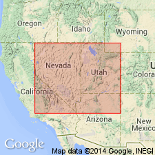
- Great Basin province
Summary:
Named as third from lowermost member (of 6) of Chainman Formation. Composed of dark fondothem shales 500 to 1800 ft thick, containing an upper deltaic meiorogenic facies. Camp Canyon Member contains three cosmopolitan goniatite zones of Visean age (Valmeyeran to early middle Chesterian). Overlies Skunk Spring Limestone Member (new); underlies Donner Member (new) (both of Chainman [Shale] Formation).
Source: GNU records (USGS DDS-6; Menlo GNULEX).
- Usage in publication:
-
- Camp Canyon Member
- Modifications:
-
- Not used
- AAPG geologic province:
-
- Great Basin province
Summary:
Camp Canyon Member of Chainman [Formation] of Sadlick (1965) is not accepted because this heterogeneous member includes variety of unrelated lithologic units of deep- to shallow-water origin, some of which are present only in its type section [designated only in PhD thesis]. Instead these rocks are included in an informal "middle member" (951 ft thick) of Chainman Shale.
Source: GNU records (USGS DDS-6; Menlo GNULEX).
- Usage in publication:
-
- Camp Canyon Member*
- Modifications:
-
- Mapped 1:24k
- Dominant lithology:
-
- Limestone
- Shale
- AAPG geologic province:
-
- Great Basin province
Summary:
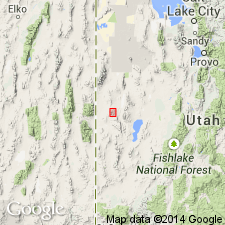
Is mapped as a member (Chesterian and Meramecian) of Chainman Formation (Mississippian) in Mountain Home Range in western Millard Co, southwest UT (Great Basin province). Subdivisions of the Chainman mostly follow Sadlick (1965) with addition of two members below his Needle Member. Sandberg and others (1980) have listed conodont zones using Sadlick's subdivisions. Overlies Skunk Spring Limestone Bed (Meramecian) of Chainman. Overlain by Willow Gap Limestone Member (Chesterian) of Chainman. Mapped as three separate units. Upper, rusty limestone unit (Chesterian) described as dusky yellowish-brown finely crystalline limestone that weathers moderate reddish brown to light brown; forms slopes and ledgy slopes; scattered chert nodules, minor cross-lamination; about 200 m thick. Middle, clayey limestone unit (Chesterian) described as dark gray muddy limestone that weathers light gray to pale yellowish brown; some silty limestone and some shale beds; weathers to ledges and flaggy and blocky talus slopes; slightly more resistant than adjacent map units; some beds quite fossiliferous containing brachiopods, pelecypods and gastropods; thickness about 90 m. Lower, black shale unit (Chesterian and Meramecian) described as grayish-black to dark-brown shale with 20% interbedded dark-gray limestone beds, and minor siltstone; usually forms covered slopes but exposed in gullies and roadcuts; large limestone concretions or septarians near base of unit occasionally are crowded with goniatite cephalopods (Gordon and others, 1957); thickness about 120 m.
Source: GNU records (USGS DDS-6; Denver GNULEX).

- Usage in publication:
-
- Camp Canyon Member*
- Modifications:
-
- Mapped 1:24k
- Dominant lithology:
-
- Limestone
- Shale
- AAPG geologic province:
-
- Great Basin province
Summary:
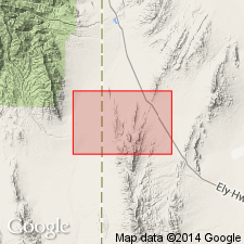
Is mapped as a member (Chesterian and Meramecian) of Chainman Formation (Mississippian) in southern part of Mountain Home Range in western Millard and Beaver Cos, southwest UT (Great Basin province). Subdivisions of the Chainman mostly follow Sadlick (1965, 1966) with addition of Delle Phosphatic Member (Sandberg and Gutschick, 1984) at base of formation. Sandberg and others (1980) have listed Chainman conodont zones using Sadlick's subdivisions. Overlies Skunk Spring Limestone Member (Meramecian) of Chainman. Overlain by Willow Gap Limestone Member (Chesterian) of Chainman. Mapped as three separate units. Upper, rusty limestone unit (Chesterian) described as dusky-yellowish-brown finely crystalline limestone that weathers reddish brown to light brown; forms slopes and ledgy slopes; sparse chert nodules, minor cross-lamination; about 200 m thick. Middle, clayey limestone unit (Chesterian) described as dark-gray muddy limestone that weathers light gray to pale yellowish brown; includes some silty limestone and shale beds; slightly more resistant than overlying and underlying map units; weathers to ledges and flaggy and blocky talus slopes; some beds contain very abundant brachiopods, pelecypods and gastropods; thickness about 90 m. Lower, black shale unit (Chesterian and Meramecian) described as grayish-black to dark-brown shale with 20% interbedded dark-gray limestone beds, and minor siltstone; commonly forms covered slopes; some large limestone concretions or septarians near base of unit contain abundant goniatite cephalopods (Gordon and others, 1957); thickness about 120 m.
Source: GNU records (USGS DDS-6; Denver GNULEX).
For more information, please contact Nancy Stamm, Geologic Names Committee Secretary.
Asterisk (*) indicates published by U.S. Geological Survey authors.
"No current usage" (†) implies that a name has been abandoned or has fallen into disuse. Former usage and, if known, replacement name given in parentheses ( ).
Slash (/) indicates name conflicts with nomenclatural guidelines (CSN, 1933; ACSN, 1961, 1970; NACSN, 1983, 2005, 2021). May be explained within brackets ([ ]).