

- Usage in publication:
-
- Camera Hill greenstone member*
- Modifications:
-
- Named
- Dominant lithology:
-
- Greenstone
- AAPG geologic province:
-
- New England province
Summary:
Pg. 169-171, pl. 34. Camera Hill greenstone member of Seboomook formation. Discrete bodies of dark volcanic material in the upper part of the Seboomook. Consists of felsite with scattered feldspar phenocrysts and some vesicles near base. Dark green where fresh, weathers gray to rusty brown. Thickness 0 to 400 feet. The Camera Hill is probably conformable with the remainder of the formation, although the contacts were not observed. Age is Devonian (Oriskany), as it lies above a faunule of that age within the Seboomook.
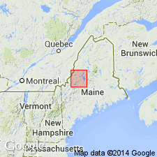
Type section: Camera Hill, [south of Spencer Stream and west of Gore Rapids], in southwest quarter of Spencer [Spencer Lake] 15-min quadrangle [Lat. 45 deg. 18 min. 28 sec. N., Long. 70 deg. 25 min. 29 sec. W., King and Bartlett Mountain 7.5-min quadrangle], Somerset Co., west-central ME. Named from Camera Hill.
Source: Publication; US geologic names lexicon (USGS Bull. 1350, p. 112-113); GNU records (USGS DDS-6; Reston GNULEX).

- Usage in publication:
-
- Camera Hill Greenstone Member
- Modifications:
-
- Not used
- AAPG geologic province:
-
- New England province
Summary:
Greenstone at Camera Hill mapped in Spencer Lake quad, ME, was previously mapped as the Camera Hill Greenstone Member of the Seboomook Formation by Boucot (1961). On this map, it is shown informally as a unit within the Seboomook Group [probably because raising it to formation rank isn't appropriate given its narrow areal extent]. [Name is not abandoned in this report.]
Source: GNU records (USGS DDS-6; Reston GNULEX).
For more information, please contact Nancy Stamm, Geologic Names Committee Secretary.
Asterisk (*) indicates published by U.S. Geological Survey authors.
"No current usage" (†) implies that a name has been abandoned or has fallen into disuse. Former usage and, if known, replacement name given in parentheses ( ).
Slash (/) indicates name conflicts with nomenclatural guidelines (CSN, 1933; ACSN, 1961, 1970; NACSN, 1983, 2005, 2021). May be explained within brackets ([ ]).