- Usage in publication:
-
- Camels Hump group*
- Modifications:
-
- Named
- Dominant lithology:
-
- Schist
- Quartzite
- Gneiss
- AAPG geologic province:
-
- New England province
Summary:
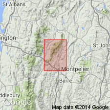
Named for wide occurrence on and near Camels Hump, a peak about 7 mi west of Waterbury, Washington Co., north-central VT. Consists of schist, quartzite, and gneiss. Intergrades with overlying Ottauquechee formation; unconformably overlies Precambrian interbedded gneiss, quartzite, and greenstone. Age is Cambrian.
Source: GNU records (USGS DDS-6; Reston GNULEX).
- Usage in publication:
-
- Camels Hump group*
- Modifications:
-
- Revised
- Overview
- AAPG geologic province:
-
- New England province
Summary:
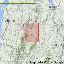
Includes rocks previously part of the Mount Holly Complex as well as the Monastery, Granville, and Pinney Hollow formations of Osberg (1952). The Monastery, Granville, and Pinney Hollow occupy about the same stratigraphic position as the Tyson, Hoosac (or Grahamville), and Pinney Hollow formations of Thompson (IN Billings and others, 1952) and Brace (1953) in areas south of Rochester, VT. It has been possible to trace the correlation of these units northward, but none form practical mapping units in this quad because of lithologic character along strike. The Camels Hump group in this quad therefore includes a lower unnamed unit composed of albite schist and gneiss, graphitic schist and quartzite, a middle unit composed of quartz-sericite-chlorite-magnetite-albite schist, and the Belvidere Mountain amphibolite (defined by Keith, 1932) at the top of the group. Camels Hump group is also mapped undivided.
Source: GNU records (USGS DDS-6; Reston GNULEX).
- Usage in publication:
-
- Camels Hump group*
- Modifications:
-
- Revised
- Age modified
- AAPG geologic province:
-
- New England province
Summary:
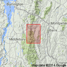
Camels Hump group includes in this area (ascending) Pinnacle formation (Clark, 1936), Underhill formation (Christman and Secor, 1961), Mount Abraham schist (new), Hazens Notch formation (not named in this paper, see Cady and others, 1963), and Pinney Hollow formation (Perry, 1929). Age revised as Cambrian(?) and Early Cambrian. Pinnacle, Underhill, Mount Abraham and lower part of Hazens Notch formations are considered Cambrian(?) because, to the north in southern Quebec, section with Pinnacle at its base includes more than 1,000 ft of strata conformably beneath fossiliferous Lower Cambrian rocks (Clark, 1936). Uppermost part of Hazens Notch and Pinney Hollow formations are Early Cambrian because the Pinney Hollow is beneath and grades up into Ottauquechee formation, which correlates stratigraphically with fossiliferous Middle Cambrian strata west of Green Mountain anticlinorium in northwestern VT (Cady, 1960).
Source: GNU records (USGS DDS-6; Reston GNULEX).
- Usage in publication:
-
- Camels Hump group*
- Modifications:
-
- Revised
- AAPG geologic province:
-
- New England province
Summary:
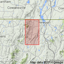
Hazens Notch and Jay Peak formations named as formations in Camels Hump group. Also includes Belvidere Mountain amphibolite. Hazens Notch formation was shown on map by Cady and others (1962), superceding this report.
Source: GNU records (USGS DDS-6; Reston GNULEX).
- Usage in publication:
-
- Camels Hump Group*
- Modifications:
-
- Age modified
- AAPG geologic province:
-
- New England province
Summary:
Tibbit Hill Volcanic Member of Pinnacle Formation, basal unit of Camels Hump Group, is shown on plate 1 as having a probable age range of from about 600 to 850 m.y., placing it in Proterozoic Z [Late Proterozoic] time.
Source: GNU records (USGS DDS-6; Reston GNULEX).
- Usage in publication:
-
- Camels Hump Group*
- Modifications:
-
- Age modified
- AAPG geologic province:
-
- New England province
Summary:
Lies stratigraphically above basement rocks of Mount Holly Complex of Grenville (1 b.y.) age. Age of Camels Hump changed to Late Proterozoic and (or) Early Cambrian.
Source: GNU records (USGS DDS-6; Reston GNULEX).
For more information, please contact Nancy Stamm, Geologic Names Committee Secretary.
Asterisk (*) indicates published by U.S. Geological Survey authors.
"No current usage" (†) implies that a name has been abandoned or has fallen into disuse. Former usage and, if known, replacement name given in parentheses ( ).
Slash (/) indicates name conflicts with nomenclatural guidelines (CSN, 1933; ACSN, 1961, 1970; NACSN, 1983, 2005, 2021). May be explained within brackets ([ ]).

