- Usage in publication:
-
- Caloso formation
- Modifications:
-
- Principal reference
- Dominant lithology:
-
- Limestone
- Chert
- AAPG geologic province:
-
- Orogrande basin
Summary:
Pg. 83, 86-87. Caloso formation. Limestone unit with maximum thickness of 86 feet. Lithologically, the Caloso is more similar to Kelly limestone (of Magdalena and Lemitar Mountains areas) than to Lake Valley formation and, it appears (based on Northrop's findings) that the Kelly may be older than the Lake Valley rather than younger as suggested by Laudon and Bowsher (1949). Fossils (corals, brachiopods, gastropods) identified by S.A. Northrop. Age is considered Early Mississippian (Kinderhook).
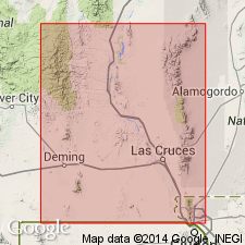
Type locality: south of Ladron Peak along Caloso Arroyo, in T. 2 N., R. 2 W., Ladron Mountains, [northern Socorro Co.], central NM. Name credited to E.A. Noble (Univ. New Mexico unpub. MS thesis, 1950).
Source: Publication; US geologic names lexicon (USGS Bull. 1200, p. 586).

- Usage in publication:
-
- Caloso formation
- Modifications:
-
- Revised
- Dominant lithology:
-
- Limestone
- Sandstone
- Shale
- Chert
- AAPG geologic province:
-
- Orogrande basin
Summary:
Caloso formation of Noble (1950) and Kelley and Silver (1952) revised in this report; here restricted to the Kinderhook part of the [type] section, which is in Caloso Arroyo, T2N, R2W, south of Ladron Peak, Socorro Co, NM, Orogrande basin. Maximum thickness is 45-50 ft [as opposed to the 86 ft described by Noble and Kelley and Silver]. The lower 20-28 ft consists of sandstones, shales, and thin-bedded, fine-grained gray limestone. In exposures near Rio Salado [to south of type locality], the basal sandstone is arkosic and contains considerable chlorite and feldspar, whereas in the exposures near Ladron Peak [type locality] the basal sandstone is a fine-grained, clean, white quartz. South of Navajo Gap [about 6 mi north of type locality] the basal sandstone is a quartz conglomerate with silica cement. The limestone unit is 17-23 ft thick, massive, dark gray, and dense to granular, containing stringers of chert 5-18 in thick and 40-60 ft long. These chert bands are dark brown or black, and in places are very fossiliferous. Caloso is separated by an unconformity from overlying Kelly formation of Osage (Early Mississippian) age; unconformably underlain by pre-Cambrian rocks. Northward from Rio Salado, Kelly is eroded, and is completely removed 3 mi north--at that point and northward, Caloso is unconformably overlain by Pennsylvanian Sandia formation. Is of Kinderhook (Early Mississippian) age. Measured sections, cross section.
Source: GNU records (USGS DDS-6; Denver GNULEX).

- Usage in publication:
-
- Caloso Member*
- Modifications:
-
- Revised
- Biostratigraphic dating
- Adopted
- AAPG geologic province:
-
- Orogrande basin
Summary:
Pg. 17-19. Caloso Member of Kelly Limestone. Caloso Formation of Kelley and Silver (1952) adopted by the USGS as Caloso Member, lower of two members of Kelly Limestone (geographically restricted to Magdalena, Ladron, and Lemitar Mountains). The lower 3 to 3.5 m is arkosic sandstone and shale. The limestone, about 6 m thick, is composed in the lower part of stromatolitic lime mudstone overlain by pellet-echinoderm-foraminifer wackestone and packstone. Total thickness 11.6 m. Unconformably overlies Precambrian rocks; unconformably underlies Ladron Member (new name) of Kelly. The brachiopod fauna from the Caloso Member's type locality was described by Armstrong (1958) and is BEECHERIA CHOUTEAUENSIS (Weller) and SPIRIFER CENTRONATUS LADRONENSIS Armstrong. Examination by Mamet of the thin section from limestone of the Caloso Member shows that it contains a microfossil assemblage of zone 8. The Endothyridae are represented mostly by LATIENDOTHYRA, MEDIOENDOTHYRA, and TUBERENDOTHRYA. Age is Early Mississippian (Keokuk).
Type locality: Caloso Arroyo, in E/2 sec. 30, T. 2 N., R. 2 W., Ladron Mountains, northern Socorro Co., central NM.
Source: Publication; Changes in stratigraphic nomenclature, 1976 (USGS Bull. 1435-A, p. A15).

- Usage in publication:
-
- Caloso Member*
- Modifications:
-
- Age modified
- AAPG geologic province:
-
- Orogrande basin
Summary:
Pg. EE13, EE20+ (App. 1, 2). Calosa Member of Kelly Limestone. Conglomerate, sandstone, mudstone, and packstone. Thickness about 35 feet. Unconformably underlies Ladron Member of Kelly Limestone; unconformably overlies Proterozoic metamorphic and igneous rocks. Fossils [listed]. Lies within Mamet (1976) microfossil zone 8. Includes ASPHALTINELLA microflora. Conodont GNATHODUS TEXANUS Roundy identified from basal 2-foot calcareous conglomerate and sandstone. Age is Early Mississippian (Tournaisian).
Section (88N-1) at north end of Magdalena Mountains, at head of abandoned Jordan Canyon Road, 9,000 ft (2,743 m) elev. Measured on north side of road, in SW/4 and NW/4 sec. 5, T. 3 S., R. 3 W., [Magdalena 7.5-min quadrangle, Socorro Co., Cibola National Forest, central NM].
[Additional locality information from USGS historical topographic map collection TopoView, accessed June 17, 2020.]
Source: Publication.
For more information, please contact Nancy Stamm, Geologic Names Committee Secretary.
Asterisk (*) indicates published by U.S. Geological Survey authors.
"No current usage" (†) implies that a name has been abandoned or has fallen into disuse. Former usage and, if known, replacement name given in parentheses ( ).
Slash (/) indicates name conflicts with nomenclatural guidelines (CSN, 1933; ACSN, 1961, 1970; NACSN, 1983, 2005, 2021). May be explained within brackets ([ ]).

