

- Usage in publication:
-
- Calico bed*
- Modifications:
-
- First used
- Dominant lithology:
-
- Sandstone
- AAPG geologic province:
-
- Plateau sedimentary province
- Paradox basin
Summary:
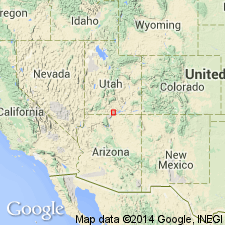
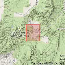
Is first used as uppermost of three informal units that comprise the Smoky Hollow Member (new) of the Upper Cretaceous Straight Cliffs Formation in the southeastern Kaiparowits Plateau region, Kane Co, UT (Plateau sedimentary province). Derivation of name not stated; no stratotype designated. Is 20 ft thick at type section of Smoky Hollow Member as measured on west side of Smoky Hollow in NE1/4 NE1/4 SW1/4 sec. 5, T42S, R4E, Kane Co, UT. Ranges from 0 to about 51 ft thick and consists of white to very light gray fine- to coarse-grained poorly sorted cross-stratified sandstone. Locally, scattered quartz and chert granules, chert pebbles, or conglomerate lenses are common. Calico bed interfingers with the upper part of the barren zone of the Smoky Hollow Member and is unconformably overlain by the John Henry Member (new) of the Straight Cliffs Formation. Calico contains channels and other bedding structures similar to those in the fluvial sandstones of the barren zone, although the Calico generally lacks ripple cross-lamination and is composed of more poorly sorted sandstone. These criteria suggest that the Calico bed was deposited mainly in fluvial environments. Age diagnostic fossils have not been found in the Calico bed nor in the Smoky Hollow, however, the Smoky Hollow is considered to be middle Turonian to perhaps early late Turonian in age based on stratigraphic position dating. Is reported to be as thick as 104 ft in a section northwest of Escalante, Garfield Co, UT (Paradox basin).
Source: GNU records (USGS DDS-6; Denver GNULEX).
- Usage in publication:
-
- Calico bed*
- Modifications:
-
- Age modified
- AAPG geologic province:
-
- Plateau sedimentary province
Summary:
Age modified to early Coniacian based on biostratigraphic information from unpublished PhD thesis (Shanley, 1991, Colo. Sch. Mines, Golden). Age assignment based on inoceramids identified by W. A. Cobban (USGS).
Source: GNU records (USGS DDS-6; Denver GNULEX).
For more information, please contact Nancy Stamm, Geologic Names Committee Secretary.
Asterisk (*) indicates published by U.S. Geological Survey authors.
"No current usage" (†) implies that a name has been abandoned or has fallen into disuse. Former usage and, if known, replacement name given in parentheses ( ).
Slash (/) indicates name conflicts with nomenclatural guidelines (CSN, 1933; ACSN, 1961, 1970; NACSN, 1983, 2005, 2021). May be explained within brackets ([ ]).