

- Usage in publication:
-
- Byram beds
- Byram substage
- Modifications:
-
- Original reference
- AAPG geologic province:
-
- Mid-Gulf Coast basin
Summary:
Pg. 517-518. Byram beds; Byram substage. Mr. D.W. Langdon enumerates (Amer. Jour. Sci., XXXI, p. 205) the fossils collected by him at Byram Station, on Pearl River, Mississippi. They are all Vicksburgian with exception of CAPULUS AMERICANUS, which is Jacksonian. As this species has never been found at Vicksburg, the presumption is that the Byram beds are older than true Vicksburgian, and this is further borne out by the fact, which I have noted from personal observation, that the Byram deposit contains, besides the species quoted by Mr. Langdon, a considerable number peculiar to it and apparently occurring nowhere else. The evidence adduced by Mr. Langdon would seem to show that there is a notable thickness of marine, though scarcely fossiliferous, deposits between the true Jackson and Byram, and it is probable that during this interval the Red Bluff beds were formed. The order of emergence of the various deposits --which were all more or less local-- may therefore be stated to be: (1) Jackson stage, (2) Red Bluff substage, (3) Byram substage, and (4) Vicksburg stage.
[The stratigraphic position of Byram as here given is now known to be incorrect. See GNC remark (ca. 1930).]
Source: US geologic names lexicon (USGS Bull. 896, p. 307).
- Usage in publication:
-
- Byram calcareous marl*
- Modifications:
-
- Revised
- AAPG geologic province:
-
- Mid-Gulf Coast basin
Summary:
Pg. 186-198. Byram calcareous marl of Vicksburg group. Largely sandy marl, but contains thin beds of impure limestone, clay, and sand. Thickness 13 to 70 feet. Top formation of Vicksburg group. Conformably overlies Marianna limestone (of Vicksburg group), and underlies Catahoula sandstone. Is same as upper Vicksburgian of Casey [at Vicksburg]. [Age is middle Oligocene.]
Source: US geologic names lexicon (USGS Bull. 896, p. 307).

- Usage in publication:
-
- Byram marl*
- Modifications:
-
- Overview
- AAPG geologic province:
-
- Arkla basin
Summary:
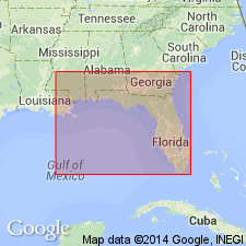
Byram marl of Vicksburg group. The present [ca. 1936] approved definition is that of C.W. Cooke, but the formation is now called Byram marl. Beds formerly included in upper part of Marianna limestone have since been separated as a distinct formation (Glendon limestone), so that the formation upon which Byram marl rests is Glendon limestone, instead of Marianna limestone. The Red Bluff clay has now been determined to correspond in time to lower part of Marianna limestone. The Byram as defined by Cooke included in upper part the beds in Mississippi that were later named (by Blanpied) Chickasawhay marl [member], and Bucatunna clay [member], and they are still included in the Byram by the USGS. Age is middle Oligocene.
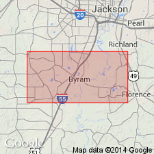
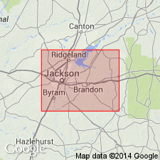
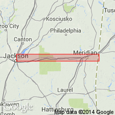
Named from exposures in bank of Pearl River at Byram, Hinds Co., MS. Recognized in Mississippi, Louisiana, southwestern Alabama, and northwestern Florida.
Source: US geologic names lexicon (USGS Bull. 896, p. 307).
- Usage in publication:
-
- Byram member
- Modifications:
-
- Revised
- AAPG geologic province:
-
- Black Warrior basin
Summary:
Pg. 18. Byram member at top of Vicksburg formation. [Age is Oligocene.]
Source: US geologic names lexicon (USGS Bull. 1200, p. 562-563).
- Usage in publication:
-
- Byram marl
- Modifications:
-
- Areal extent
- AAPG geologic province:
-
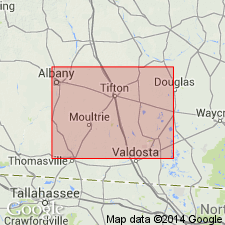
- South Georgia sedimentary province
Vernon, R.O., 1942, Geology of Holmes and Washington Counties, Florida: Florida Geological Survey Bulletin, no. 21, 161 p., (incl. geologic maps)
Summary:
Pg. 56. Limestone mapped as Suwanee in this report [Holmes and Washington Counties, Florida] may represent time interval equivalent to that required for deposition of Glendon limestone, Byram marl, and lower Chickasawhay marl of western Alabama and eastern Mississippi. Not possible to establish mappable units within the Suwannee. [Age is Oligocene.]
Source: US geologic names lexicon (USGS Bull. 1200, p. 562-563).
- Usage in publication:
-
- Byram limestone
- Modifications:
-
- Revised
- AAPG geologic province:
-
- Atlantic Coast basin
Summary:
Chart 12. Byram limestone of Vicksburg group. As shown on correlation chart, comprises (ascending) Glendon limestone, Byram marl, and Bucatunna clay members. [Age is Oligocene.]
Source: US geologic names lexicon (USGS Bull. 1200, p. 562-563).
- Usage in publication:
-
- Byram formation*
- Modifications:
-
- Revised
- AAPG geologic province:
-
- Mid-Gulf Coast basin
Summary:
Pg. 1315 (fig. 1), 1329-1344. Byram formation as herein treated includes, in addition to marl to which name Byram was applied originally, the Glendon limestone member at base and Bucatunna clay member at top. Overlies Marianna limestone; underlies Chickasawhay limestone and Flint River formation. [Age is Oligocene.]
Source: US geologic names lexicon (USGS Bull. 1200, p. 562-563).
- Usage in publication:
-
- Byram formation*
- Modifications:
-
- Areal extent
- AAPG geologic province:
-
- Mid-Gulf Coast basin
Summary:
Pg. 80-98, pls. 1, 3, 4, 5. Byram formation including Glendon and Bucatunna members is present in belt across Mississippi from Warren County and southern part of Yazoo County on west to Wayne County on east. Present in western and central Alabama and has been doubtfully identified in Florida. Thickness about 110 feet. Entire section not exposed at any one place. Overlies Marianna limestone; disconformably(?) underlies Catahoula sandstone. [Age is Oligocene.]
Source: US geologic names lexicon (USGS Bull. 1200, p. 562-563).
- Usage in publication:
-
- Byram formation
- Modifications:
-
- Areal extent
Tonti, E.C., 1955, Certain disconformities and lithology of the Vicksburg Stage of southeastern United States [abs.]: Dissertation Abstracts, v. 15, no. 8, p. 1372., Louisiana State Univ. PhD dissert., 104 p.
Summary:
In stratigraphic investigation of Vicksburgian deposits in Mississippi, Alabama, and Florida, two sedimentary cycles were identified. District disconformity marks upper and lower boundary of each unit. Lowermost cycle extends from disconformity at base of Mint Springs-Mariana formation to similar break at top of Byram formation (this report). Uppermost cycle contains Bucatunna marl and clay facies extending to disconformity at base of overlying Catahoula and Chickasawhay formations. Name Vicksburg stage suggested to include these deposits. Name Hennessey Bayou member proposed for lower Bucatunna transgressive unit heretofore included in Byram formation. [Age is Oligocene.]
Source: US geologic names lexicon (USGS Bull. 1200, p. 562-563).
- Usage in publication:
-
- Byram member
- Modifications:
-
- Revised
- AAPG geologic province:
-
- Mid-Gulf Coast basin
Summary:
Pg. 12, 53, pl. 4. Byram member of Marianna formation. Rank reduced to member. Overlies Glendon member and underlies Bucatunna member, both of Marianna. Age is Oligocene.
Source: GNC index card files (USGS-Reston).
- Usage in publication:
-
- Byram Formation
- Modifications:
-
- Areal extent
- AAPG geologic province:
-
- South Georgia sedimentary province
Summary:
Pg. B50-B51, 53. Byram Formation. Section of Oligocene rocks penetrated in test well at Cairo, Georgia, is believed from foraminiferal evidence to be Marianna Limestone, not known previously to occur in Georgia. Recognition of the Marianna necessitates assignment of some of overlying beds, previously considered to be part of Ocala Limestone (late Eocene), to the Byram Formation. Consists of yellowish-brown, dense, clayey, finely crystalline dolomite. Yields poor-quality ground water. No fossils. Age is middle Oligocene.
Depth interval 459 to 673 ft, USGS test well GGS 962, Cairo, Georgia.
Source: Publication.

- Usage in publication:
-
- Byram Formation
- Modifications:
-
- Overview
- AAPG geologic province:
-
- Mid-Gulf Coast basin
Summary:
Pg. 29. Byram Formation of Vicksburg Group. Includes, from the bottom up, yellow to white irregularly indurated, coquinoid and crystalline limestone (Glendon Limestone Member); gray to grayish-orange, sandy, glauconitic, fossiliferous marl (unnamed marl member); and yellow sand and dark bentonitic, carbonaceous clay (Bucatunna Clay Member). Thickness 39 to 89 feet. Present in south Alabama. Age is early Oligocene, Vicksburg (Rupelian).
Source: Publication.

- Usage in publication:
-
- Byram Formation, marl member
- Modifications:
-
- Overview
- AAPG geologic province:
-
- Mid-Gulf Coast basin
Summary:
In AL, the Byram Formation overlies the Marianna Limestone and includes the Glendon Limestone Member, an informal unnamed marl member (referred to in this report as the "Byram marl"), and the Bucatunna Clay Member. In MS, the Glendon and the Bucatunna are used at formation rank and the "Byram marl" becomes the Byram Formation. The Byram has been recognized from Covington Co., in extreme south-central AL to Warren Co., western MS. The Byram Limestone of FL is equivalent to the Glendon Limestone of AL and MS. In south-central AL, the Byram is more calcareous than at the type locality in Hinds Co., MS. In Monroe Co., the Byram includes approximately 5 ft of yellow to orange, massive, hard, fossiliferous limestone. This limestone facies becomes a minor part of the unit to the west. Near Glendon, Clarke Co., the Byram consists of 8 ft of very calcareous, argillaceous marl and at St. Stephens Quarry, in Washington Co., it consists of 1 to 2 ft of greenish-gray argillaceous, silty, fossiliferous marl. The Byram in Wayne and Clark Cos., MS, ranges in thickness from 3 to 22 ft and consists of greenish-gray to dark-gray argillaceous, glauconitic marl and in Jasper and Rankin Cos, it ranges from 1 to 30 ft and is described as fossiliferous, sandy, argillaceous, glauconitic marl. In Warren Co., western MS, the Byram is 25 to 40 ft thick and is composed of fossiliferous sandy, argillaceous, glauconitic marl and minor bentonitic clay.
Source: GNU records (USGS DDS-6; Reston GNULEX).
For more information, please contact Nancy Stamm, Geologic Names Committee Secretary.
Asterisk (*) indicates published by U.S. Geological Survey authors.
"No current usage" (†) implies that a name has been abandoned or has fallen into disuse. Former usage and, if known, replacement name given in parentheses ( ).
Slash (/) indicates name conflicts with nomenclatural guidelines (CSN, 1933; ACSN, 1961, 1970; NACSN, 1983, 2005, 2021). May be explained within brackets ([ ]).