

- Usage in publication:
-
- Burns latite complex*
- Modifications:
-
- Original reference
- Dominant lithology:
-
- Latite
- Tuff
- AAPG geologic province:
-
- San Juan Mountains province
Summary:
Burns latite complex. Succession of flows, tuffs, breccias, and dikes of dark hornblendic quartz-bearing latite of andesitic habit. Thickness 1,200 feet. Is unconformably overlain by great thickness of pyroxene andesite, and unconformably overlies Eureka rhyolite. Included in Silverton volcanic series. The most widely distributed variety of the hornblendic latites is named Niagara Gulch latite; another variety is named Canby latite.
[Burns latite (also Burns latite tuff) adopted by the USGS. Age is Tertiary (Miocene). Named from exposures in Burns Gulch, Silverton quadrangle, southwestern Colorado.]
Source: US geologic names lexicon (USGS Bull. 896, p. 300).
- Usage in publication:
-
- Burns Formation*
- Modifications:
-
- Redescribed
- Dominant lithology:
-
- Lava
- Breccia
- Tuff
- Shale
- AAPG geologic province:
-
- San Juan Mountains province
Summary:
Redescribed--name changed from Burns Latite to Burns Formation. Is a more heterogeneous unit than originally thought. Includes lava flows, breccias, and tuffs associated with volcanic domes and welded ash-flow tuffs, and about 200 ft of tuffaceous and varved shale and limestone interlayered with the volcanic rocks. Is several thousand ft thick. Overlies Eureka Tuff (formerly called Eureka rhyolite); underlies Henson Formation (formerly called Henson tuff and revised to include an unnamed basal quartz latite). Is of middle and late Tertiary age. Known in the San Juan volcanic depression, CO in the San Juan Mountain province as one of four formations of the Silverton Volcanic Group (formerly Silverton Volcanic Series).
Source: GNU records (USGS DDS-6; Denver GNULEX).
- Usage in publication:
-
- Burns Formation*
- Modifications:
-
- Age modified
- AAPG geologic province:
-
- San Juan Mountains province
Luedke, R.G., and Burbank, W.S., 1968, Volcanism and cauldron development in the western San Juan Mountains, Colorado: Colorado School of Mines Quarterly, v. 63, no. 3, p. 175-208.
Summary:
Burns Formation of Silverton Volcanic Group. Age changed from middle and late Tertiary --to-- Oligocene. (Adopted by the USGS.)
Source: Changes in stratigraphic nomenclature, 1968 (USGS Bull. 1294-A, p. A4).
- Usage in publication:
-
- Burns Formation*
- Modifications:
-
- Mapped 1:24k (Hinsdale Co, CO)
- Dominant lithology:
-
- Lava
- Breccia
- Mudstone
- Shale
- Siltstone
- AAPG geologic province:
-
- San Juan Mountains province
Summary:
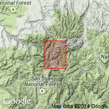
Is mapped as lower formation (of two) of the Silverton Volcanic Group (Oligocene) along North Fork of Henson Creek in southeast corner of quadrangle in western Hinsdale Co, CO (San Juan Mountain province). Underlying unit unknown; overlain by Henson Formation of Silverton Volcanic Group. Map unit described as medium- to dark-gray thick pyroxene-bearing rhyodacitic lava flows and flow breccias; at or near top are greenish-gray thin-bedded calcareous and sandy mudstone, shale, and siltstone with a few thin beds of fine-grained sandstone and limestone; locally very carbonaceous with fossil plants; locally absent in map area owing in part to nondeposition and in part to erosion. [Thickness is not given; may exceed 200 ft thick based on map expression.]
Source: GNU records (USGS DDS-6; Denver GNULEX).
- Usage in publication:
-
- Burns Formation*
- Modifications:
-
- Revised
- AAPG geologic province:
-
- San Juan Mountains province
Summary:
Burns Formation. Removed from †Silverton Volcanic Group (abandoned). Equivalent to the Henson and Sheep Mountain Formations. Interpreted as a post-collapse accumulation of lava flows and breccias in the San Juan caldera, southwestern Colorado. Age is Oligocene.
Source: Publication; Changes in stratigraphic nomenclature, 1973 (USGS Bull. 1395-A, p. A6-A7).
- Usage in publication:
-
- Burns Member*
- Modifications:
-
- Revised
- AAPG geologic province:
-
- San Juan Mountains province
Summary:
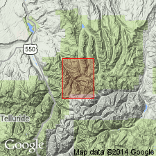
Burns Formation reduced to Burns Member of Silverton Volcanics. Silverton reinstated as a formation, but restricted to Henson Member, pyroxene andesite member, and Burns Member. The three members are not a sequence; they are a complexly interfingering assemblage. Burns includes a rhyolite, hornblende rhyodacite, and biotite-quartz latite, all the same age. Was deposited adjacent to the San Juan and Uncompahgre calderas after their collapse, but before subsidence of the Silverton caldera. Of Oligocene age. Report area shows parts of Silverton in Ts41 to 44N, Rs4 and 5W, Hinsdale Co, CO in the San Juan Mountain province.
Source: GNU records (USGS DDS-6; Denver GNULEX).
For more information, please contact Nancy Stamm, Geologic Names Committee Secretary.
Asterisk (*) indicates published by U.S. Geological Survey authors.
"No current usage" (†) implies that a name has been abandoned or has fallen into disuse. Former usage and, if known, replacement name given in parentheses ( ).
Slash (/) indicates name conflicts with nomenclatural guidelines (CSN, 1933; ACSN, 1961, 1970; NACSN, 1983, 2005, 2021). May be explained within brackets ([ ]).