The National Geologic Map Database is migrating to a new infrastructure. We apologize for any service disruptions during this process.
|
|---|


- Usage in publication:
-
- Burlingame limestone
- Modifications:
-
- Original reference
- Dominant lithology:
-
- Limestone
- AAPG geologic province:
-
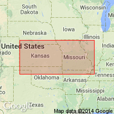
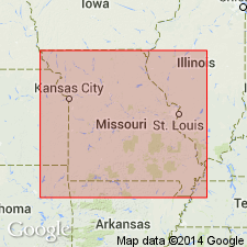
- Forest City basin
Summary:
Pg. 105. Burlingame limestone. Just west of Burlingame [Osage County], eastern Kansas, system No. 5 makes its first appearance. It is 8 feet thick, brown, shelly, and covers the third and last heavy bed of shales in this section, which is 150 or 200 feet thick. Age is Pennsylvanian.
Source: US geologic names lexicon (USGS Bull. 896, 1200); supplemental information from GNU records (USGS DDS-6; Denver GNULEX).

- Usage in publication:
-
- Burlingame limestone
- Modifications:
-
- Areal extent
Summary:
Pg. 72, 73, 94, 105. Burlingame limestone. Proposed by J.G. Hall for limestone system No. 5, consisting of brown shelly limestone 8 feet thick, overlying Osage shale. ["Osage" as here used included †Burlingame (Scranton) shale.]
Source: US geologic names lexicon (USGS Bull. 896, p. 298).

- Usage in publication:
-
- Burlingame limestone member
- Modifications:
-
- Revised
- AAPG geologic province:
-
- Forest City basin
Summary:
Burlingame limestone member of Nemaha formation. Bluish, brown-weathering, hard, massive, fossiliferous limestone. Thickness 2 to 5 feet. Separated from underlying Rulo limestone member of Nemaha by 7 to 12 feet of unnamed shale and from overlying Fargo limestone member of Nemaha by 11 to 32 feet of unnamed shale. Age is Pennsylvanian. Report includes measured sections, cross sections.
Source: GNC KS-NE Pennsylvanian Corr. Chart, sheet 1, Oct. 1936; supplemental information from GNU records (USGS DDS-6; Denver GNULEX).

- Usage in publication:
-
- Burlingame limestone formation
- Modifications:
-
- Revised
- AAPG geologic province:
-
- Forest City basin
- Nemaha anticline
Summary:
Pg. 5, 10; G.E. Condra and E.C. Reed, 1943, Nebraska Geol. Survey Bull., no. 14, p. 45-46. Burlingame limestone formation of Wabaunsee group. Thickness 20+/- feet. In Nebraska, comprises the following members (ascending): Taylor Branch limestone, bluish-gray, massive, weathers brownish, 2 to 4.5 feet; Winnebago shale, bluish, argillaceous, with some limy fossiliferous seams, 8 to 12 feet; and South Fork limestone, one massive bluish bed, or 2 or 3 beds separated by shale, 2 to 6 feet. Overlies Scranton shale formation; underlies Soldier Creek shale formation. Age is Late Pennsylvanian (Virgilian).
[Misprint (USGS Bull. 1200, p. 542): Condra's Nebraska Geol. Survey Paper no. 8 was published in 1935, not 1933.]
Source: Publication; US geologic names lexicon (USGS Bull. 1200, p. 541); GNC KS-NE Pennsylvanian Corr. Chart, sheet 2, Oct. 1936.

- Usage in publication:
-
- Burlingame limestone member
- Burlingame limestone
- Modifications:
-
- Overview
Summary:
Burlingame limestone member, basal member of Wabaunsee formation in Missouri. In Kansas the Wabaunsee is treated as a group and the Burlingame as a formation. The present Kansas and Nebraska Surveys use Soldier Creek shale for the beds overlying Burlingame limestone.
See also "Modern classifications of the Pennsylvanian rocks of eastern Kansas and southeastern Nebraska," compiled by M.G. Wilmarth, Secretary of Committee on Geologic Names, USGS unpub. corr. chart, Oct. 1936, 2 sheets.
Source: US geologic names lexicon (USGS Bull. 896, p. 298).

- Usage in publication:
-
- Burlingame limestone
- Modifications:
-
- Revised
- AAPG geologic province:
-
- Forest City basin
Summary:
Pg. 215-216. Burlingame limestone of Wabaunsee group. Soldier Creek shale and overlying Wakarusa limestone have been included by various writers in Burlingame limestone at several places in central and southern Kansas. The name Burlingame should be restricted to lower limestone, which seems to accord with Hall's original description. Thickness 4 to 16 feet. Has been mapped from southern Nebraska across Kansas, and identified 40+/- miles south of Kansas-Oklahoma line. The limestone makes a fairly prominent escarpment that crosses western part of Burlingame, Kansas. Age is Late Pennsylvanian (Virgil).
Source: US geologic names lexicon (USGS Bull. 896, p. 298); GNC KS-NE Pennsylvanian Corr. Chart, sheet 2, Oct. 1936.
- Usage in publication:
-
- Burlingame limestone
- Modifications:
-
- Areal extent
- Dominant lithology:
-
- Limestone
- Shale
- AAPG geologic province:
-
- Forest City basin
Summary:
Pg. 309 (fig. 14). Burlingame limestone. Graphic section of Pennsylvanian in Adams County, southeastern Iowa, shows Burlingame limestone occurring below Soldier Creek shale and above Silver Lake shale. Age is Late Pennsylvanian (Virgilian).
Source: US geologic names lexicon (USGS Bull. 1200, p. 541).

- Usage in publication:
-
- Burlingame limestone
- Modifications:
-
- Overview
- Revised(?)
- AAPG geologic province:
-
- Forest City basin
Summary:
Chart no. 6 (column 32, Missouri, collated by R.C. Moore). Pennsylvanian correlation chart shows Burlingame limestone in Shawnee group in Missouri. Occurs above Howard limestone and below Wakarusa limestone, both of Shawnee group. Elsewhere in Iowa, Kansas, and Nebraska (columns 31 and 33, collated by R.C. Moore), the Howard, Burlingame, and Wakarusa limestones are assigned to Wabaunsee group. Age is [Late Pennsylvanian]; Virgilian.
Source: Publication; US geologic names lexicon (USGS Bull. 1200, p. 541).
- Usage in publication:
-
- Burlingame limestone
- Modifications:
-
- Revised
- AAPG geologic province:
-
- Forest City basin
Summary:
Pg. 18. [Stratigraphically restricted Burlingame.] Three limestones and two shales now included in Soldier Creek shale were formerly included in the Burlingame.
Source: US geologic names lexicon (USGS Bull. 1200, p. 541).

- Usage in publication:
-
- Burlingame limestone
- Modifications:
-
- Overview
- Revised
- AAPG geologic province:
-
- Forest City basin
Summary:
Pg. 20. Assigned to Wabaunsee group when that group was redefined for Missouri.
Source: US geologic names lexicon (USGS Bull. 1200, p. 541).

- Usage in publication:
-
- Burlingame limestone member*
- Modifications:
-
- Revised
Summary:
Pg. 2273-2275. Burlingame limestone member of Bern limestone. Rank reduced to member status in Bern limestone (new). Underlies Soldier Creek shale member; overlies Silver Lake shale member of Scranton shale (reintroduced as a formation). Age is Late Pennsylvanian (Virgilian).
Source: US geologic names lexicon (USGS Bull. 1200, p. 541).

- Usage in publication:
-
- Burlingame limestone
- Modifications:
-
- Areal extent
- AAPG geologic province:
-
- Forest City basin
Summary:
Pg. 13, fig. 5. Burlingame limestone of Wabaunsee group. Consists of three limestone beds separated by shale. Upper limestone, about 6 inches thick, is dark gray and finely crystalline, contains fossil fragments, and is underlain by dark-gray clayey shale about 1.5 feet thick. The lower two limestones are separated by calcareous laminated gray shale about 5 feet thick. Upper of the two limestones is gray, argillaceous, and blocky; lower is concretionary, sandy, and fragmental. Total thickness 12 feet. Underlies Soldier Creek shale; overlies Silver Lake shale. Age is Late Pennsylvanian (Virgilian).
Source: US geologic names lexicon (USGS Bull. 1200, p. 541).

- Usage in publication:
-
- Burlingame Limestone Member
- Modifications:
-
- Overview
- AAPG geologic province:
-
- Forest City basin
Summary:
(Paleozoic Era; Pennsylvanian System by J.M Jewett, H.G. O'Connor, and D.E. Zeller, p. 40.) Burlingame Limestone Member of Bern Limestone of Nemaha subgroup [informal] of Wabaunsee Group. Recognized in Kansas. A fine-grained, hard, thick-bedded, light-gray to brown limestone that appears mottled and brecciated in some exposures. Shale partings occur in the limestone beds. Fusulinids are common in the more persistent part, and algal remains are conspicuous near the top. Biscuit-like algal deposits, composed of SOMPHOSPONGIA, are numerous in a few exposures in northeastern Kansas. Thickness from about 2 to 16 feet. Occurs above Silver Lake Shale Member of Scranton Shale and below Soldier Creek Shale Member of Bern Limestone. Age is Late Pennsylvanian (Virgilian).
["Subgroup" not recognized as a formal stratigraphic rank term (CSN, 1933; ACSN, 1961, 1970; NACSN, 1983, 2005, 2021). Considered informal and should not be capitalized.]
Source: Publication.
- Usage in publication:
-
- Burlingame Limestone Member
- Modifications:
-
- Overview
- AAPG geologic province:
-
- Forest City basin
Summary:
Pg. 129, 127 (fig. 37). Burlingame Limestone Member, basal member of Bern Formation of Nemaha subgroup [informal] of Wabaunsee Group. Where exposed in Atchison County, Missouri, is commonly a single, massive bed of argillaceous limestone; average thickness about 2 feet. Uppermost part of this bed contains a large amount of fossil material, which is coated with "Osagia." In Nodaway County, Missouri, composed (from the base upward) of about 1 foot of greenish-gray, dense, algal limestone, 3 to 4 feet of calcareous claystone, and of a few inches of slabby limestone. Shown on stratigraphic section overlying Silver Lake Shale Member of Scranton Formation of Sacfox subgroup [informal] of Wabaunsee Group, and underlying Soldier Creek Shale Member of Bern Formation. Age is Late Pennsylvanian (Virgilian).
["Subgroup" not recognized as a formal stratigraphic rank term (CSN, 1933; ACSN, 1961, 1970; NACSN, 1983, 2005, 2021). Considered informal and should not be capitalized.]
Source: Publication.
For more information, please contact Nancy Stamm, Geologic Names Committee Secretary.
Asterisk (*) indicates published by U.S. Geological Survey authors.
"No current usage" (†) implies that a name has been abandoned or has fallen into disuse. Former usage and, if known, replacement name given in parentheses ( ).
Slash (/) indicates name conflicts with nomenclatural guidelines (CSN, 1933; ACSN, 1961, 1970; NACSN, 1983, 2005, 2021). May be explained within brackets ([ ]).