

- Usage in publication:
-
- Burley lake beds*
- Modifications:
-
- Original reference
- AAPG geologic province:
-
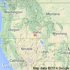
- Great Basin province
Summary:
Pg. 434-439; H.T. Stearns, 1932 (Corr. chart of Idaho compiled by M.G. Wilmarth, dated Sept. 1, 1932). Burley lake beds. Deposited in ancient Lake Burley. Not exposed. Log of city well at Burley, Cassia Co., southern Idaho, gives thickness of 150 feet. The beds are essentially horizontal and capped in south and east by gravel deposited by Snake River and Goose Creek. Not disturbed by diastrophism since deposition. As the beds reach nearly to old shore line the lake must have practically silted up before it was drained. Older than Minidoka basalt and younger than Sand Spring basalt. Age is Pleistocene.
Source: US geologic names lexicons (USGS Bull. 896, p. 298; USGS Bull. 1200, p. 384).
- Usage in publication:
-
- Burley lake beds*
- Modifications:
-
- Overview
- AAPG geologic province:
-
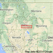
- Great Basin province
- Snake River basin
Summary:
Deposited in ancient Burley lake which was formed by damming of Snake River by Sand Springs basalt in Pleistocene. Unit not mapped as is covered by younger deposits. Log of city well at Burley, Cassia Co, ID, Great Basin province, indicates that 150 ft of alluvium was deposited in lake. Lake covered about same area as now included in Minidoka project.
Source: GNU records (USGS DDS-6; Denver GNULEX).
- Usage in publication:
-
- Burley lake beds*
- Modifications:
-
- Areal extent
- AAPG geologic province:
-
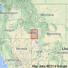
- Great Basin province
- Snake River basin
Summary:
Pg. 118; USGS Circ. 371, p. 7, 8, 1956. Burley lake beds (not exposed). Clay, silt, sand, and fine gravel, unconsolidated to well-compacted and intercalated basalt. Underlie alluvium and windblown deposits. Intercalated basalt layers occur 150 to 225 feet below the surface and at the bottom of the formation, separating it from the underlying Raft(?) lake beds. Thickness 450+/- feet. Age is Pleistocene.
Known only from drillholes in vicinity of Burley, in Cassia Co., and Rupert and Paul, in Minidoka Co., southern ID.
Source: Publication; US geologic names lexicon (USGS Bull. 1200, p. 540-541).
For more information, please contact Nancy Stamm, Geologic Names Committee Secretary.
Asterisk (*) indicates published by U.S. Geological Survey authors.
"No current usage" (†) implies that a name has been abandoned or has fallen into disuse. Former usage and, if known, replacement name given in parentheses ( ).
Slash (/) indicates name conflicts with nomenclatural guidelines (CSN, 1933; ACSN, 1961, 1970; NACSN, 1983, 2005, 2021). May be explained within brackets ([ ]).