The National Geologic Map Database is migrating to a new infrastructure. We apologize for any service disruptions during this process.
|
|---|


- Usage in publication:
-
- Burleigh Hill Member
- Modifications:
-
- Named
- Dominant lithology:
-
- Shale
- Limestone
- AAPG geologic province:
-
- New England province
Summary:
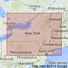
The Burleigh Hill Member of the Rochester Shale is here named in the area from Grimsby, Ontario, CAN, to Lockport, NY. It consists of sparsely fossiliferous gray, whitish weathering, platy, well-laminated shale with thin micritic limestone interbeds. It comprises the upper calcareous portion of the Rochester Shale and sharply overlies the Bryozoa beds (unit E) of the Lewiston Member, and gradationally underlies the DeCew Dolostone or grades laterally into the transitional Gates Member of Chadwick (1918) of the Rochester in Moore Co., NY. Thickness is 11.2 m (34 ft) at the type locality. Age is Middle Silurian (Wenlockian).
Source: GNU records (USGS DDS-6; Reston GNULEX).
- Usage in publication:
-
- Burleigh Hill Member*
- Modifications:
-
- Overview
- AAPG geologic province:
-
- Appalachian basin
Summary:
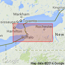
The Burleigh Hill Member of the Rochester Shale in western NY consists of dark- to medium-gray, pale and platy-weathering, highly calcareous to dolomitic mudstone with abundant thin interbeds of medium-gray, pale-buff weathering, laminated calcisiltites (pelletal grainstones) that become thicker and more closely spaced in the upper 5 to 10 ft of the unit. Unit is sparsely fossiliferous. Thickness is 30 ft. Well exposed in an outcrop on Gasport Road in the town of Gasport, Niagara Co., NY. Underlies the Lewiston Member of the Rochester Shale and conformably underlies the DeCew Dolomite in most areas, but unconformably underlies the DeCew in the southern Niagara River Gorge near Niagara Falls. The Burleigh Hill is of Early Silurian (middle Wenlockian) age based on conodonts. [Report uses the Early-Late Silurian boundary of Harland and others (1982) between the Wenlockian and Ludlovian.]
Source: GNU records (USGS DDS-6; Reston GNULEX).
For more information, please contact Nancy Stamm, Geologic Names Committee Secretary.
Asterisk (*) indicates published by U.S. Geological Survey authors.
"No current usage" (†) implies that a name has been abandoned or has fallen into disuse. Former usage and, if known, replacement name given in parentheses ( ).
Slash (/) indicates name conflicts with nomenclatural guidelines (CSN, 1933; ACSN, 1961, 1970; NACSN, 1983, 2005, 2021). May be explained within brackets ([ ]).