The National Geologic Map Database is migrating to a new infrastructure. We apologize for any service disruptions during this process.
|
|---|


- Usage in publication:
-
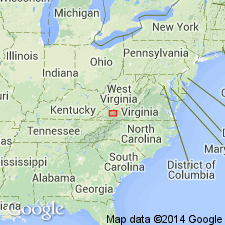
- Burkes Garden limestone member
- Modifications:
-
- Named
- Dominant lithology:
-
- Limestone
- AAPG geologic province:
-
- Appalachian basin
Summary:
Named the Burkes Garden limestone member of the Benbolt formation for Burkes Garden Creek, 1-1/2 miles south of Gose Mill, Tazewell Co., southwestern VA. The Burkes Garden is divided into a CHASMATOPORA zone (47 feet thick) and a cross-bedded limestone unit (63 feet thick). In Burkes Garden and Thompson Valley, the member is 100 to 200 feet thick; in median belts, it thins from about 100 feet near Russell-Tazewell Co. line to 60 feet at Tazewell, and is thin or absent on northwest side of Clear Fork Valley east of Gratton. Unit overlies the Shannondale limestone member of the Benbolt formation and underlies the Gratton limestone. The Burkes Garden limestone member is of Middle Ordovician age.
Source: GNU records (USGS DDS-6; Reston GNULEX).
For more information, please contact Nancy Stamm, Geologic Names Committee Secretary.
Asterisk (*) indicates published by U.S. Geological Survey authors.
"No current usage" (†) implies that a name has been abandoned or has fallen into disuse. Former usage and, if known, replacement name given in parentheses ( ).
Slash (/) indicates name conflicts with nomenclatural guidelines (CSN, 1933; ACSN, 1961, 1970; NACSN, 1983, 2005, 2021). May be explained within brackets ([ ]).