The National Geologic Map Database is migrating to a new infrastructure. We apologize for any service disruptions during this process.
|
|---|


- Usage in publication:
-
- Bullpen Member*
- Modifications:
-
- Named
- Dominant lithology:
-
- Claystone
- Mudstone
- Sandstone
- Limestone
- AAPG geologic province:
-
- Green River basin
Summary:
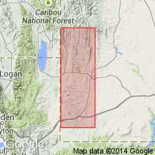
Named as a member of Wasatch Formation for exposures that cap bluffs of Green River Formation south of Bullpen Creek, southwest part of Kemmerer and southeast part of Sage quads, Lincoln Co, WY in Greater Green River basin. Type section (partial) designated and measured in NW1/4 sec 1, T20N, R118W. Is 177 ft 6 in thick at type. A complete section at south side Elk Mountain is 400 ft thick. Merges with Tunp Member (new) of Wasatch near Tunp Range. Consists of red to pink, green, light-gray claystone and mudstone. Claystone may be bentonitic. Mudstone is silty and sandy. Cross-laminated, fine- to coarse-grained sandstone and gritty granule conglomerate abundant in beds 5-40 ft thick northeast of Elk Mountain. Salmon-colored to red mudstone, gray sandstone, and pebbly conglomeratic sandstone characteristic of upper half. Thin, slabby, brown, gray to white limestone beds are extensive. Lower contact with Green River Formation is gradational and conformable. Overlain by Sillem Member (new) of Fowkes Formation. Is of latest early or middle Eocene age. Fossil mollusks identified. Stratigraphic chart.
Source: GNU records (USGS DDS-6; Denver GNULEX).
- Usage in publication:
-
- Bullpen Member*
- Modifications:
-
- Overview
- AAPG geologic province:
-
- Green River basin
Summary:
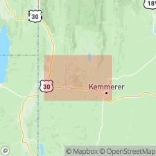
Mapped (geologic map, cross sections) as the upper of 6 members of Wasatch Formation in several areas in the central and southwest parts of area, Lincoln Co, WY in the Greater Green River basin. Is younger than the mudstone tongue of the Wasatch and older than the Sillem Member of the Fowkes Formation. Can be as thick as 320 ft in report area. Eocene age.
Source: GNU records (USGS DDS-6; Denver GNULEX).
For more information, please contact Nancy Stamm, Geologic Names Committee Secretary.
Asterisk (*) indicates published by U.S. Geological Survey authors.
"No current usage" (†) implies that a name has been abandoned or has fallen into disuse. Former usage and, if known, replacement name given in parentheses ( ).
Slash (/) indicates name conflicts with nomenclatural guidelines (CSN, 1933; ACSN, 1961, 1970; NACSN, 1983, 2005, 2021). May be explained within brackets ([ ]).