- Usage in publication:
-
- Brushy Basin shale member*
- Modifications:
-
- Original reference
- Dominant lithology:
-
- Shale
- Sandstone
- AAPG geologic province:
-
- Paradox basin
Summary:
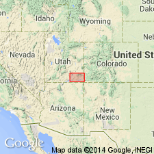
Pg. 59, pl. 15, strat. sections. Brushy Basin shale member of Morrison formation. Brightly banded shales, thin limestones, conglomerates, and sandstones forming top member of Morrison formation in San Juan country. Thickness 350 to 470 feet. Dinosaur remains. Overlies Westwater Canyon sandstone member. Age is Late Jurassic.
[Named from exposures in Brushy Basin, near Blanding, San Juan Co., southeastern UT.]
Source: US geologic names lexicons (USGS Bull. 896, p. 281; supplemental information from USGS Bull. 1200, p. 506-507).
- Usage in publication:
-
- Brushy Basin member*
- Modifications:
-
- Overview
- AAPG geologic province:
-
- San Juan basin
Summary:
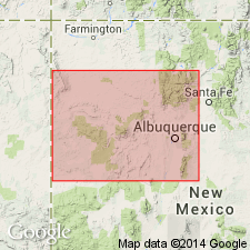
Pg. 314, 315 (fig. 60), 320-321, 323-324, 326, 329, 332-333. Brushy Basin shale member of Morrison formation. In Laguna, New Mexico, area, Recapture, Westwater Canyon, and most of Brushy Basin members are present in stratigraphic interval previously considered as Recapture. Sandstone previously considered as Westwater Canyon is at top of Brushy Basin and is known locally as Jackpile ore-bearing bed. Thickness ranges from 0 to about 370 feet; thickness largely determined by amount of deformation and erosion before deposition of Dakota sandstone. [Age is Late Jurassic.]
Source: US geologic names lexicon (USGS Bull. 1200, p. 506-507).
- Usage in publication:
-
- Brushy Basin shale member*
- Modifications:
-
- Areal extent
- AAPG geologic province:
-
- Black Mesa basin
Summary:
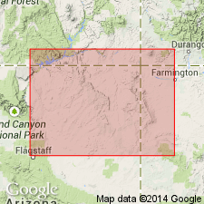
Pg. 3 (fig. 2), 55, strat. sections, pls. 1, 3. Brushy Basin shale member of Morrison formation. Present in northeastern and eastern parts of Navajo country. Intertongues with Westwater Canyon member; underlies Burro Canyon formation and where that is absent Dakota sandstone. Thicknesses: 194 feet at McElmo Creek [Montezuma Co., CO-San Juan Co., UT]; 156 feet in Carrizo Mountains area [Apache Co., AZ-San Juan Co., NM]; 148 feet at Toadlena, San Juan Co., NM; 51 feet at Thoreau, McKinley Co., NM. Age is Late Jurassic.
Source: Publication; US geologic names lexicon (USGS Bull. 1200, p. 506-507).
- Usage in publication:
-
- Brushy Basin member*
- Modifications:
-
- Revised
- AAPG geologic province:
-
- Paradox basin
Summary:
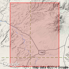
As the upper member of Morrison formation underlies the newly named Karla Kay conglomerate member of Burro Canyon formation at Tozer Gulch, tributary of McElmo Canyon in sec 30, T36N, R18W, Montezuma Co, CO, Paradox basin. Brushy Basin-Karla Kay contact placed at contact between green bentonitic mudstone that has a frothy-weathering surface (Brushy Basin) with a tan gray to gray-green conglomerate and conglomeratic sandstone (Karla Kay). Mudstones of Burro Canyon have hackly-weathering, a different weathering characteristic from the Brushy Basin. The end of Brushy Basin deposition also a time of reduction in volcanic ash to shoestring channel-filling sandstone and conglomerate of Karla Kay resulting from uplift west of Four Corners area. Cross section. Section of 150.5 ft of Brushy Basin measured at Tozer Gulch. Overlies Westwater Canyon Member of Morrison. Late Jurassic age.
Source: GNU records (USGS DDS-6; Denver GNULEX).
- Usage in publication:
-
- Brushy Basin Member*
- Modifications:
-
- Geochronologic dating
- AAPG geologic province:
-
- Paradox basin
Summary:
Pg. 11-12, geologic time scale (inside front cover). Brushy Basin Member of Morrison Formation (Jurassic). Sample from a slightly altered sandstone in Disappointment Valley, Dawson Draw quadrangle, San Miguel County, Colorado, yielded a Pb-alpha age 585 +/-65 Ma (zircon), indicating age of source rock [Precambrian Z]. Age published and discussed by Shawe and others (1968).
Source: Publication.
- Usage in publication:
-
- Brushy Basin Member
- Modifications:
-
- Revised
- AAPG geologic province:
-
- San Juan basin
Summary:
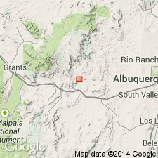
Revised in that Jackpile sandstone, the informal economic unit formerly at the top of the Brushy Basin Member, removed from the Brushy Basin and formally defined as the upper member of the Upper Jurassic Morrison Formation. Occurs in the San Juan basin area, NM. Overlies the stratigraphically restricted Brushy Basin. Underlies Oak Canyon Member of Dakota Sandstone.
Source: GNU records (USGS DDS-6; Denver GNULEX).
- Usage in publication:
-
- Brushy Basin Member
- Modifications:
-
- Age modified
- Geochronologic dating
- AAPG geologic province:
-
- Paradox basin
Summary:
Samples taken from bentonites and bentonitic mudstones in the Morrison Formation near Notom, Wayne Co, UT in Paradox basin show that the Morrison at this locality is post-Kimmeridgian, Tithonian or Late Jurassic, Neocomian to [Barremian, Aptian,] Albian or Early Cretaceous age. Fission-track data on 15 samples (1 on apatite, 14 on zircon) from Brushy Basin, upper of three members in Morrison, yielded ages from 142 Ma to 97 Ma. The lower part of Brushy Basin is Late Jurassic as are underlying Salt Wash and Tidwell Members. The upper part of Brushy Basin, which ranged from 99 to 123 Ma, covers a large part of the Early Cretaceous. The sedimentation rates for Tidwell, Salt Wash, and lower part of Brushy Basin were about 6.2 m/m.y., whereas the sedimentation rate for upper part of Brushy Basin was only about 0.6 m/m.y. The reduction in sedimentation rate in late Brushy Basin time was probably related to reduction in plutonic activity caused by slowing of collision at about 140 to 145 m.y. between the North American and Farallon plates.
Source: GNU records (USGS DDS-6; Denver GNULEX).
- Usage in publication:
-
- Brushy Basin Member*
- Modifications:
-
- Revised
- AAPG geologic province:
-
- San Juan basin
Summary:
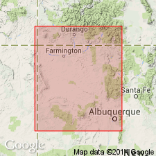
Unconformably (a regional unconformity) underlies the newly named Encinal Canyon Member of Dakota Sandstone from south (Laguna, Cibola Co) to Cuba (Sandoval Co), San Juan basin, NM. Jackpile sandstone, an economic unit at top of Brushy Basin unconformably underlies Encinal Canyon for most of the extent along the east side of basin, and it interfingers with the underlying mudstone unit of Brushy Basin. Encinal Canyon was included in Brushy Basin Member by some geologists in earlier reports. Of Late Jurassic age.
Source: GNU records (USGS DDS-6; Denver GNULEX).
- Usage in publication:
-
- Brushy Basin Member*
- Modifications:
-
- Revised
- AAPG geologic province:
-
- Paradox basin
- Plateau sedimentary province
Summary:
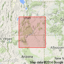
Is upper member of Morrison Formation in eastern Plateau sedimentary province, UT, and in Paradox basin, UT. Interfingers with and is replaced by Fiftymile Member (new) of Morrison in western Plateau sedimentary province, UT. Occurrence of "Christmas tree" conglomerate, a zone of colorful chert pebbles, common in Brushy Basin. Basal contact placed at top of highest cliff-forming sandstone bed of Salt Wash. Unconformably (K-1) overlain by Cedar Mountain Formation, but contact difficult to select on west side of Colorado Plateau where basal member of Cedar Mountain, the Buckhorn Conglomerate Member, is missing. Fiftymile is a proximal facies of Brushy Basin which was deposited in a mudflat, lacustrine, fluvial, and overbank floodplain environment. Of Late Jurassic age. Correlation chart. Cross sections.
Source: GNU records (USGS DDS-6; Denver GNULEX).
- Usage in publication:
-
- Brushy Basin Member
- Modifications:
-
- Geochronologic dating
- AAPG geologic province:
-
- Paradox basin
Summary:
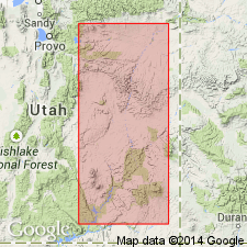
Single-crystal, laser-fusion 40Ar/39Ar ages on plagioclase and alkali feldspar range from 153-145 +/-1-2 Ma. Five samples dated are from Montezuma Creek section and one from Dinosaur National Monument, San Juan Co, UT, Paradox basin. Samples were taken at Montezuma Creek section from about 30 m to about 85 m from the base of a 105 m thick section; at Dinosaur National Monument, sample was taken about 10 m above main dinosaur-bearing layer. Age is late Kimmeridgian to Tithonian (Late Jurassic); however as no age data is from uppermost part of unit, it is possible that upper beds could be Early Cretaceous.
Source: GNU records (USGS DDS-6; Denver GNULEX).
For more information, please contact Nancy Stamm, Geologic Names Committee Secretary.
Asterisk (*) indicates published by U.S. Geological Survey authors.
"No current usage" (†) implies that a name has been abandoned or has fallen into disuse. Former usage and, if known, replacement name given in parentheses ( ).
Slash (/) indicates name conflicts with nomenclatural guidelines (CSN, 1933; ACSN, 1961, 1970; NACSN, 1983, 2005, 2021). May be explained within brackets ([ ]).

