The National Geologic Map Database is migrating to a new infrastructure. We apologize for any service disruptions during this process.
|
|---|


- Usage in publication:
-
- Brownville limestone member
- Modifications:
-
- Original reference
- Dominant lithology:
-
- Limestone
- AAPG geologic province:
-
- Forest City basin
Summary:
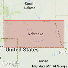
Pg. 17, 20. Brownville limestone, basal member of Admire(?) formation. Overlies McKissick Grove shales and is separated from overlying Aspinwall limestone by 10 to 25 feet of shale. Is light-bluish green; upper part somewhat nodular; lower part massive. In section east of Lehmer quarry (in sec. 32, T. 1 N., R. 16 E.), 3 miles south and 2 miles west of Falls City, Nemaha County, southeastern Nebraska, it consists of 2 limestones separated by 7 inches of bluish shale and weathered limestone. Thickness 2.5 to 6 feet. Age is Pennsylvanian. Report includes measured sections, cross sections.
Source: US geologic names lexicon (USGS Bull. 896, p. 277); GNC KS-NE Pennsylvanian Corr. Chart, sheet 1, Oct. 1936; supplemental information from GNU records (USGS DDS-6; Denver GNULEX).

- Usage in publication:
-
- Brownville limestone bed
- Modifications:
-
- Revised
- AAPG geologic province:
-
- Forest City basin
Summary:
Pg. 73, 74, 81, 89. Brownville limestone bed of Admire shale member of Wabaunsee formation. Two grayish limestones separated by a thin shale. Thickness 3 to 5 feet. Top limestone is usually thinner; lower one forms rounded blocks. Both beds weather yellowish or brownish. Is basal bed of Admire shale member of Wabaunsee formation. Overlies Pony Creek shale; underlies Aspinwall shale. Age is Late Pennsylvanian (Missouri age). Report includes cross sections, measured sections, geologic maps, stratigraphic tables.
Named from exposures low in Missouri bluffs south of Brownville, Nemaha Co., southeastern NE.
Source: US geologic names lexicon (USGS Bull. 896, p. 277); GNC KS-NE Pennsylvanian Corr. Chart, sheet 1, Oct. 1936; supplemental information from GNU records (USGS DDS-6; Denver GNULEX).

- Usage in publication:
-
- Brownville limestone
- Modifications:
-
- Revised
Summary:
Brownville limestone in upper part of Wabaunsee group. Restricted Admire shale to beds above Brownville limestone, and treated latter as a distinct formation, and this definition was adopted by Moore and Condra in their Oct. 1932 revised classification chart of Pennsylvanian rocks of Kansas and Nebraska. Age is Late Pennsylvanian (Virgil).
Source: US geologic names lexicon (USGS Bull. 896, p. 277); GNC KS-NE Pennsylvanian Corr. Chart, sheet 2, Oct. 1936.

- Usage in publication:
-
- Brownville limestone formation
- Modifications:
-
- Revised
- AAPG geologic province:
-
- Forest City basin
- Nemaha anticline
Summary:
Pg. 9. Brownville limestone formation. Top formation of Wabaunsee group restricted. Thickness 2 to 4 feet. Overlies Pony Creek shale formation and underlies Permian Admire group. Age is Late Pennsylvanian (Virgil).
Source: US geologic names lexicon (USGS Bull. 896, p. 277); GNC KS-NE Pennsylvanian Corr. Chart, sheet 2, Oct. 1936.
- Usage in publication:
-
- Brownville limestone
- Modifications:
-
- Overview
Summary:
Pg. 43. Brownville limestone. Overlies Wood Siding formation (new).
Source: US geologic names lexicon (USGS Bull. 1200, p. 499).

- Usage in publication:
-
- Brownville limestone member*
- Modifications:
-
- Revised
Summary:
Pg. 2273-2275. Brownville limestone member of Wood Siding formation. Rank reduced to member status in Wood Siding formation (redefined). Overlies Pony Creek shale member; underlies Towle shale member of Onaga formation (new). Age is Late Pennsylvanian (Virgilian).
Source: US geologic names lexicon (USGS Bull. 1200, p. 499).
- Usage in publication:
-
- Brownville limestone member
- Modifications:
-
- Overview
- AAPG geologic province:
-
- Chautauqua platform
Summary:
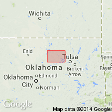
Pg. 67-71. Brownville limestone member of Wood Siding formation. Member descirbed in Pawnee County, north-central Oklahoma, where it is a single limestone unit. Thickness less than 1 foot to as much as 15 feet. Overlies Pony Creek shale member; underlies Permian Admire shale. Continuous from southeastern Nebraska to north-central Oklahoma, where it has been traced as far south as North Canadian River; south of river, the "Prague" of Seminole County is probably continuation of Brownville. Age is Late Pennsylvanian (Virgilian).
Source: US geologic names lexicon (USGS Bull. 1200, p. 499).
- Usage in publication:
-
- Brownville limestone member
- Modifications:
-
- Revised
- AAPG geologic province:
-
- Chautauqua platform
Summary:
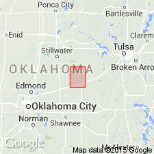
Pg. 4-6. Brownville limestone member of Konawa formation. Basal member of Konawa formation in report on Lincoln County, north-central Oklahoma. Underlies Americus(?) limestone. Stratigraphically above Grayhorse limestone. Thickness less than 1 foot to more than 3 feet. Age is Late Pennsylvanian (Virgilian).
Source: US geologic names lexicon (USGS Bull. 1200, p. 499).
- Usage in publication:
-
- Brownville Limestone Member
- Modifications:
-
- Overview
Summary:
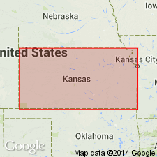
(Paleozoic Era; Pennsylvanian System by J.M Jewett, H.G. O'Connor, and D.E. Zeller, p. 43) Brownville Limestone Member of Wood Siding Formation of Richardson subgroup [informal] of Wabaunsee Group. Recognized in northeastern Kansas. A bluish-gray limestone that weathers yellowish-brown or brown, occurring in a single bed or in two beds separated by a thin bed of shale. Thickness ranges from about 1 to 5 feet. Underlies, with apparent conformity, Permian Towle Shale Member of Onaga Shale of Admire Group. Overlies Pony Creek Shale Member of Wood Siding Formation. Fossiliferous (fusulinids, crinoid fragments, bryozoans, trilobites). Age is Late Pennsylvanian (Virgilian).
["Subgroup" not recognized as a formal stratigraphic rank term (CSN, 1933; ACSN, 1961, 1970; NACSN, 1983, 2005, 2021). Considered informal and should not be capitalized.]
Source: Publication.
For more information, please contact Nancy Stamm, Geologic Names Committee Secretary.
Asterisk (*) indicates published by U.S. Geological Survey authors.
"No current usage" (†) implies that a name has been abandoned or has fallen into disuse. Former usage and, if known, replacement name given in parentheses ( ).
Slash (/) indicates name conflicts with nomenclatural guidelines (CSN, 1933; ACSN, 1961, 1970; NACSN, 1983, 2005, 2021). May be explained within brackets ([ ]).