The National Geologic Map Database is migrating to a new infrastructure. We apologize for any service disruptions during this process.
|
|---|


- Usage in publication:
-
- Bronson formation*
- Modifications:
-
- Original reference
- Dominant lithology:
-
- Limestone
- Sandstone
- Shale
- AAPG geologic province:
-
- Cherokee basin
Summary:
Pg. 1, 17, 21. Bronson formation. Heavy limestone formation, 60 to 80 feet thick, including some sandstone and shale. Overlies Dudley shale and underlies Chanute shale. [Chanute as here used includes Cherryvalle shale, Drum limestone, and Chanute shale.] Includes (ascending) Hertha limestone, Ladore shale, Mound Valley [Bethany Falls] limestone, Galesburg shale, and Dennis [Winterset] limestone. Age is Pennsylvanian.
Source: US geologic names lexicon (USGS Bull. 896, p. 272).

- Usage in publication:
-
- Bronson formation
- Modifications:
-
- Overview
Summary:
Bronson formation. In succeeding years [ca. 1905-1930] this name had very limited usage in the literature, but when used it was applied to beds beneath Cherryvale shale and above Dudley shale.
Source: US geologic names lexicon (USGS Bull. 896, p. 272).
- Usage in publication:
-
- Bronson group
- Modifications:
-
- Overview
Summary:
Correlation chart. Defined Bronson group as extending from top of Winterset limestone (above) to base of shale and channel sandstone underlying Hertha limestone and resting unconformably on Pleasanton shale. Age is Late Pennsylvanian (Missouri age).
Source: US geologic names lexicon (USGS Bull. 896, p. 272); GNC KS-NE Pennsylvanian Corr. Chart, sheet 1, Oct. 1936.

- Usage in publication:
-
- Bronson group
- Modifications:
-
- Revised
- Dominant lithology:
-
- Limestone
- AAPG geologic province:
-
- Chautauqua platform
Summary:
Pg. 90, 97. Bronson group [restricted]. Bronson was introduced by Adams in 1904 for prominent compact group of limestones in lower part of Missouri series which until recently has been designated Hertha (here renamed Sniabar limestone, as explained under Hertha limestone), Bethany Falls, and Winterset. This group of limestones and associated shales, which are now referred to (ascending) the Swope, Galesburg, and Dennis formations, form a distinct and very persistent stratigraphic unit traceable from Iowa to southern Kansas. The distinction from associated strata is, however, mainly lithologic, and accordingly physiographic, rather than paleontologic. The division is a convenient and natural one from stratigraphic standpoint. [The Swope limestone of Moore rested on what he called Ladore shale and treated as top formation of his Bourbon group (new name). R.C. Moore and G.E. Condra (Oct. 1932, revised classification chart of Pennsylvanian rocks of Kansas and Nebraska) used Bronson group as redefined by Moore in Aug-Sept., 1932, and this same definition was used by Moore in 1935.]
Source: US geologic names lexicon (USGS Bull. 896, p. 272); GNC KS-NE Pennsylvanian Corr. Chart, sheet 2, Oct. 1936.
- Usage in publication:
-
- Bronson group
- Modifications:
-
- Principal reference
- AAPG geologic province:
-
- Cherokee basin
- Forest City basin
Summary:
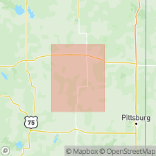
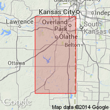
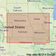
Pg. 131. Type locality of Bronson group is near Bronson, Bourbon Co., KS. The group is recognized from southwest IA to northern OK. Extends from top of Winterset limestone to base of Sniabar limestone.
Source: US geologic names lexicon (USGS Bull. 896, p. 272).
- Usage in publication:
-
- Bronson group
- Modifications:
-
- Revised
- AAPG geologic province:
-
- Cherokee basin
Summary:
Base of Bronson group is base of Hertha limestone, which overlies Bourbon group; latter includes all rocks down to base of Warrensburg sandstone.
Source: US geologic names lexicon (USGS Bull. 896, p. 272); GNC KS-NE Pennsylvanian Corr. Chart, sheet 2, Oct. 1936.
- Usage in publication:
-
- Bronson formation
- Bronson group
- Modifications:
-
- Overview
- AAPG geologic province:
-
- Forest City basin
Summary:
Table opp. P. 14. Bronson formation as first defined by Adams included from top of Dennis limestone to base of Hertha limestone. [Bourbon formation included in Bronson group on p. 19 and excluded on p. 21.]
Source: US geologic names lexicon (USGS Bull. 896, p. 272); GNC KS-NE Pennsylvanian Corr. Chart, sheet 2, Oct. 1936.

- Usage in publication:
-
- Bronson group
- Modifications:
-
- Overview
Summary:
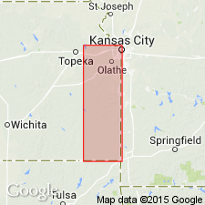
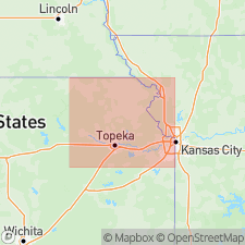
Pg. 41, 43, 76. Bronson group as here used is as defined by Adams. It conformably overlies Bourbon formation and underlies Fontana shale, basal formation of Kansas City group as here restricted. Is chiefly limestone. Includes beds from base of Hertha limestone up to top of Dennis limestone, and corresponds to lower part of Kansas City group as previously defined. Thickness in type region (vicinity of Bronson, Bourbon County, Kansas), 100+/- feet; in Kansas City area, 85+/- feet; in southern Kansas, 150 to 175 feet. Age is Late Pennsylvanian (Missouri age).
[The USGS has not yet [as of 1938] given consideration to the revival of Bronson and restriction of Kansas City Formation, for use in its publications.]
Source: US geologic names lexicon (USGS Bull. 896, p. 272); GNC KS-NE Pennsylvanian Corr. Chart, sheet 2, Oct. 1936.

- Usage in publication:
-
- Bronson group*
- Modifications:
-
- Areal extent
- AAPG geologic province:
-
- Anadarko basin
Summary:
Extended as an undivided unit into the subsurface of Baca County, Colorado, in the Anadarko basin east of the Las Animas arch. Assigned to the Late Pennsylvanian (Missouri age). Overlies Cherokee shale. Underlies Kansas City group. [Report includes correlation chart.]
Source: US geologic names lexicon (USGS Bull. 896, p. 272).
- Usage in publication:
-
- Bronson subgroup [informal]
- Modifications:
-
- Revised
Summary:
Pg. 2029, 2031 (fig. 4). Strata included in Kansas City group as now defined are divisible into three main parts of subequal thickness, which are treated as [informal] subgroups (ascending): Bronson, Linn (new), and Zarah (new). Bronson extends from base of Hertha formation to top of Dennis formation and includes (ascending) Hertha, Ladore, Swope, Galesburg, and Dennis formations. Uppermost Bronson unit (Winterset limestone) extends as far southward as T. 8 N. in Oklahoma, but Hertha disappears before Kansas-Oklahoma State line is reached. South of point where Hertha disappears, lower Missourian deposits are referred to Skiatook group and are named (ascending) Seminole formation, Checkerboard limestone, Coffeyville formation, Dennis formation, Cherryvale shale, and Drum limestone. Oklahoma Geological Survey uses Hogshooter (instead of Dennis) and Dewey as a formation name, rather than a member of Drum limestone.
["Subgroup" not recognized as a formal stratigraphic rank term (CSN, 1933; ACSN, 1961, 1970; NACSN, 1983, 2005, 2021). Considered informal and should not be capitalized.]
Source: US geologic names lexicon (USGS Bull. 1200, p. 490-491).
For more information, please contact Nancy Stamm, Geologic Names Committee Secretary.
Asterisk (*) indicates published by U.S. Geological Survey authors.
"No current usage" (†) implies that a name has been abandoned or has fallen into disuse. Former usage and, if known, replacement name given in parentheses ( ).
Slash (/) indicates name conflicts with nomenclatural guidelines (CSN, 1933; ACSN, 1961, 1970; NACSN, 1983, 2005, 2021). May be explained within brackets ([ ]).