The National Geologic Map Database is migrating to a new infrastructure. We apologize for any service disruptions during this process.
|
|---|


- Usage in publication:
-
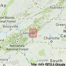
- Brevard schist*
- Modifications:
-
- Named
- Dominant lithology:
-
- Schist
- Slate
- AAPG geologic province:
-
- Piedmont-Blue Ridge province
Summary:
Name Brevard schist introduced in this report for unit near Brevard in western NC consisting mostly of dark bluish black or black schist of sedimentary origin. Between Swanannoa Gap and Old Fort the schistose character is less pronounced and the rock is a banded mica-slate. All strata are fine grained except a few siliceous layers, which represent original sandy strata. The rocks are composed mainly of very fine quartz and muscovite, with many tiny grains of iron oxides scattered throughout. Graphite in minute grains is a common constituent and here and there occurs in layers. A few mi southwest of Fairview limestones appear at frequent intervals for more than 50 mi. Principal variation in appearance of formation is in presence or absence of garnets (of secondary origin). Thickness is greater than 1,000 ft. Rests unconformably on Archean gneisses and granites. Age is Cambrian.
Source: GNU records (USGS DDS-6; Reston GNULEX).
- Usage in publication:
-
- Brevard schist, series
- Modifications:
-
- Areal extent
- Age modified
- AAPG geologic province:
-
- Piedmont-Blue Ridge province
Summary:
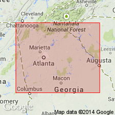
Brevard series occupies belt averaging about 2 mi in width and extending from Habersham Co. southwestward across state into AL. Series includes biotite gneiss, mica schist, quartzite, chlorite, schist, and marble. Brevard schist was mapped as Cambrian by Keith but is similar to schists in Carolina series. Brevard schist was traced southwestward into AL where it is included in Ashland and Wedowee formations. Keith believed Brevard rested unconformably on Carolina gneiss and old granites, but no evidence of this unconformity is found in GA. Henderson granite gneiss in NC and Lithonia granite gneiss in GA are intrusive into Brevard schist. Name Brevard is retained, but author believes that Brevard series is essentially part of Carolina series and is Precambrian in age.
Source: GNU records (USGS DDS-6; Reston GNULEX).
- Usage in publication:
-
- Brevard schist
- Modifications:
-
- Overview
- AAPG geologic province:
-
- Piedmont-Blue Ridge province
Summary:
Brevard described as fine-grained black and dark schist with lenses of limestone varying from a few hundred ft to more than 1 mi in length and up to 250 ft in thickness. Unit is Early Cambrian(?).
Source: GNU records (USGS DDS-6; Reston GNULEX).
- Usage in publication:
-
- Brevard Phyllite Member
- Modifications:
-
- Revised
- Age modified
- AAPG geologic province:
-
- Piedmont-Blue Ridge province
Summary:
Brevard Schist reduced in rank and revised as Brevard Phyllite Member of Chauga River Formation. Age stated as late Precambrian and Early Cambrian.
Source: GNU records (USGS DDS-6; Reston GNULEX).
- Usage in publication:
-
- Brevard Phyllite
- Modifications:
-
- Revised
- AAPG geologic province:
-
- Piedmont-Blue Ridge province
Summary:
Unit termed Brevard Phyllite in this report. Age is late Precambrian and Early Cambrian.
Source: GNU records (USGS DDS-6; Reston GNULEX).
For more information, please contact Nancy Stamm, Geologic Names Committee Secretary.
Asterisk (*) indicates published by U.S. Geological Survey authors.
"No current usage" (†) implies that a name has been abandoned or has fallen into disuse. Former usage and, if known, replacement name given in parentheses ( ).
Slash (/) indicates name conflicts with nomenclatural guidelines (CSN, 1933; ACSN, 1961, 1970; NACSN, 1983, 2005, 2021). May be explained within brackets ([ ]).