The National Geologic Map Database is migrating to a new infrastructure. We apologize for any service disruptions during this process.
|
|---|


- Usage in publication:
-
- Brazer limestone*
- Modifications:
-
- Original reference
- Dominant lithology:
-
- Limestone
- AAPG geologic province:
-
- Wasatch uplift
Summary:
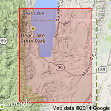
Pg. 407, 413. Brazer limestone. Massive to thin-bedded light-gray siliceous limestone and sandstone, 800 to 1,400 feet thick, in northern Utah. Underlies Wells formation and overlies Madison limestone. Recognized in northeastern Utah, eastern and south-central Idaho, and southwestern Wyoming. Age is middle and late Mississippian.
[Named from exposures in Brazer (now Brazier) Canyon, Rich Co., northeastern UT. Brazier Canyon in secs. 18 and 19, T. 11 N., R. 8 E., Rex Peak 7.5-min quadrangle, Rich Co., Crawford Mountains, northeastern UT (USGS GNIS database, USGS historical topographic map collection TopoView; accessed February 13, 2013).]
Source: US geologic names lexicon (USGS Bull. 896, p. 256).
- Usage in publication:
-
- Brazer dolomite*
- Modifications:
-
- Principal reference
- Dominant lithology:
-
- Dolomite
- AAPG geologic province:
-
- Wasatch uplift
Summary:
Pg. 2741-2769. Brazer dolomite. Brazer dolomite in its type area consists of about 850 feet of dolomite with a few beds of quartz sandstone and limestone near top. Divided into three members (unnamed) in Crawford Mountains, Utah. Member 1 consists mainly of thin-bedded cherty fine-grained dolomite weathering dark-yellowish brown; member 2, thick-bedded medium- to coarse-crystalline crinoidal cherty dolomite weathering mostly yellowish gray; member 3 consists of several distinct rock types that are interbedded, most common type being thin-bedded fine-grained dolomite weathering dark yellowish brown. Overlies Lodgepole limestone. Underlies sandstones and carbonate rocks that are referred to Wells formation as used by McKelvey and others (1956). Lower two-thirds of formation has yielded fauna of Early Mississippian age that suggests correlation with Mission Canyon limestone of type Madison group; upper third of formation contains fauna of uncertain affinities, interpreted as Late Mississippian in age. Inasmuch as Brazer cannot be recognized on lithologic or faunal basis outside type area, it is herein reeommended that name he restricted to Mississippian dolomite sequence in Crawford Mountains. New nomenclature should be devised for Upper Mississippian limestone-sandstone facies, previously called Brazer, in northern Cordilleran region. Richardson (1913, 1914) did not indicate precise type locality nor give detailed section in either of his papers on Randolph quadrangle. Recent interpretations of type Brazer have been based on Williams statement (1943) that type section is at mouth of Brazer Canyon where the formation is incomplete because of faulting. Reasons presented for regarding this interpretation as incorrect and site for type section suggested.
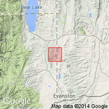
Type section: in NW/4 sec. 20, T. 11 N., R. 8 E., Crawford Mountains, [Rex Peak 7.5-min quadrangle], Rich Co., northeastern UT.
[Brazer (now Brazier) Canyon in secs. 18 and 19, T. 11 N., R. 8 E., Rex Peak 7.5-min quadrangle, Rich Co., northeastern UT.]
Source: US geologic names lexicon (USGS Bull. 1200, p. 462).
- Usage in publication:
-
- Brazer Limestone*
- Modifications:
-
- Not used
Summary:
Name has been misapplied in south-central ID to limestones that range from Early Mississippian to Early Permian age. The usage in ID is not consistent with Brazer Limestone as used at its type in UT. Name Brazer not used in south-central ID. Name White Knob Limestone (new) given to limestones in south-central ID formerly called Brazer.
Source: GNU records (USGS DDS-6; Denver GNULEX).
- Usage in publication:
-
- Brazer Limestone*
- Modifications:
-
- Areal extent
- AAPG geologic province:
-
- Wasatch uplift
Summary:
Restricted areally to the Crawford Mountains, Rich Co., UT on the Wasatch uplift. Is not recognizable in Old Laketown Canyon, 14 mi northwest of the Crawford Mountains. Extent eastward into southwest WY and east to north flank of Uinta Mountains not yet established. New names, Little Flat Formation and overlying Monroe Canyon Limestone are the replacement terms. The Little Flat and Monroe Canyon are the newly-named Chesterfield Range Group. Equivalents of these formations are recognized in Wells Canyon ID and in Old Laketown Canyon, UT.
Source: GNU records (USGS DDS-6; Denver GNULEX).
- Usage in publication:
-
- Brazer Dolomite
- Modifications:
-
- Revised
- Overview
- AAPG geologic province:
-
- Wasatch uplift
Summary:
Divided into (ascending order): Delle Phosphatic Member (new), members 1 and 2 of Osagean age, and member 3 of Osagean and Meramecian age in Brazer Canyon, Crawford, Mountains, UT in the Wasatch uplift. Brazer Canyon lay on the cratonic platform. Delle was called phosphatic member in earlier reports. Brazer overlies Woodhurst Member of Lodgepole Limestone and underlies Humbug Formation in Brazer Canyon. Basal contact of Delle is a hardground developed on top of Lodgepole. Delle also assigned as basal member of Aspen Range, Little Flat, Deep Creek, and Woodman Formations, and of Chainman Shale and Deseret Limestone at other localities. Correlation of Brazer with other lithostratigraphic units in the Snake River basin, ID, on Wasatch uplift, and in Great Basin province, UT, shown on correlation chart. Areal extent map of Brazer and of Delle.
Source: GNU records (USGS DDS-6; Denver GNULEX).
For more information, please contact Nancy Stamm, Geologic Names Committee Secretary.
Asterisk (*) indicates published by U.S. Geological Survey authors.
"No current usage" (†) implies that a name has been abandoned or has fallen into disuse. Former usage and, if known, replacement name given in parentheses ( ).
Slash (/) indicates name conflicts with nomenclatural guidelines (CSN, 1933; ACSN, 1961, 1970; NACSN, 1983, 2005, 2021). May be explained within brackets ([ ]).