The National Geologic Map Database is migrating to a new infrastructure. We apologize for any service disruptions during this process.
|
|---|


- Usage in publication:
-
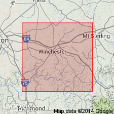
- Boonesborough metabentonite beds nos. 1, 2, 3
- Modifications:
-
- Named
- Dominant lithology:
-
- Bentonite
- Clay
- AAPG geologic province:
-
- Cincinnati arch
Summary:
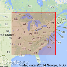
Three metabentonite beds "formally named" in the Tyrone Formation. All three share the same type section on KY Hwy 627 in Clark Co., and are also found in an old, abandoned quarry on KY Hwy 418. Bed No. 1, the lowest of 18 metabentonites in the Tyrone, is 1.7 ft thick and is described as a flaggy unit of dolomitic limestone and limy dolostone with metabentonite clay. Occurs 6 to 13 ft above the base of the Tyrone. It can be found in the subsurface of TN and OH. Bed No. 2 is 0.3 ft thick and is characteristically metabentonite with glauconite and 3-D worm burrows. Overlies prominent banded irregular lens of cream-colored chert. Bed No. 3 is very thin, and overlies prominent ripple-marked surface on top of mud-cracked, thin-bedded white-gray dolomitic limestone.
Source: GNU records (USGS DDS-6; Reston GNULEX).
- Usage in publication:
-
- Boonesborough metabentonite no. 1
- Modifications:
-
- Areal extent
- AAPG geologic province:
-
- Cincinnati arch
Summary:
Stratigraphically lowest of 18 metabentonites occurring in the Tyrone Limestone of KY. Bed is generally intercalated with flaggy, dolomitic limestone lenses and thinner impure, smectitic clayey shales, and, therefore is difficult to recognize in the field, but is persistent and useful as a key marker horizon. Unit may be present approximately 19 ft above the Establishment Member of the lower Plattin in southeastern MO. Boonesborough No. 1 is probably equivalent to the Barriefield Hill Metabentonite (new name) of Jefferson Co., NY, and Frontenac Co., Ontario, CAN.
Source: GNU records (USGS DDS-6; Reston GNULEX).
For more information, please contact Nancy Stamm, Geologic Names Committee Secretary.
Asterisk (*) indicates published by U.S. Geological Survey authors.
"No current usage" (†) implies that a name has been abandoned or has fallen into disuse. Former usage and, if known, replacement name given in parentheses ( ).
Slash (/) indicates name conflicts with nomenclatural guidelines (CSN, 1933; ACSN, 1961, 1970; NACSN, 1983, 2005, 2021). May be explained within brackets ([ ]).