- Usage in publication:
-
- Bonner Springs shale
- Modifications:
-
- Overview
Summary:
Correlation chart. Bonner Springs shale of Lansing group. New name [see Newell, 1935]; underlies Plattsburg limestone and overlies Farley limestone. Age is Late Pennsylvanian (Missouri age).
Source: US geologic names lexicon (USGS Bull. 896, p. 235); GNC KS-NE Pennsylvanian Corr. Chart, sheet 1, Oct. 1936.
- Usage in publication:
-
- Bonner Springs shale
- Modifications:
-
- Overview
- AAPG geologic province:
-
- Forest City basin
Summary:
Pg. 85, 93, 97. Bonner Springs shale of Lansing group. Includes the strata between top of Wyandotte limestone and base of Plattsburg limestone. Age is Late Pennsylvanian (Missouri age). [Origin of name not stated. On p. 46 Bonner Springs shale is described as consisting of 20.2 feet of gray arenaceous shale with plant fossils.]
Source: US geologic names lexicon (USGS Bull. 896, p. 235); GNC KS-NE Pennsylvanian Corr. Chart, sheet 2, Oct. 1936.
- Usage in publication:
-
- Bonner Springs shale*
- Modifications:
-
- Principal reference
- Dominant lithology:
-
- Shale
- AAPG geologic province:
-
- Forest City basin
Summary:
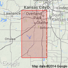
Pg. 18, 65, 67-69. The term Bonner Springs is here applied to shale between underlying Plattsburg limestone and overlying Farley limestone, and generally erroneously referred to as "upper Lane shale." It is much younger than true Lane shale. Consists of shale (olive-green, argillaceous, maroon layer near top) underlain by soft greenish-buff micaceous sandstone or arenaceous shale. In places includes at top a 5-foot bed of limestone and shell breccia, as 0.5 mile west of Bonner Springs. One-half mile east of De Soto the breccia bed of the Bonner Springs lies on Farley limestone, through absence of shale of the Bonner. Thickness of formation 0 to 35+/- feet.
Named for town in Wyandotte Co. Type exposure at cement plant northeast of the town.
Source: US geologic names lexicon (USGS Bull. 896, p. 235); GNC KS-NE Pennsylvanian Corr. Chart, sheet 2, Oct. 1936.

- Usage in publication:
-
- Bonner Springs shale
- Modifications:
-
- Overview
Summary:
Bonner Springs shale of Kansas City group. Stated that Newell is author of this name. Thickness 10 to 45 feet. Age is Late Pennsylvanian (Missouri age).
Source: US geologic names lexicon (USGS Bull. 896, p. 235); GNC KS-NE Pennsylvanian Corr. Chart, sheet 2, Oct. 1936.
- Usage in publication:
-
- Bonner Springs shale*
- Modifications:
-
- Revised
Summary:
Pg. 2031 (fig. 4); 1949, Kansas Geol. Survey Bull., no. 83, p. 111. Bonner Springs shale. In Kansas City group. Underlies Merriam limestone member of Plattsburg formation; overlies Farley limestone member of Wyandotte formation. This is classification agreed upon by state geological surveys of Iowa, Kansas, Missouri, Nebraska, and Oklahoma. [Age is Late Pennsylvanian (Missourian).]
Source: US geologic names lexicon (USGS Bull. 1200, p. 427).
- Usage in publication:
-
- Bonner Springs shale*
- Modifications:
-
- Areal extent
Summary:
Pg. 34. Bonner Springs shale. Thickness in Nebraska 8 to 10 feet. [Age is Late Pennsylvanian (Missourian).]
Source: US geologic names lexicon (USGS Bull. 1200, p. 427).
- Usage in publication:
-
- Bonner Springs shale*
- Modifications:
-
- Areal extent
- AAPG geologic province:
-
- Iowa shelf
Summary:
Pg. 418 (fig. 1), 420. Bonner Springs shale. In Schildberg quarry, in NE/4 SE/4 sec. 5, T. 75 N., R. 29 W., Madison County, Iowa, consists of 4 feet of olive to dark-gray shale with a thin coal-like layer near top; lower 3 feet contains numerous limestone nodules. [Age is Late Pennsylvanian (Missourian).]
Source: US geologic names lexicon (USGS Bull. 1200, p. 427).
- Usage in publication:
-
- Bonner Springs formation*
- Modifications:
-
- Areal extent
Summary:
Pg. 24-25, fig. 5. Bonner Springs formation of Kansas City group. Uppermost formation in Kansas City group. Consists of gray to black shale overlain by maroon shale that commonly contains limestone nodules. Thickness commonly 10 feet. Overlies Wyandotte limestone; underlies Plattsburg limestone. Age is Late Pennsylvanian (Missourian).
Source: US geologic names lexicon (USGS Bull. 1200, p. 427).
For more information, please contact Nancy Stamm, Geologic Names Committee Secretary.
Asterisk (*) indicates published by U.S. Geological Survey authors.
"No current usage" (†) implies that a name has been abandoned or has fallen into disuse. Former usage and, if known, replacement name given in parentheses ( ).
Slash (/) indicates name conflicts with nomenclatural guidelines (CSN, 1933; ACSN, 1961, 1970; NACSN, 1983, 2005, 2021). May be explained within brackets ([ ]).

