

- Usage in publication:
-
- Bonham clay
- Modifications:
-
- Original reference
- Dominant lithology:
-
- Clay
Summary:
Pg. 8. Bonham clay. A partly calcareous and partly non-calcareous clay, which toward the west in Fannin County merges into Austin chalk and toward the east extends through Fannin, Lamar, and Red River Counties. In Fannin county it conformably underlies Brownstown marl and conformably overlies Ector tongue of Austin chalk. In Lamar and Red River Counties the upper part of Bonham clay is replaced by Blossom sand, which is conformably underlain by the lithologically persistent lower part of Bonham clay, which there rests unconformably on Eagle Ford clay. In previous reports has been confused with Eagle Ford. Age is Late Cretaceous (Gulfian).
Named from exposures a short distance north of town of Bonham, Fannin Co., TX, and for fact that town, especially the part north of RR, is located on the clay.
Source: US geologic names lexicon (USGS Bull. 896, p. 234).

- Usage in publication:
-
- Bonham marl*
- Modifications:
-
- Revised
Summary:
Name changed (at request of L.W. Stephenson) to Bonham marl April 7, 1936.
Source: US geologic names lexicon (USGS Bull. 896, p. 234).
- Usage in publication:
-
- Bonham marl*
- Modifications:
-
- Overview
Summary:
Chart 9. Chart shows Bonham marl below the Gober tongue of Austin chalk and above the Ector tongue. Age is Late Cretaceous (Gulfian).
Source: US geologic names lexicon (USGS Bull. 1200, p. 425-426).
- Usage in publication:
-
- Bonham clay
- Modifications:
-
- Biostratigraphic dating
- Revised
Summary:
Pg. 35. Foraminifera described. Bonham clay listed in Austin group.
Source: US geologic names lexicon (USGS Bull. 1200, p. 425-426).

- Usage in publication:
-
- Bonham Formation
- Modifications:
-
- Mapped 1:250k
- Dominant lithology:
-
- Marl
- Clay
- AAPG geologic province:
-
- Ouachita folded belt
Summary:
Bonham Formation. Marl and clay. marl, sandy, progressively more sandy eastward, glauconite abundant locally, waxy, greenish-gray; weathers yellowish-gray. Clay bed near middle, calcareous, abundantly glauconitic; marine megafossils common. Thickness 375 to 530 feet. [Correlative with lower part of Tokio Formation of Oklahoma and Arkansas.] Lies above Eagle Ford Formation and below Blossom Sand. Age is Late Cretaceous.
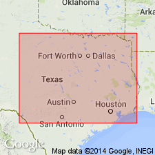
[Mapped in mostly continuous belt south of Red River, in Fannin, Lamar, and Red River Cos., northeastern TX.]
Source: Publication.

- Usage in publication:
-
- Bonham Marl
- Modifications:
-
- Mapped 1:250k
- Dominant lithology:
-
- Marl
- Clay
- AAPG geologic province:
-
- Ouachita folded belt
- South Oklahoma folded belt
Summary:
Pamphlet [p. 3]. Bonham Marl of Austin Group. Marl and clay, medium- to light-gray, weathers from light-gray to yellowish-gray with weak fissility, silty, progressively more calcareous westward, variable amount of glauconite but most abundant near middle, poorly to thinly bedded, marine megafossils. Thickness approximately 400 feet. Lies below Gober Chalk, Brownstown Marl, or Blossom Sand, and above Ector Chalk; all of Austin Group. Age is Late Cretaceous.
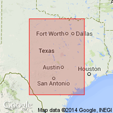
[Mapped in mostly continuous belt on north side of Bois d'Arc Creek, Bonham area, Fannin and Grayson Cos., northeastern TX; central eastern part of map sheet.]
Source: Publication.
For more information, please contact Nancy Stamm, Geologic Names Committee Secretary.
Asterisk (*) indicates published by U.S. Geological Survey authors.
"No current usage" (†) implies that a name has been abandoned or has fallen into disuse. Former usage and, if known, replacement name given in parentheses ( ).
Slash (/) indicates name conflicts with nomenclatural guidelines (CSN, 1933; ACSN, 1961, 1970; NACSN, 1983, 2005, 2021). May be explained within brackets ([ ]).