The National Geologic Map Database is migrating to a new infrastructure. We apologize for any service disruptions during this process.
|
|---|


- Usage in publication:
-
- Bois d'Arc limestone*
- Modifications:
-
- Original reference
- Dominant lithology:
-
- Shale
- Limestone
- AAPG geologic province:
-
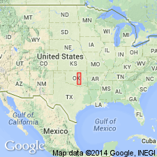
- Arkoma basin
Summary:
Pg. 256-268. Bois d'Arc limestone of Hunton group. Thin-bedded, crystalline and noncrystalline limestone, with occasional chert lentils and thin beds of intercalated yellowish shale. Lower part has New Scotland aspect, but is more nearly Becraft than New Scotland of New York. It may yet be determined that upper 40 feet is Oriskany in age. Thickness varies from 0 to 90 feet; average 60 feet. Maximum thickness in type area is 64 feet. Originally included as top division of Hunton formation. Overlies Haragan shale. Fossils (sponges, anthozoans, crinoids, brachiopods, gastropods, crustaceans). Age is Devonian. Report includes fossil lists, correlation chart.
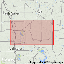
Named from exposures along Bois d'Arc Creek, Pontotoc Co., centra southern OK. Occurs in the Arbuckle Mountains of south-central Oklahoma.
Source: US geologic names lexicon (USGS Bull. 896, p. 227); supplemental information from GNU records (USGS DDS-6; Denver GNULEX).

- Usage in publication:
-
- Bois d'Arc limestone*
- Modifications:
-
- Biostratigraphic dating
- AAPG geologic province:
-
- Arkoma basin
Summary:
Pg. 667. Bois d'Arc limestone. Contains upper Oriskany fossils in upper 5 to 8 feet, and Helderberg fossils in lower part. In all probability it does not pass unbroken into the Haragan. All lower Oriskanian is absent in Arbuckle Mountains.
Source: US geologic names lexicon (USGS Bull. 896, p. 227).
- Usage in publication:
-
- Bois d'Arc limestone*
- Modifications:
-
- Principal reference
- Revised
- Age modified
- AAPG geologic province:
-
- Arkoma basin
Summary:
Pg. 470-474. Top formation of Hunton group is here named Frisco limestone, 0 to 20 feet thick. It rests on Bois d'Arc limestone [restricted], 0 to 90 feet thick, which contains abundant fauna that indicates Becraft age. Fauna of Frisco limestone is Oriskany. The Frisco is best exposed in bed and bank of Bois d'Arc Creek and in vicinity of Coal Creek, 7 miles south of Frisco.
Type locality designated along Bois d'Arc Creek, in sec. 4, T. 2 N., R. 6 E., Pontotoc Co., OK (Arkoma basin) [in error, see entry under Amsden (1957)].
Source: US geologic names lexicon (USGS Bull. 896, p. 227).
- Usage in publication:
-
- Bois d'Arc limestone*
- Modifications:
-
- Age modified
- AAPG geologic province:
-
- Arkoma basin
Summary:
Pg. 32. Bois d'Arc limestone. Is evidently of early Oriskany age.
Source: US geologic names lexicon (USGS Bull. 896, p. 227).
- Usage in publication:
-
- Bois d'Arc limestone*
- Modifications:
-
- Revised
- AAPG geologic province:
-
- Arkoma basin
Summary:
Pg. 132, 134. Overlies Cravatt formation of Kite group (both new). Reeds considered Cravatt as basal part of Bois d'Arc. Age is Early Devonian.
Source: US geologic names lexicon (USGS Bull. 1200, p. 415).

- Usage in publication:
-
- Bois d'Arc formation
- Bois d'Arc limestone
- Modifications:
-
- Principal reference
- Revised
- AAPG geologic province:
-
- Arkoma basin
Summary:
Pg. 6 (fig. 3), 7, 38-47. Subdivided to include Cravatt member below and Fittstown member (new) above. Thickness 45 to 200 feet with at least part of this variation caused by facies gradation from Bois d'Arc into Haragan formation. Underlies Frisco formation; overlies Haragan. Reeds (1926, Amer. Mus. Nat. Hist. Jour., v. 26) designated type locality as along Bois d'Arc Creek, sec. 4, T. 2 N., R. 6 E.; but this must be in error since Bois d'Arc Creek is not present in section 4; however, it is well exposed on north bank of this creek in sec. 11, T. 2 N., R. 6 E., and presumably this was location to which he referred. Type section designated.
Type section: in sec. 4, T. 2 N., R. 6 E., starting at top of Cedar Hill and extending north along banks of Chimneyhill Creek.
Source: US geologic names lexicon (USGS Bull. 1200, p. 415).
- Usage in publication:
-
- Bois d'Arc formation
- Modifications:
-
- Revised
- AAPG geologic province:
-
- Arkoma basin
Summary:
Bois d'Arc formation. Consists of two members or lithofacies, lower cherty argillaceous calcilutite (Cravatt member) and upper calcarenite (Fittstown member). Both stratigraphic and faunal evidence indicate that these are facies of one another, and that entire formation is facies of Haragan formation. Brachiopod fauna described.
Source: US geologic names lexicon (USGS Bull. 1200, p. 415).
For more information, please contact Nancy Stamm, Geologic Names Committee Secretary.
Asterisk (*) indicates published by U.S. Geological Survey authors.
"No current usage" (†) implies that a name has been abandoned or has fallen into disuse. Former usage and, if known, replacement name given in parentheses ( ).
Slash (/) indicates name conflicts with nomenclatural guidelines (CSN, 1933; ACSN, 1961, 1970; NACSN, 1983, 2005, 2021). May be explained within brackets ([ ]).