The National Geologic Map Database is migrating to a new infrastructure. We apologize for any service disruptions during this process.
|
|---|


- Usage in publication:
-
- Bob formation
- Modifications:
-
- Original reference
- Dominant lithology:
-
- Limestone
- Shale
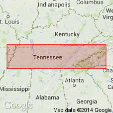
- AAPG geologic province:
-
- Cincinnati arch
Summary:
Pg. 410-432. Bob formation. Basal 5 to 30 feet (UNCINULUS zone) red limestone and shales in lower two-thirds, overlain by gray massive limestone; very similar lithologically to Dixon formation. Middle 25 to 42 feet white, yellow, blue, and grayish shales and limestones holding abundance of brachiopods and called DICTYONELLA zone. Uppermost 15 feet massive nodular cherty limestone or hard shale, called CONCHIDIUM zone, because brachiopods of genus CONCHIDIUM are most characteristic fossil. Is middle formation of Brownsport group. Overlies Beech River formation and underlies Lobelville formation. Age is Silurian (Niagaran).
[Named from Bob Landing, Decatur Co., western TN.]
[GNC remark (ca. 1936, US geologic names lexicon, USGS Bull. 896, p. 224): now treated as middle member of Brownsport formation. Bob cyrstalline limestone member of Brownsport formation adopted by the USGS.]
Source: US geologic names lexicon (USGS Bull. 896, p. 224).
- Usage in publication:
-
- Bob
- Modifications:
-
- Not used
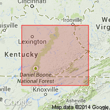
- AAPG geologic province:
-
- Cincinnati arch
Summary:
In area of this report, author believes there is no valid basis for subdividing the Brownsport into three members or formations. It is proposed that terms Beech River, Bob, and Lobelville be abandoned.
Source: GNU records (USGS DDS-6; Reston GNULEX).

- Usage in publication:
-
- Bob formation
- Modifications:
-
- Areal extent
- AAPG geologic province:
-
- Cincinnati arch
Summary:
Pg. 262-264, figs. 2, 81. Bob formation of Brownsport group. Typically a massive-bedded, silt-free, medium- to coarse-grained, gray, crystalline limestone with glassy appearance. Locally contains red specks and green grains of glauconite. At some localities entire formation consists of limestone interbedded with shale. Thickness 5 to 30 feet, averages 25 feet. Throughout most of outcrop belt is a continuous blanket of limestone, but in some areas appears to pinch and swell, possibly to extent of being locally absent or represented only by an alternation of limestone and shale deposited contemporaneously with massive phase elsewhere. Bob limestone is conformable with both Beech River and Lobelville formations; in several localities, grades into both by progressive interbedding. Where Lobelville is absent, the Bob is unconformably overlain either by Decatur limestone, a Devonian formation, or Chattanooga shale. Pate and Bassler (1908) named Bob limestone for bluff 0.5 mi below Bobs Landing along west bank of Tennessee River in Decatur County. Type section given by Pate and Bassler (p. 421), however, is composed of 20 feet of Dixon and 40 feet of Beech River, but no Bob limestone as recognized elsewhere by these writers nor as recognized and mapped by Miser, Jewell, and present writer. As shown in this report in section 3, A'-A'', figure 81, Bob limestone occurs on hill above the bluff, the Beech River being 80 feet thick and the Bob 5 to 25, increasing in thickness northward. The Bob is overlain by the Lobelville. Foerste (1903) named Gant limestone and Gant bed from exposures in Wayne County. Gant limestone included 30 feet of limestone and is equivalent to Bob limestone as recognized by Miser, Jewell, Wilson, and by Pate and Bassler at some localities. If name Bob had not become so well established, it would be recommended here that Bob limestone be dropped in preference to Gant. [Age is Middle Silurian.]
Source: US geologic names lexicon (USGS Bull. 1200, p. 408-409).
- Usage in publication:
-
- Bob Limestone
- Modifications:
-
- Areal extent
- AAPG geologic province:
-
- Cincinnati arch
Summary:
Bob Limestone of Brownsport Group described in western KY, where unit is 5 to 40 ft thick. Overlies Beech River Formation and underlies Lobelville Formation. Grades westward into Moccasin Springs Formation and northward into Wabash Formation. Age is Middle Silurian (Niagaran).
Source: GNU records (USGS DDS-6; Reston GNULEX).
- Usage in publication:
-
- Bob Limestone Member*
- Modifications:
-
- Biostratigraphic dating
- AAPG geologic province:
-
- Cincinnati arch
Summary:
Bob Limestone Member of Brownsport Formation occurs in du Pont Geohydrological Survey well near Waverly, Humphreys Co., central TN. Specimen of conodont PSEUDOONEOTODUS BICORNIS? at 607.4 to 608.4 ft in the Bob could indicate a late Wenlockian or early Ludlovian age at that level.
Source: GNU records (USGS DDS-6; Reston GNULEX).
For more information, please contact Nancy Stamm, Geologic Names Committee Secretary.
Asterisk (*) indicates published by U.S. Geological Survey authors.
"No current usage" (†) implies that a name has been abandoned or has fallen into disuse. Former usage and, if known, replacement name given in parentheses ( ).
Slash (/) indicates name conflicts with nomenclatural guidelines (CSN, 1933; ACSN, 1961, 1970; NACSN, 1983, 2005, 2021). May be explained within brackets ([ ]).