

- Usage in publication:
-
- Bluff Mesa formation*
Summary:
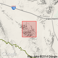
Pg. 12 (table 1), 16-19, 21, pls. 1, 8. Bluff Mesa formation of Trinity group. Term used to designate unit previously called Bluff beds by Taff (1891) and Bluff formation by Smith (1940). Name Bluff preoccupied. In Eagle Mountains area, Hudspeth County, southwestern Texas, consists of black nodular limestone weathering blue gray, limestone pebble conglomerates, brown shales, and some sandstones; limestones contain abundant ORBITOLINA, and some rudistid reef beds. Thickness 147 to a little more than 1,000 feet; greatest thickness is exposed on northeastern front of mountains north of Spar Valley. Conformable upon Yucca formation and unconformable upon Permian(?) beds where Yucca is missing; grades upward into quartzites of Cox sandstone through series of interbedded shales and thin quartzitic sandstones. Age is Early Cretaceous.
Source: US geologic names lexicon (USGS Bull. 1200, p. 405).
- Usage in publication:
-
- Bluff Mesa Formation
- Modifications:
-
- Mapped 1:250k
- Dominant lithology:
-
- Limestone
- Shale
- Sandstone
- AAPG geologic province:
-
- Permian basin
Summary:
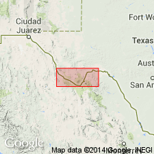
Bluff Mesa Formation. Mapped in Presidio County, Texas; notable exposures at north end of Chinati Mountains. Consists of limestone, shale, and sandstone. Upper part, consists of about four cycles typically starting at base with limestone, very hard, resistant, medium- to thick-bedded, in part rudistid-bearing, forms top and back slope of cuestas; in foreslopes, alternations of nodular, dark-gray, ORBITOLINA-bearing limestone, marl, and dark-gray clay shale followed upward by sandstone, medium-grained, quartz cemented, resistant, cross-bedded, light-brown, gradational laterally and vertically into less resistant, calcareous sandstone; lowest cycle, forms caprock sequence, is somewhat different, 40 feet of limestone, followed upward by sandstone, a persistent 10-foot oyster bed, and 50 feet of clay shale; thickness of upper part 450 feet. Lower part, a series of 15- to 20-foot cliff-forming beds of white limestone and locally sandstone, with slope-forming interbeds of shale and nodular limestone; sandstone, medium-grained, quartz cemented, thick-bedded, cross-bedded, dark-brown; thickness 200 feet. Total thickness 650 feet. Overlies Yucca Formation. Underlies Cox Sandstone with gradational contact. Age is Early Cretaceous.
Source: Publication; supplemental information from GNU records (USGS DDS-6; Denver GNULEX).
For more information, please contact Nancy Stamm, Geologic Names Committee Secretary.
Asterisk (*) indicates published by U.S. Geological Survey authors.
"No current usage" (†) implies that a name has been abandoned or has fallen into disuse. Former usage and, if known, replacement name given in parentheses ( ).
Slash (/) indicates name conflicts with nomenclatural guidelines (CSN, 1933; ACSN, 1961, 1970; NACSN, 1983, 2005, 2021). May be explained within brackets ([ ]).